Albrighton elevation
Albrighton (England, Shropshire), United Kingdom elevation is 95 meters and Albrighton elevation in feet is 312 ft above sea level [src 1]. Albrighton is a seat of a third-order administrative division (feature code) with elevation that is 23 meters (75 ft) bigger than average city elevation in United Kingdom.
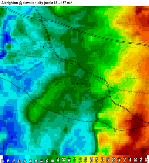
Below is the Elevation map of Albrighton, which displays elevation range with different colors. Scale of the first map is from 67 to 157 m (220 to 515 ft) with average elevation of 100.8 meters (=331 ft) [note 1]
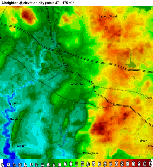
These maps also provides idea of topography and contour of this city, they are displayed at different zoom levels. More info about maps, scale and edge coordinates you can find below images.
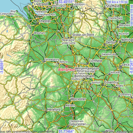
| \ | Map #1 | Map #2 | Topo.Map |
| Scale [m] | 67..157 m | 47..175 m | × |
| Scale [ft] | 220..515 ft | 154..574 ft | × |
| Average | 100.8 m = 331 ft | 106 m = 348 ft | × |
| Width | 5.93 km = 3.7 mi | 11.86 km = 7.4 mi | 189.8 km = 117.9 mi |
| Height | 5.93 km = 3.7 mi | 11.86 km = 7.4 mi | 189.8 km = 117.9 mi |
| ↑Max Latitude | 52.663061° | 52.689706° | 53.48151° |
| Latitude at center | 52.6364° | 52.6364° | 52.6364° |
| ↓Min Latitude | 52.609723° | 52.583029° | 51.77464° |
| ← Min Longitude | -2.323605° | -2.367551° | -3.68591° |
| Longitude center | -2.27966° | -2.27966° | -2.27966° |
| →Max Longitude | -2.235715° | -2.191769° | -0.87341° |
Nearby cities:
Cities around Albrighton sort by population:
• Wolverhampton elevation 160 m
12 km,  118°
118°
• Telford 163 m
12.3 km,  291°
291°
• Ryton 66 m
5.2 km,  245°
245°
• Codsall 125 m
5.3 km,  97°
97°
• Shifnal 91 m
7.3 km,  301°
301°
• Woodcote 112 m
11.4 km,  341°
341°
• Coven 100 m
10 km,  77°
77°
• Brewood 113 m
8.4 km,  57°
57°
• Wheaton Aston 112 m
9.2 km,  25°
25°
• Pattingham 121 m
5.3 km,  169°
169°
• Madeley 107 m
10.4 km,  268°
268°
• Tong 94 m
3.6 km, 337°
Multilingual:
 En español:
Albrighton elevación 95 m.
 En France:
Albrighton élévation 95 m.
 Auf Deutsch:
Albrighton höhe über dem Meeresspiegel ist 95 m.

Sources and notes:
- [note 1] Map square and city borders are not equal. Map elevation data is calculated only from area inside that square.
- [src 1] Elevation data from geonames database provided with same terms of usage.
- [src 2] The elevation map of Albrighton is generated using elevation data from NASA's 3 arcsec (90m) resolution SRTM data.
- [src 3] Base (background) map © OpenStreetMap contributors tiles are generated by Geofabrik and OpenTopoMap.
Copyright & License:
This Albrighton Elevation Map is licensed under CC BY-SA. You may reuse any part from this page, if you give a proper credit by linking to this URL:
 More info on terms of use page.