Wolverhampton elevation
Wolverhampton (England), United Kingdom elevation is 160 meters and Wolverhampton elevation in feet is 525 ft above sea level [src 1]. Wolverhampton is a seat of a second-order administrative division (feature code) with elevation that is 88 meters (289 ft) bigger than average city elevation in United Kingdom.
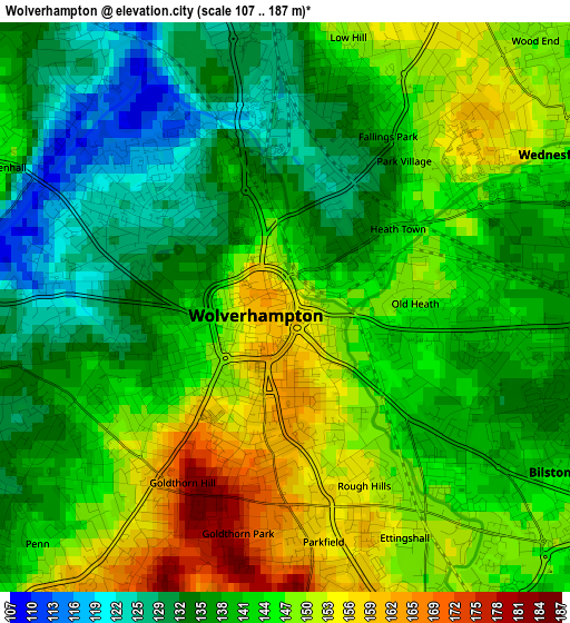
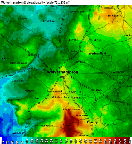
Below is the Elevation map of Wolverhampton, which displays elevation range with different colors. Scale of the first map is from 107 to 187 m (351 to 614 ft) with average elevation of 142 meters (=466 ft) [note 1]
These maps also provides idea of topography and contour of this city, they are displayed at different zoom levels. More info about maps, scale and edge coordinates you can find below images.
| \ | Map #1 | Map #2 | Topo.Map |
| Scale [m] | 107..187 m | 72..235 m | × |
| Scale [ft] | 351..614 ft | 236..771 ft | × |
| Average | 142 m = 466 ft | 139 m = 456 ft | × |
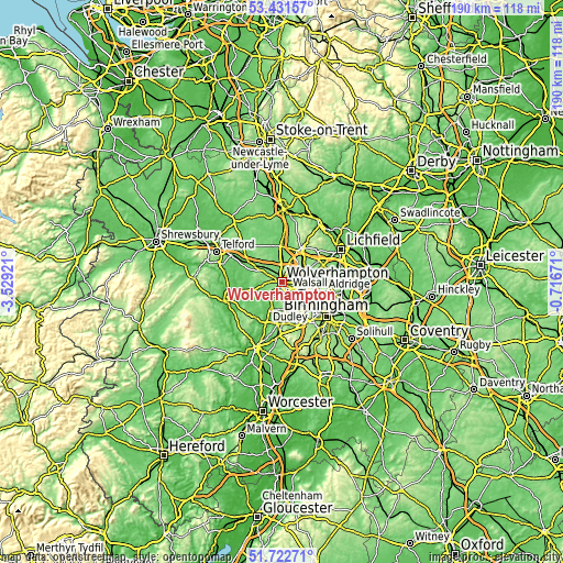
| Width | 5.94 km = 3.7 mi | 11.88 km = 7.4 mi | 190 km = 118.1 mi |
| Height | 5.94 km = 3.7 mi | 11.88 km = 7.4 mi | 190 km = 118.1 mi |
| ↑Max Latitude | 52.612162° | 52.638838° | 53.43157° |
| Latitude at center | 52.58547° | 52.58547° | 52.58547° |
| ↓Min Latitude | 52.558762° | 52.532037° | 51.72271° |
| ← Min Longitude | -2.166905° | -2.210851° | -3.52921° |
| Longitude center | -2.12296° | -2.12296° | -2.12296° |
| →Max Longitude | -2.079015° | -2.035069° | -0.71671° |
Nearby cities:
Cities around Wolverhampton sort by population:
• Tipton elevation 144 m
7.3 km,  149°
149°
• Bloxwich 166 m
8.8 km,  65°
65°
• Wednesfield 141 m
2.8 km,  64°
64°
• Willenhall 136 m
4.3 km,  90°
90°
• Wednesbury 136 m
7.7 km,  119°
119°
• Featherstone 129 m
6.9 km,  16°
16°
• Wombourn 90 m
7.1 km,  215°
215°
• Codsall 125 m
7.2 km,  312°
312°
• Bilston 144 m
4 km, 123°
• Essington 183 m
6.6 km,  42°
42°
• Coven 100 m
7.9 km,  353°
353°
• Darlaston 141 m
6.4 km,  109°
109°
Multilingual:
 En español:
Wolverhampton elevación 160 m.
 En France:
Wolverhampton élévation 160 m.
 Auf Deutsch:
Wolverhampton höhe über dem Meeresspiegel ist 160 m.

Sources and notes:
- [note 1] Map square and city borders are not equal. Map elevation data is calculated only from area inside that square.
- [src 1] Elevation data from geonames database provided with same terms of usage.
- [src 2] The elevation map of Wolverhampton is generated using elevation data from NASA's 3 arcsec (90m) resolution SRTM data.
- [src 3] Base (background) map © OpenStreetMap contributors tiles are generated by Geofabrik and OpenTopoMap.
Copyright & License:
This Wolverhampton Elevation Map is licensed under CC BY-SA. You may reuse any part from this page, if you give a proper credit by linking to this URL:
 More info on terms of use page.