Willenhall elevation
Willenhall (England, Walsall), United Kingdom elevation is 136 meters and Willenhall elevation in feet is 446 ft above sea level [src 1]. Willenhall is a populated place (feature code) with elevation that is 64 meters (210 ft) bigger than average city elevation in United Kingdom.
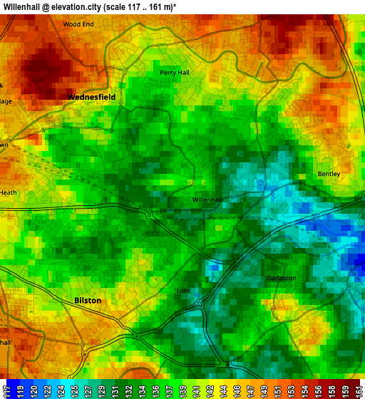
Below is the Elevation map of Willenhall, which displays elevation range with different colors. Scale of the first map is from 117 to 161 m (384 to 528 ft) with average elevation of 139.2 meters (=457 ft) [note 1]
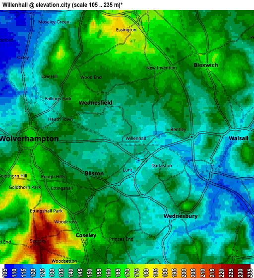
These maps also provides idea of topography and contour of this city, they are displayed at different zoom levels. More info about maps, scale and edge coordinates you can find below images.
| \ | Map #1 | Map #2 | Topo.Map |
| Scale [m] | 117..161 m | 105..235 m | × |
| Scale [ft] | 384..528 ft | 344..771 ft | × |
| Average | 139.2 m = 457 ft | 145.1 m = 476 ft | × |
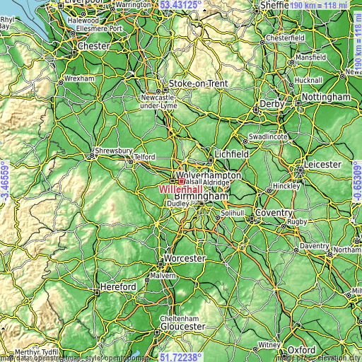
| Width | 5.94 km = 3.7 mi | 11.88 km = 7.4 mi | 190 km = 118.1 mi |
| Height | 5.94 km = 3.7 mi | 11.88 km = 7.4 mi | 190 km = 118.1 mi |
| ↑Max Latitude | 52.611832° | 52.638508° | 53.43125° |
| Latitude at center | 52.58514° | 52.58514° | 52.58514° |
| ↓Min Latitude | 52.558431° | 52.531707° | 51.72238° |
| ← Min Longitude | -2.103285° | -2.147231° | -3.46559° |
| Longitude center | -2.05934° | -2.05934° | -2.05934° |
| →Max Longitude | -2.015395° | -1.971449° | -0.65309° |
Nearby cities:
Cities around Willenhall sort by population:
• Wolverhampton elevation 160 m
4.3 km,  270°
270°
• Walsall 129 m
5.1 km,  89°
89°
• West Bromwich 165 m
8.6 km,  149°
149°
• Tipton 144 m
6.2 km,  185°
185°
• Bloxwich 166 m
5.2 km,  45°
45°
• Wednesfield 141 m
2.1 km,  305°
305°
• Wednesbury 136 m
4.5 km, 147°
• Featherstone 129 m
7 km,  341°
341°
• Pelsall 146 m
7.9 km, 51°
• Bilston 144 m
2.4 km,  204°
204°
• Essington 183 m
4.9 km,  1°
1°
• Darlaston 141 m
2.7 km,  139°
139°
Multilingual:
 En español:
Willenhall elevación 136 m.
 En France:
Willenhall élévation 136 m.
 Auf Deutsch:
Willenhall höhe über dem Meeresspiegel ist 136 m.

Sources and notes:
- [note 1] Map square and city borders are not equal. Map elevation data is calculated only from area inside that square.
- [src 1] Elevation data from geonames database provided with same terms of usage.
- [src 2] The elevation map of Willenhall is generated using elevation data from NASA's 3 arcsec (90m) resolution SRTM data.
- [src 3] Base (background) map © OpenStreetMap contributors tiles are generated by Geofabrik and OpenTopoMap.
Copyright & License:
This Willenhall Elevation Map is licensed under CC BY-SA. You may reuse any part from this page, if you give a proper credit by linking to this URL:
 More info on terms of use page.