Pelsall elevation
Pelsall (England, Walsall), United Kingdom elevation is 146 meters and Pelsall elevation in feet is 479 ft above sea level [src 1]. Pelsall is a populated place (feature code) with elevation that is 74 meters (243 ft) bigger than average city elevation in United Kingdom.
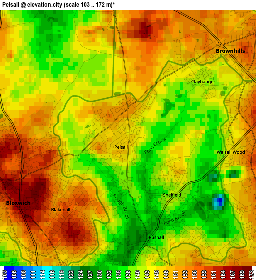
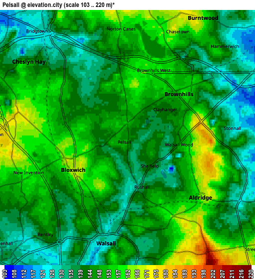
Below is the Elevation map of Pelsall, which displays elevation range with different colors. Scale of the first map is from 103 to 172 m (338 to 564 ft) with average elevation of 145.7 meters (=478 ft) [note 1]
These maps also provides idea of topography and contour of this city, they are displayed at different zoom levels. More info about maps, scale and edge coordinates you can find below images.
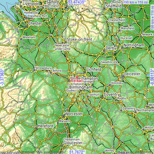
| \ | Map #1 | Map #2 | Topo.Map |
| Scale [m] | 103..172 m | 103..220 m | × |
| Scale [ft] | 338..564 ft | 338..722 ft | × |
| Average | 145.7 m = 478 ft | 145.6 m = 478 ft | × |
| Width | 5.93 km = 3.7 mi | 11.86 km = 7.4 mi | 189.8 km = 117.9 mi |
| Height | 5.93 km = 3.7 mi | 11.86 km = 7.4 mi | 189.8 km = 117.9 mi |
| ↑Max Latitude | 52.655765° | 52.682415° | 53.47435° |
| Latitude at center | 52.6291° | 52.6291° | 52.6291° |
| ↓Min Latitude | 52.602418° | 52.57572° | 51.7672° |
| ← Min Longitude | -2.011325° | -2.055271° | -3.37363° |
| Longitude center | -1.96738° | -1.96738° | -1.96738° |
| →Max Longitude | -1.923435° | -1.879489° | -0.56113° |
Nearby cities:
Cities around Pelsall sort by population:
• Walsall elevation 129 m
5 km,  192°
192°
• Cannock 154 m
8.1 km,  327°
327°
• Bloxwich 166 m
2.8 km,  243°
243°
• Burntwood 173 m
6.3 km,  25°
25°
• Willenhall 136 m
7.9 km,  231°
231°
• Brownhills 143 m
2.3 km,  78°
78°
• Great Wyrley 135 m
4.8 km,  321°
321°
• Aldridge 162 m
4.3 km,  127°
127°
• Streetly 164 m
7.6 km, 131°
• Chasetown 156 m
5.6 km, 30°
• Norton Canes 151 m
4.7 km,  3°
3°
• Essington 183 m
6.1 km,  270°
270°
Multilingual:
 En español:
Pelsall elevación 146 m.
 En France:
Pelsall élévation 146 m.


Sources and notes:
- [note 1] Map square and city borders are not equal. Map elevation data is calculated only from area inside that square.
- [src 1] Elevation data from geonames database provided with same terms of usage.
- [src 2] The elevation map of Pelsall is generated using elevation data from NASA's 3 arcsec (90m) resolution SRTM data.
- [src 3] Base (background) map © OpenStreetMap contributors tiles are generated by Geofabrik and OpenTopoMap.
Copyright & License:
This Pelsall Elevation Map is licensed under CC BY-SA. You may reuse any part from this page, if you give a proper credit by linking to this URL:
 More info on terms of use page.