Streetly elevation
Streetly (England, Walsall), United Kingdom elevation is 164 meters and Streetly elevation in feet is 538 ft above sea level [src 1]. Streetly is a populated place (feature code) with elevation that is 92 meters (302 ft) bigger than average city elevation in United Kingdom.
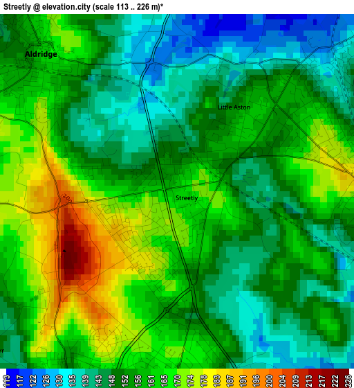
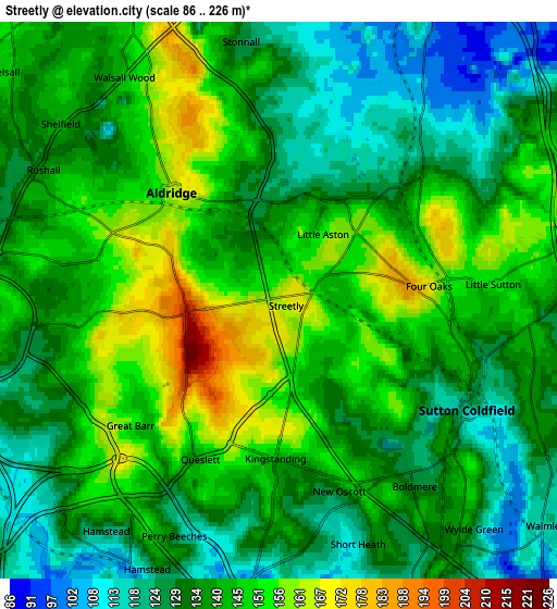
Below is the Elevation map of Streetly, which displays elevation range with different colors. Scale of the first map is from 113 to 226 m (371 to 741 ft) with average elevation of 156 meters (=512 ft) [note 1]
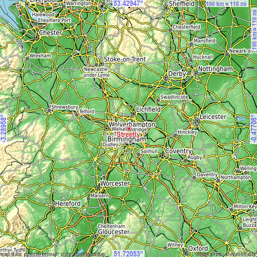
These maps also provides idea of topography and contour of this city, they are displayed at different zoom levels. More info about maps, scale and edge coordinates you can find below images.
| \ | Map #1 | Map #2 | Topo.Map |
| Scale [m] | 113..226 m | 86..226 m | × |
| Scale [ft] | 371..741 ft | 282..741 ft | × |
| Average | 156 m = 512 ft | 138.7 m = 455 ft | × |
| Width | 5.94 km = 3.7 mi | 11.88 km = 7.4 mi | 190 km = 118.1 mi |
| Height | 5.94 km = 3.7 mi | 11.88 km = 7.4 mi | 190 km = 118.1 mi |
| ↑Max Latitude | 52.610023° | 52.6367° | 53.42947° |
| Latitude at center | 52.58333° | 52.58333° | 52.58333° |
| ↓Min Latitude | 52.55662° | 52.529895° | 51.72053° |
| ← Min Longitude | -1.927275° | -1.971221° | -3.28958° |
| Longitude center | -1.88333° | -1.88333° | -1.88333° |
| →Max Longitude | -1.839385° | -1.795439° | -0.47708° |
Nearby cities:
Cities around Streetly sort by population:
• Walsall elevation 129 m
6.8 km,  271°
271°
• Sutton Coldfield 119 m
4.9 km,  112°
112°
• Bloxwich 166 m
9 km,  295°
295°
• Washwood Heath 100 m
10 km,  157°
157°
• Aston 113 m
9.3 km,  180°
180°
• Wednesbury 136 m
10.1 km,  249°
249°
• Brownhills 143 m
6.5 km,  328°
328°
• Aldridge 162 m
3.4 km,  317°
317°
• Hockley 131 m
9.5 km,  193°
193°
• Pelsall 146 m
7.6 km,  311°
311°
• Castle Vale 89 m
9.3 km,  140°
140°
• Shenstone 104 m
6.7 km,  24°
24°
Multilingual:
 En español:
Streetly elevación 164 m.
 En France:
Streetly élévation 164 m.
 Auf Deutsch:
Streetly höhe über dem Meeresspiegel ist 164 m.

Sources and notes:
- [note 1] Map square and city borders are not equal. Map elevation data is calculated only from area inside that square.
- [src 1] Elevation data from geonames database provided with same terms of usage.
- [src 2] The elevation map of Streetly is generated using elevation data from NASA's 3 arcsec (90m) resolution SRTM data.
- [src 3] Base (background) map © OpenStreetMap contributors tiles are generated by Geofabrik and OpenTopoMap.
Copyright & License:
This Streetly Elevation Map is licensed under CC BY-SA. You may reuse any part from this page, if you give a proper credit by linking to this URL:
 More info on terms of use page.