Castle Vale elevation
Castle Vale (England, City and Borough of Birmingham), United Kingdom elevation is 89 meters and Castle Vale elevation in feet is 292 ft above sea level [src 1]. Castle Vale is a populated place(s) (feature code) with elevation that is 17 meters (56 ft) bigger than average city elevation in United Kingdom.
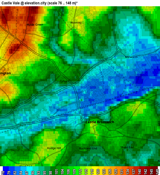
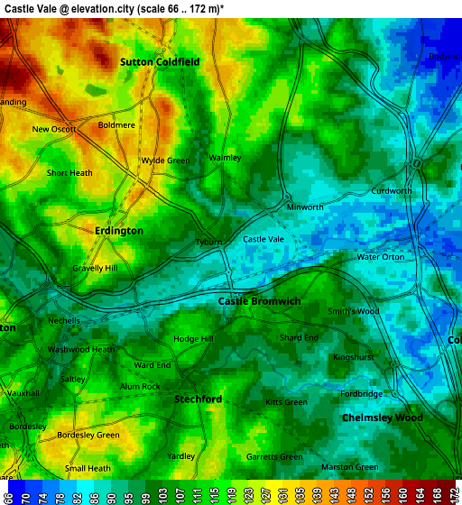
Below is the Elevation map of Castle Vale, which displays elevation range with different colors. Scale of the first map is from 76 to 148 m (249 to 486 ft) with average elevation of 101.1 meters (=332 ft) [note 1]
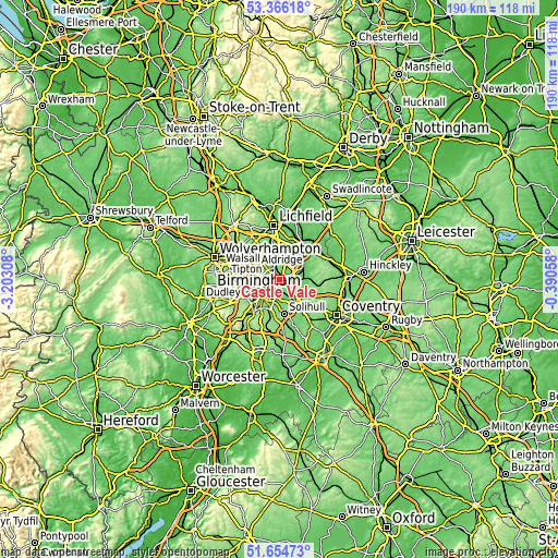
These maps also provides idea of topography and contour of this city, they are displayed at different zoom levels. More info about maps, scale and edge coordinates you can find below images.
| \ | Map #1 | Map #2 | Topo.Map |
| Scale [m] | 76..148 m | 66..172 m | × |
| Scale [ft] | 249..486 ft | 217..564 ft | × |
| Average | 101.1 m = 332 ft | 105.8 m = 347 ft | × |
| Width | 5.95 km = 3.7 mi | 11.89 km = 7.4 mi | 190.3 km = 118.2 mi |
| Height | 5.95 km = 3.7 mi | 11.89 km = 7.4 mi | 190.3 km = 118.2 mi |
| ↑Max Latitude | 52.545523° | 52.572239° | 53.36618° |
| Latitude at center | 52.51879° | 52.51879° | 52.51879° |
| ↓Min Latitude | 52.492041° | 52.465276° | 51.65473° |
| ← Min Longitude | -1.840775° | -1.884721° | -3.20308° |
| Longitude center | -1.79683° | -1.79683° | -1.79683° |
| →Max Longitude | -1.752885° | -1.708939° | -0.39058° |
Nearby cities:
Cities around Castle Vale sort by population:
• Birmingham elevation 149 m
8.1 km,  239°
239°
• Sutton Coldfield 119 m
5.5 km,  345°
345°
• Washwood Heath 100 m
2.9 km,  224°
224°
• Aston 113 m
6.2 km,  250°
250°
• Acocks Green 125 m
7.8 km,  189°
189°
• Hockley 131 m
8.4 km,  255°
255°
• Streetly 164 m
9.3 km,  320°
320°
• Chelmsley Wood 93 m
6 km,  138°
138°
• Kingsbury 77 m
9.2 km,  59°
59°
• Water Orton 86 m
3.9 km,  95°
95°
• Curdworth 89 m
4.4 km,  67°
67°
• Bickenhill 114 m
10 km,  151°
151°
Multilingual:
 En español:
Castle Vale elevación 89 m.
 En France:
Castle Vale élévation 89 m.
 Auf Deutsch:
Castle Vale höhe über dem Meeresspiegel ist 89 m.

Sources and notes:
- [note 1] Map square and city borders are not equal. Map elevation data is calculated only from area inside that square.
- [src 1] Elevation data from geonames database provided with same terms of usage.
- [src 2] The elevation map of Castle Vale is generated using elevation data from NASA's 3 arcsec (90m) resolution SRTM data.
- [src 3] Base (background) map © OpenStreetMap contributors tiles are generated by Geofabrik and OpenTopoMap.
Copyright & License:
This Castle Vale Elevation Map is licensed under CC BY-SA. You may reuse any part from this page, if you give a proper credit by linking to this URL:
 More info on terms of use page.