Tipton elevation
Tipton (England, Sandwell), United Kingdom elevation is 144 meters and Tipton elevation in feet is 472 ft above sea level [src 1]. Tipton is a populated place (feature code) with elevation that is 72 meters (236 ft) bigger than average city elevation in United Kingdom.
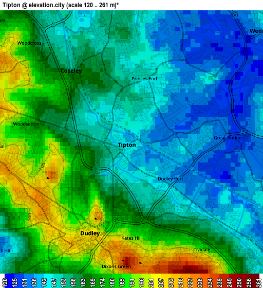
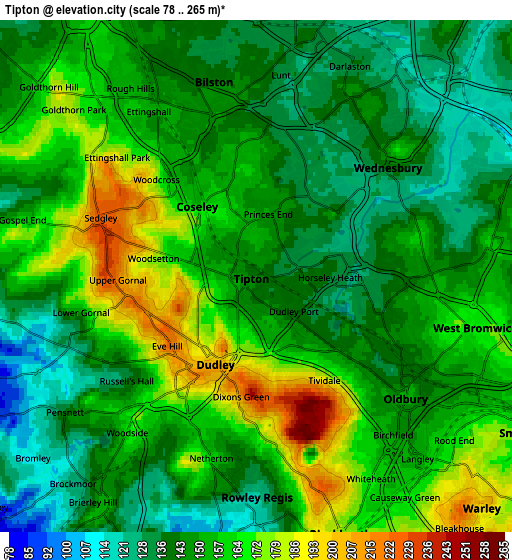
Below is the Elevation map of Tipton, which displays elevation range with different colors. Scale of the first map is from 120 to 261 m (394 to 856 ft) with average elevation of 161.3 meters (=529 ft) [note 1]
These maps also provides idea of topography and contour of this city, they are displayed at different zoom levels. More info about maps, scale and edge coordinates you can find below images.
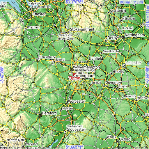
| \ | Map #1 | Map #2 | Topo.Map |
| Scale [m] | 120..261 m | 78..265 m | × |
| Scale [ft] | 394..856 ft | 256..869 ft | × |
| Average | 161.3 m = 529 ft | 152 m = 499 ft | × |
| Width | 5.95 km = 3.7 mi | 11.89 km = 7.4 mi | 190.2 km = 118.2 mi |
| Height | 5.95 km = 3.7 mi | 11.89 km = 7.4 mi | 190.2 km = 118.2 mi |
| ↑Max Latitude | 52.556286° | 52.582996° | 53.37675° |
| Latitude at center | 52.52956° | 52.52956° | 52.52956° |
| ↓Min Latitude | 52.502818° | 52.476059° | 51.66571° |
| ← Min Longitude | -2.111675° | -2.155621° | -3.47398° |
| Longitude center | -2.06773° | -2.06773° | -2.06773° |
| →Max Longitude | -2.023785° | -1.979839° | -0.66148° |
Nearby cities:
Cities around Tipton sort by population:
• Wolverhampton elevation 160 m
7.3 km,  329°
329°
• Dudley 161 m
3.5 km,  197°
197°
• West Bromwich 165 m
5.1 km,  103°
103°
• Brierley Hill 152 m
6.4 km,  214°
214°
• Willenhall 136 m
6.2 km,  5°
5°
• Wednesbury 136 m
3.9 km,  50°
50°
• Oldbury 145 m
4.8 km,  133°
133°
• Cradley Heath 109 m
6.5 km,  188°
188°
• Bilston 144 m
4 km,  354°
354°
• Netherton 132 m
5.2 km, 191°
• Rowley Regis 210 m
5.4 km,  162°
162°
• Darlaston 141 m
4.7 km,  29°
29°
Multilingual:
 En español:
Tipton elevación 144 m.
 En France:
Tipton élévation 144 m.


Sources and notes:
- [note 1] Map square and city borders are not equal. Map elevation data is calculated only from area inside that square.
- [src 1] Elevation data from geonames database provided with same terms of usage.
- [src 2] The elevation map of Tipton is generated using elevation data from NASA's 3 arcsec (90m) resolution SRTM data.
- [src 3] Base (background) map © OpenStreetMap contributors tiles are generated by Geofabrik and OpenTopoMap.
Copyright & License:
This Tipton Elevation Map is licensed under CC BY-SA. You may reuse any part from this page, if you give a proper credit by linking to this URL:
 More info on terms of use page.