Codsall elevation
Codsall (England, Staffordshire), United Kingdom elevation is 125 meters and Codsall elevation in feet is 410 ft above sea level [src 1]. Codsall is a populated place (feature code) with elevation that is 53 meters (174 ft) bigger than average city elevation in United Kingdom.
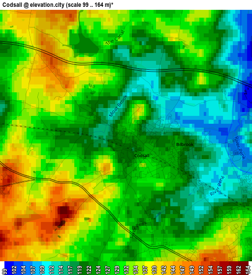
Below is the Elevation map of Codsall, which displays elevation range with different colors. Scale of the first map is from 99 to 164 m (325 to 538 ft) with average elevation of 127 meters (=417 ft) [note 1]
These maps also provides idea of topography and contour of this city, they are displayed at different zoom levels. More info about maps, scale and edge coordinates you can find below images.
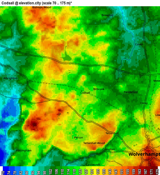
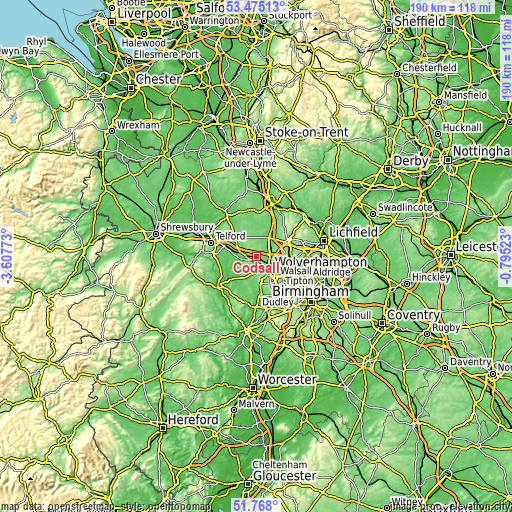
| \ | Map #1 | Map #2 | Topo.Map |
| Scale [m] | 99..164 m | 70..175 m | × |
| Scale [ft] | 325..538 ft | 230..574 ft | × |
| Average | 127 m = 417 ft | 119.2 m = 391 ft | × |
| Width | 5.93 km = 3.7 mi | 11.86 km = 7.4 mi | 189.8 km = 117.9 mi |
| Height | 5.93 km = 3.7 mi | 11.86 km = 7.4 mi | 189.8 km = 117.9 mi |
| ↑Max Latitude | 52.656555° | 52.683204° | 53.47513° |
| Latitude at center | 52.62989° | 52.62989° | 52.62989° |
| ↓Min Latitude | 52.603209° | 52.576511° | 51.768° |
| ← Min Longitude | -2.245425° | -2.289371° | -3.60773° |
| Longitude center | -2.20148° | -2.20148° | -2.20148° |
| →Max Longitude | -2.157535° | -2.113589° | -0.79523° |
Nearby cities:
Cities around Codsall sort by population:
• Wolverhampton elevation 160 m
7.2 km,  132°
132°
• Wednesfield 141 m
8.7 km,  115°
115°
• Willenhall 136 m
10.8 km, 117°
• Ryton 66 m
10.1 km,  261°
261°
• Featherstone 129 m
7.5 km,  77°
77°
• Essington 183 m
9.7 km,  90°
90°
• Albrighton 95 m
5.3 km,  277°
277°
• Coven 100 m
5.3 km,  57°
57°
• Brewood 113 m
5.6 km,  19°
19°
• Wheaton Aston 112 m
9.2 km,  351°
351°
• Pattingham 121 m
6.3 km,  223°
223°
• Tong 94 m
7.8 km,  301°
301°
Multilingual:
 En español:
Codsall elevación 125 m.
 En France:
Codsall élévation 125 m.


Sources and notes:
- [note 1] Map square and city borders are not equal. Map elevation data is calculated only from area inside that square.
- [src 1] Elevation data from geonames database provided with same terms of usage.
- [src 2] The elevation map of Codsall is generated using elevation data from NASA's 3 arcsec (90m) resolution SRTM data.
- [src 3] Base (background) map © OpenStreetMap contributors tiles are generated by Geofabrik and OpenTopoMap.
Copyright & License:
This Codsall Elevation Map is licensed under CC BY-SA. You may reuse any part from this page, if you give a proper credit by linking to this URL:
 More info on terms of use page.