Telford elevation
Telford (England, Telford and Wrekin), United Kingdom elevation is 163 meters and Telford elevation in feet is 535 ft above sea level [src 1]. Telford is a seat of a second-order administrative division (feature code) with elevation that is 91 meters (299 ft) bigger than average city elevation in United Kingdom.
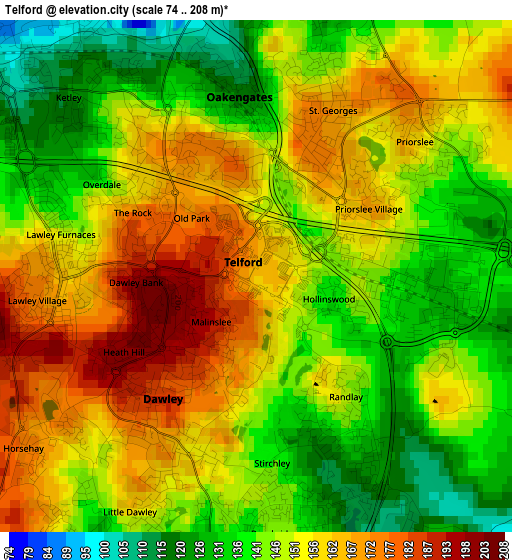
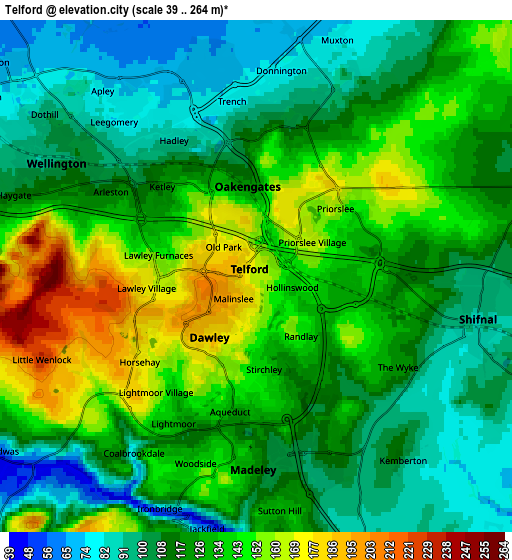
Below is the Elevation map of Telford, which displays elevation range with different colors. Scale of the first map is from 74 to 208 m (243 to 682 ft) with average elevation of 150.3 meters (=493 ft) [note 1]
These maps also provides idea of topography and contour of this city, they are displayed at different zoom levels. More info about maps, scale and edge coordinates you can find below images.
| \ | Map #1 | Map #2 | Topo.Map |
| Scale [m] | 74..208 m | 39..264 m | × |
| Scale [ft] | 243..682 ft | 128..866 ft | × |
| Average | 150.3 m = 493 ft | 124 m = 407 ft | × |
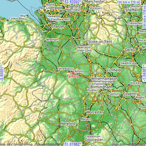
| Width | 5.93 km = 3.7 mi | 11.85 km = 7.4 mi | 189.6 km = 117.8 mi |
| Height | 5.93 km = 3.7 mi | 11.85 km = 7.4 mi | 189.6 km = 117.8 mi |
| ↑Max Latitude | 52.703227° | 52.729847° | 53.52092° |
| Latitude at center | 52.67659° | 52.67659° | 52.67659° |
| ↓Min Latitude | 52.649937° | 52.623268° | 51.81562° |
| ← Min Longitude | -2.493205° | -2.537151° | -3.85551° |
| Longitude center | -2.44926° | -2.44926° | -2.44926° |
| →Max Longitude | -2.405315° | -2.361369° | -1.04301° |
Nearby cities:
Cities around Telford sort by population:
• Wellington elevation 101 m
5.2 km,  299°
299°
• Ryton 66 m
9.4 km,  134°
134°
• Hadley 107 m
3.5 km,  318°
318°
• Newport 75 m
11.1 km,  25°
25°
• Oakengates 120 m
2 km,  357°
357°
• Shifnal 91 m
5.2 km,  97°
97°
• Broseley 155 m
7.4 km,  197°
197°
• Woodcote 112 m
10 km,  51°
51°
• Ironbridge 71 m
5.9 km, 203°
• Tong 94 m
10.1 km, 96°
• Eyton upon the Weald Moors 55 m
7.8 km, 324°
• Madeley 107 m
4.9 km,  167°
167°
Multilingual:
 En español:
Telford elevación 163 m.
 En France:
Telford élévation 163 m.


Sources and notes:
- [note 1] Map square and city borders are not equal. Map elevation data is calculated only from area inside that square.
- [src 1] Elevation data from geonames database provided with same terms of usage.
- [src 2] The elevation map of Telford is generated using elevation data from NASA's 3 arcsec (90m) resolution SRTM data.
- [src 3] Base (background) map © OpenStreetMap contributors tiles are generated by Geofabrik and OpenTopoMap.
Copyright & License:
This Telford Elevation Map is licensed under CC BY-SA. You may reuse any part from this page, if you give a proper credit by linking to this URL:
 More info on terms of use page.