Alcester elevation
Alcester (England, Warwickshire), United Kingdom elevation is 45 meters and Alcester elevation in feet is 148 ft above sea level [src 1]. Alcester is a populated place (feature code) with elevation that is 27 meters (89 ft) smaller than average city elevation in United Kingdom.
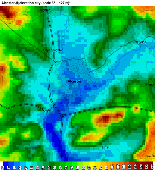
Below is the Elevation map of Alcester, which displays elevation range with different colors. Scale of the first map is from 33 to 127 m (108 to 417 ft) with average elevation of 61.8 meters (=203 ft) [note 1]
These maps also provides idea of topography and contour of this city, they are displayed at different zoom levels. More info about maps, scale and edge coordinates you can find below images.
| \ | Map #1 | Map #2 | Topo.Map |
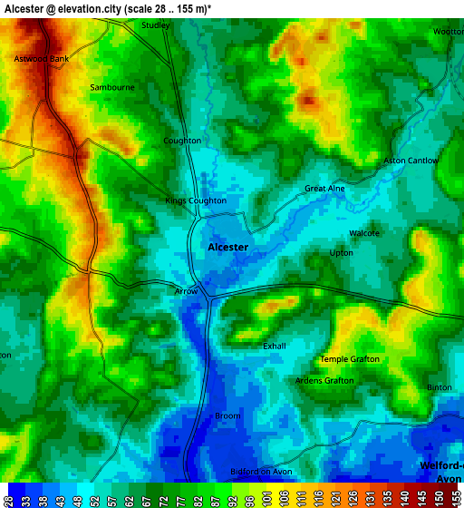
| Scale [m] | 33..127 m | 28..155 m | × |
| Scale [ft] | 108..417 ft | 92..509 ft | × |
| Average | 61.8 m = 203 ft | 72 m = 236 ft | × |
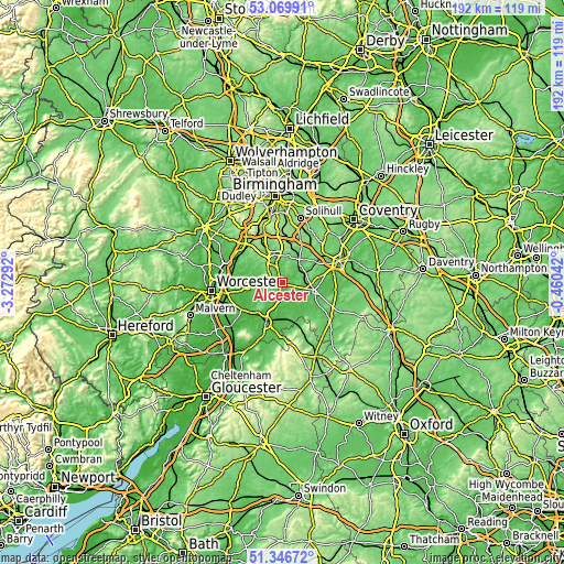
| Width | 5.99 km = 3.7 mi | 11.97 km = 7.4 mi | 191.6 km = 119.1 mi |
| Height | 5.99 km = 3.7 mi | 11.97 km = 7.4 mi | 191.6 km = 119.1 mi |
| ↑Max Latitude | 52.243586° | 52.270486° | 53.06991° |
| Latitude at center | 52.21667° | 52.21667° | 52.21667° |
| ↓Min Latitude | 52.189738° | 52.162789° | 51.34672° |
| ← Min Longitude | -1.910615° | -1.954561° | -3.27292° |
| Longitude center | -1.86667° | -1.86667° | -1.86667° |
| →Max Longitude | -1.822725° | -1.778779° | -0.46042° |
Nearby cities:
Cities around Alcester sort by population:
• Redditch elevation 115 m
11.3 km,  331°
331°
• Stratford-upon-Avon 44 m
11.2 km,  104°
104°
• Studley 75 m
6.2 km,  343°
343°
• Bidford-on-Avon 36 m
5.3 km,  174°
174°
• Bidford-on-avon 39 m
5.5 km, 172°
• Henley in Arden 74 m
10.2 km,  36°
36°
• Astwood Bank 145 m
6.8 km,  314°
314°
• Kington 59 m
10.4 km,  259°
259°
• Harvington 49 m
9.3 km,  204°
204°
• South Littleton 43 m
11.5 km,  187°
187°
• Inkberrow 86 m
7.8 km,  266°
266°
• Wilmcote 76 m
6.9 km,  86°
86°
Multilingual:
 En español:
Alcester elevación 45 m.
 En France:
Alcester élévation 45 m.


Sources and notes:
- [note 1] Map square and city borders are not equal. Map elevation data is calculated only from area inside that square.
- [src 1] Elevation data from geonames database provided with same terms of usage.
- [src 2] The elevation map of Alcester is generated using elevation data from NASA's 3 arcsec (90m) resolution SRTM data.
- [src 3] Base (background) map © OpenStreetMap contributors tiles are generated by Geofabrik and OpenTopoMap.
Copyright & License:
This Alcester Elevation Map is licensed under CC BY-SA. You may reuse any part from this page, if you give a proper credit by linking to this URL:
 More info on terms of use page.