Kington elevation
Kington (England, Worcestershire), United Kingdom elevation is 59 meters and Kington elevation in feet is 194 ft above sea level [src 1]. Kington is a populated place (feature code) with elevation that is 13 meters (43 ft) smaller than average city elevation in United Kingdom.
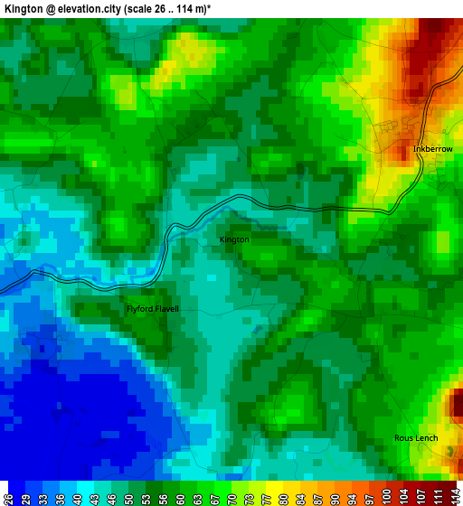
Below is the Elevation map of Kington, which displays elevation range with different colors. Scale of the first map is from 26 to 114 m (85 to 374 ft) with average elevation of 54.8 meters (=180 ft) [note 1]
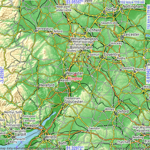
These maps also provides idea of topography and contour of this city, they are displayed at different zoom levels. More info about maps, scale and edge coordinates you can find below images.
| \ | Map #1 | Topo.Map |
| Scale [m] | 26..114 m | × |
| Scale [ft] | 85..374 ft | × |
| Average | 54.8 m = 180 ft | × |
| Width | 5.99 km = 3.7 mi | 191.7 km = 119.1 mi |
| Height | 5.99 km = 3.7 mi | 191.7 km = 119.1 mi |
| ↑Max Latitude | 52.226926° | 53.05357° |
| Latitude at center | 52.2° | 52.2° |
| ↓Min Latitude | 52.173057° | 51.32972° |
| ← Min Longitude | -2.060615° | -3.42292° |
| Longitude center | -2.01667° | -2.01667° |
| →Max Longitude | -1.972725° | -0.61042° |
Nearby cities:
Cities around Kington sort by population:
• Droitwich elevation 42 m
11.7 km,  309°
309°
• Pershore 22 m
10.6 km,  202°
202°
• Alcester 45 m
10.4 km,  79°
79°
• Studley 75 m
11.5 km,  47°
47°
• Bidford-on-Avon 36 m
11.2 km,  107°
107°
• Bidford-on-avon 39 m
11.5 km, 108°
• Fernhill Heath 51 m
12.7 km,  285°
285°
• Astwood Bank 145 m
8.6 km,  38°
38°
• Stoke Prior 62 m
11.9 km,  338°
338°
• Harvington 49 m
9.2 km,  135°
135°
• Inkberrow 86 m
2.8 km,  59°
59°
• Wychbold 56 m
12.1 km,  326°
326°
Multilingual:
 En español:
Kington elevación 59 m.
 En France:
Kington élévation 59 m.


Sources and notes:
- [note 1] Map square and city borders are not equal. Map elevation data is calculated only from area inside that square.
- [src 1] Elevation data from geonames database provided with same terms of usage.
- [src 2] The elevation map of Kington is generated using elevation data from NASA's 3 arcsec (90m) resolution SRTM data.
- [src 3] Base (background) map © OpenStreetMap contributors tiles are generated by Geofabrik and OpenTopoMap.
Copyright & License:
This Kington Elevation Map is licensed under CC BY-SA. You may reuse any part from this page, if you give a proper credit by linking to this URL:
 More info on terms of use page.