Pershore elevation
Pershore (England, Worcestershire), United Kingdom elevation is 22 meters and Pershore elevation in feet is 72 ft above sea level [src 1]. Pershore is a populated place (feature code) with elevation that is 50 meters (164 ft) smaller than average city elevation in United Kingdom.
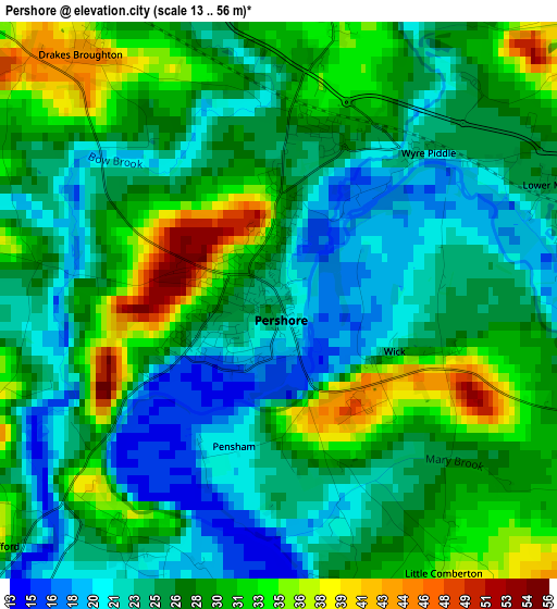
Below is the Elevation map of Pershore, which displays elevation range with different colors. Scale of the first map is from 13 to 56 m (43 to 184 ft) with average elevation of 27.1 meters (=89 ft) [note 1]
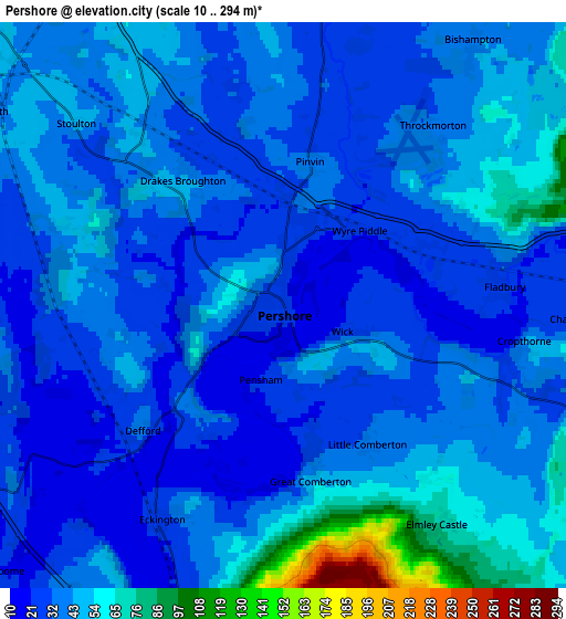
These maps also provides idea of topography and contour of this city, they are displayed at different zoom levels. More info about maps, scale and edge coordinates you can find below images.
| \ | Map #1 | Map #2 | Topo.Map |
| Scale [m] | 13..56 m | 10..294 m | × |
| Scale [ft] | 43..184 ft | 33..965 ft | × |
| Average | 27.1 m = 89 ft | 39.4 m = 129 ft | × |
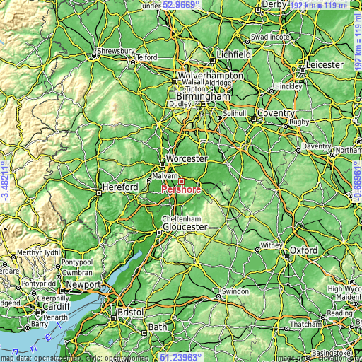
| Width | 6 km = 3.7 mi | 12 km = 7.5 mi | 192.1 km = 119.4 mi |
| Height | 6 km = 3.7 mi | 12 km = 7.5 mi | 192 km = 119.3 mi |
| ↑Max Latitude | 52.13861° | 52.165573° | 52.9669° |
| Latitude at center | 52.11163° | 52.11163° | 52.11163° |
| ↓Min Latitude | 52.084634° | 52.057621° | 51.23963° |
| ← Min Longitude | -2.119805° | -2.163751° | -3.48211° |
| Longitude center | -2.07586° | -2.07586° | -2.07586° |
| →Max Longitude | -2.031915° | -1.987969° | -0.66961° |
Nearby cities:
Cities around Pershore sort by population:
• Worcester elevation 29 m
13.1 km,  311°
311°
• Evesham 35 m
8.9 km,  103°
103°
• Tewkesbury 12 m
14.5 km,  203°
203°
• Kington 59 m
10.6 km,  22°
22°
• Kempsey 18 m
10.1 km,  287°
287°
• Badsey 37 m
12.3 km, 102°
• Bredon 26 m
9.5 km, 197°
• Upton upon Severn 16 m
11.1 km,  240°
240°
• Harvington 49 m
10.9 km,  72°
72°
• South Littleton 43 m
12.7 km,  88°
88°
• Inkberrow 86 m
13 km,  29°
29°
• Eckington 19 m
5.7 km,  209°
209°
Multilingual:
 En español:
Pershore elevación 22 m.
 En France:
Pershore élévation 22 m.


Sources and notes:
- [note 1] Map square and city borders are not equal. Map elevation data is calculated only from area inside that square.
- [src 1] Elevation data from geonames database provided with same terms of usage.
- [src 2] The elevation map of Pershore is generated using elevation data from NASA's 3 arcsec (90m) resolution SRTM data.
- [src 3] Base (background) map © OpenStreetMap contributors tiles are generated by Geofabrik and OpenTopoMap.
Copyright & License:
This Pershore Elevation Map is licensed under CC BY-SA. You may reuse any part from this page, if you give a proper credit by linking to this URL:
 More info on terms of use page.