Redditch elevation
Redditch (England, Worcestershire), United Kingdom elevation is 115 meters and Redditch elevation in feet is 377 ft above sea level [src 1]. Redditch is a populated place (feature code) with elevation that is 43 meters (141 ft) bigger than average city elevation in United Kingdom.
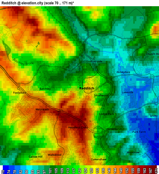
Below is the Elevation map of Redditch, which displays elevation range with different colors. Scale of the first map is from 70 to 171 m (230 to 561 ft) with average elevation of 116.1 meters (=381 ft) [note 1]
These maps also provides idea of topography and contour of this city, they are displayed at different zoom levels. More info about maps, scale and edge coordinates you can find below images.
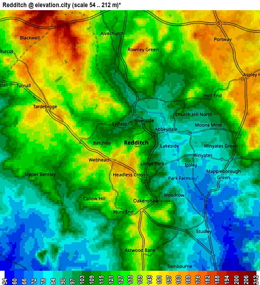
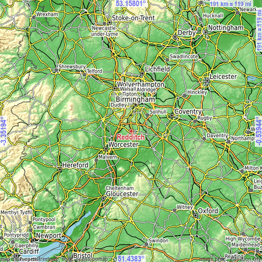
| \ | Map #1 | Map #2 | Topo.Map |
| Scale [m] | 70..171 m | 54..212 m | × |
| Scale [ft] | 230..561 ft | 177..696 ft | × |
| Average | 116.1 m = 381 ft | 117.2 m = 385 ft | × |
| Width | 5.98 km = 3.7 mi | 11.95 km = 7.4 mi | 191.2 km = 118.8 mi |
| Height | 5.98 km = 3.7 mi | 11.95 km = 7.4 mi | 191.2 km = 118.8 mi |
| ↑Max Latitude | 52.333362° | 52.360207° | 53.15801° |
| Latitude at center | 52.3065° | 52.3065° | 52.3065° |
| ↓Min Latitude | 52.279622° | 52.252728° | 51.4383° |
| ← Min Longitude | -1.989635° | -2.033581° | -3.35194° |
| Longitude center | -1.94569° | -1.94569° | -1.94569° |
| →Max Longitude | -1.901745° | -1.857799° | -0.53944° |
Nearby cities:
Cities around Redditch sort by population:
• Bromsgrove elevation 90 m
8.4 km,  292°
292°
• Alcester 45 m
11.3 km,  151°
151°
• Studley 75 m
5.4 km,  137°
137°
• Barnt Green 196 m
7.2 km,  324°
324°
• Dickens Heath 150 m
11.4 km,  39°
39°
• Alvechurch 123 m
5.2 km,  345°
345°
• Henley in Arden 74 m
11.5 km,  98°
98°
• Astwood Bank 145 m
5.2 km,  173°
173°
• Stoke Prior 62 m
9.2 km,  265°
265°
• Inkberrow 86 m
10.7 km,  192°
192°
• Wychbold 56 m
11.7 km,  261°
261°
• Tidbury Green 158 m
10.3 km, 36°
Multilingual:
 En español:
Redditch elevación 115 m.
 En France:
Redditch élévation 115 m.
 Auf Deutsch:
Redditch höhe über dem Meeresspiegel ist 115 m.

Sources and notes:
- [note 1] Map square and city borders are not equal. Map elevation data is calculated only from area inside that square.
- [src 1] Elevation data from geonames database provided with same terms of usage.
- [src 2] The elevation map of Redditch is generated using elevation data from NASA's 3 arcsec (90m) resolution SRTM data.
- [src 3] Base (background) map © OpenStreetMap contributors tiles are generated by Geofabrik and OpenTopoMap.
Copyright & License:
This Redditch Elevation Map is licensed under CC BY-SA. You may reuse any part from this page, if you give a proper credit by linking to this URL:
 More info on terms of use page.