Alvechurch elevation
Alvechurch (England, Worcestershire), United Kingdom elevation is 123 meters and Alvechurch elevation in feet is 404 ft above sea level [src 1]. Alvechurch is a populated place (feature code) with elevation that is 51 meters (167 ft) bigger than average city elevation in United Kingdom.
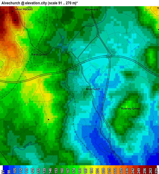
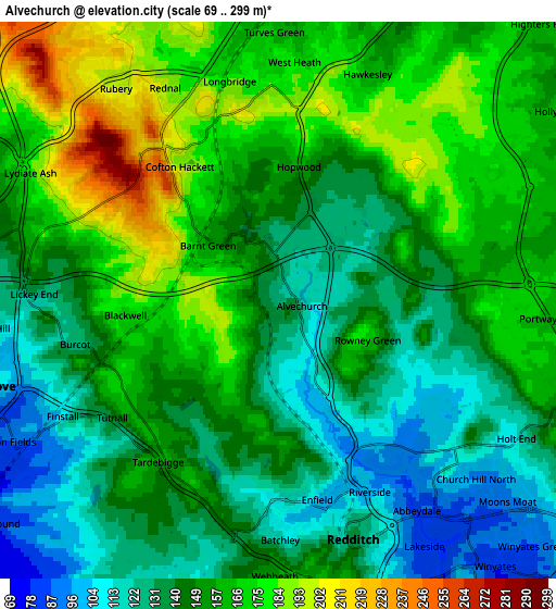
Below is the Elevation map of Alvechurch, which displays elevation range with different colors. Scale of the first map is from 91 to 270 m (299 to 886 ft) with average elevation of 148.2 meters (=486 ft) [note 1]
These maps also provides idea of topography and contour of this city, they are displayed at different zoom levels. More info about maps, scale and edge coordinates you can find below images.
| \ | Map #1 | Map #2 | Topo.Map |
| Scale [m] | 91..270 m | 69..299 m | × |
| Scale [ft] | 299..886 ft | 226..981 ft | × |
| Average | 148.2 m = 486 ft | 150.4 m = 493 ft | × |
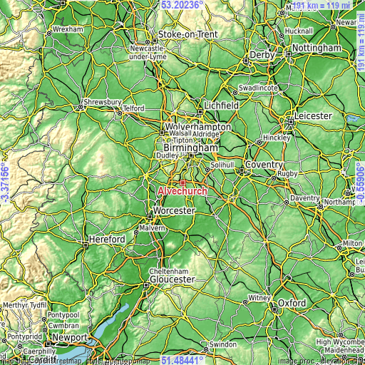
| Width | 5.97 km = 3.7 mi | 11.94 km = 7.4 mi | 191 km = 118.7 mi |
| Height | 5.97 km = 3.7 mi | 11.94 km = 7.4 mi | 191 km = 118.7 mi |
| ↑Max Latitude | 52.378564° | 52.405382° | 53.20236° |
| Latitude at center | 52.35173° | 52.35173° | 52.35173° |
| ↓Min Latitude | 52.32488° | 52.298013° | 51.48441° |
| ← Min Longitude | -2.009255° | -2.053201° | -3.37156° |
| Longitude center | -1.96531° | -1.96531° | -1.96531° |
| →Max Longitude | -1.921365° | -1.877419° | -0.55906° |
Nearby cities:
Cities around Alvechurch sort by population:
• Redditch elevation 115 m
5.2 km,  165°
165°
• Bromsgrove 90 m
6.7 km,  254°
254°
• Bartley Green 189 m
9.5 km,  346°
346°
• Studley 75 m
10.3 km,  151°
151°
• Barnt Green 196 m
3 km,  285°
285°
• Dickens Heath 150 m
9.3 km,  66°
66°
• Astwood Bank 145 m
10.4 km, 169°
• Stoke Prior 62 m
9.7 km,  233°
233°
• Romsley 212 m
9.8 km,  320°
320°
• Belbroughton 116 m
11.3 km, 293°
• Cheswick Green 136 m
10.8 km, 72°
• Tidbury Green 158 m
8.1 km, 66°
Multilingual:
 En español:
Alvechurch elevación 123 m.
 En France:
Alvechurch élévation 123 m.
 Auf Deutsch:
Alvechurch höhe über dem Meeresspiegel ist 123 m.

Sources and notes:
- [note 1] Map square and city borders are not equal. Map elevation data is calculated only from area inside that square.
- [src 1] Elevation data from geonames database provided with same terms of usage.
- [src 2] The elevation map of Alvechurch is generated using elevation data from NASA's 3 arcsec (90m) resolution SRTM data.
- [src 3] Base (background) map © OpenStreetMap contributors tiles are generated by Geofabrik and OpenTopoMap.
Copyright & License:
This Alvechurch Elevation Map is licensed under CC BY-SA. You may reuse any part from this page, if you give a proper credit by linking to this URL:
 More info on terms of use page.