Belbroughton elevation
Belbroughton (England, Worcestershire), United Kingdom elevation is 116 meters and Belbroughton elevation in feet is 381 ft above sea level [src 1]. Belbroughton is a populated place (feature code) with elevation that is 44 meters (144 ft) bigger than average city elevation in United Kingdom.
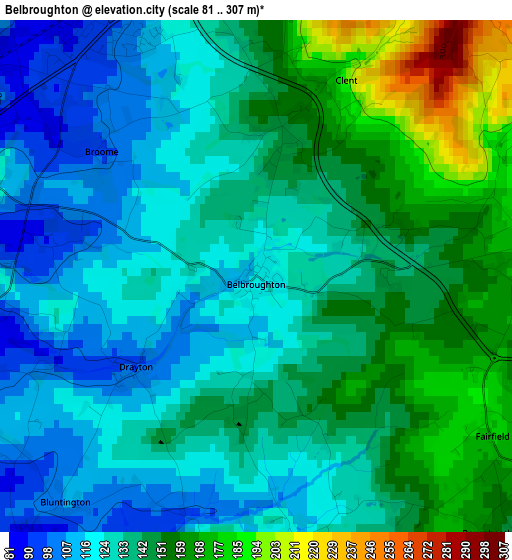
Below is the Elevation map of Belbroughton, which displays elevation range with different colors. Scale of the first map is from 81 to 307 m (266 to 1007 ft) with average elevation of 137.7 meters (=452 ft) [note 1]
These maps also provides idea of topography and contour of this city, they are displayed at different zoom levels. More info about maps, scale and edge coordinates you can find below images.
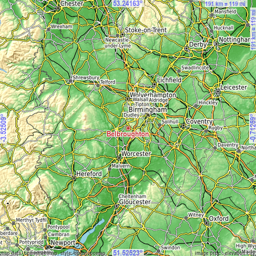
| \ | Map #1 | Topo.Map |
| Scale [m] | 81..307 m | × |
| Scale [ft] | 266..1007 ft | × |
| Average | 137.7 m = 452 ft | × |
| Width | 5.96 km = 3.7 mi | 190.8 km = 118.6 mi |
| Height | 5.96 km = 3.7 mi | 190.8 km = 118.6 mi |
| ↑Max Latitude | 52.41858° | 53.24163° |
| Latitude at center | 52.39177° | 52.39177° |
| ↓Min Latitude | 52.364944° | 51.52523° |
| ← Min Longitude | -2.162785° | -3.52509° |
| Longitude center | -2.11884° | -2.11884° |
| →Max Longitude | -2.074895° | -0.71259° |
Nearby cities:
Cities around Belbroughton sort by population:
• Kidderminster elevation 37 m
8.9 km,  267°
267°
• Stourbridge 86 m
7.3 km,  347°
347°
• Halesowen 128 m
7.9 km,  36°
36°
• Bromsgrove 90 m
7.4 km,  147°
147°
• Brierley Hill 152 m
10 km,  359°
359°
• Bartley Green 189 m
9.6 km,  59°
59°
• Hagley 133 m
3.9 km, 350°
• Barnt Green 196 m
8.4 km,  115°
115°
• Cradley Heath 109 m
9.3 km,  15°
15°
• Kinvere 64 m
10.1 km,  309°
309°
• Hartlebury 71 m
10.1 km,  230°
230°
• Romsley 212 m
5.2 km,  53°
53°
Multilingual:
 En español:
Belbroughton elevación 116 m.
 En France:
Belbroughton élévation 116 m.
 Auf Deutsch:
Belbroughton höhe über dem Meeresspiegel ist 116 m.

Sources and notes:
- [note 1] Map square and city borders are not equal. Map elevation data is calculated only from area inside that square.
- [src 1] Elevation data from geonames database provided with same terms of usage.
- [src 2] The elevation map of Belbroughton is generated using elevation data from NASA's 3 arcsec (90m) resolution SRTM data.
- [src 3] Base (background) map © OpenStreetMap contributors tiles are generated by Geofabrik and OpenTopoMap.
Copyright & License:
This Belbroughton Elevation Map is licensed under CC BY-SA. You may reuse any part from this page, if you give a proper credit by linking to this URL:
 More info on terms of use page.