Kinvere elevation
Kinvere (England, Staffordshire), United Kingdom elevation is 64 meters and Kinvere elevation in feet is 210 ft above sea level [src 1]. Kinvere is a populated place (feature code) with elevation that is 8 meters (26 ft) smaller than average city elevation in United Kingdom.
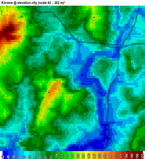
Below is the Elevation map of Kinvere, which displays elevation range with different colors. Scale of the first map is from 42 to 202 m (138 to 663 ft) with average elevation of 87.1 meters (=286 ft) [note 1]
These maps also provides idea of topography and contour of this city, they are displayed at different zoom levels. More info about maps, scale and edge coordinates you can find below images.
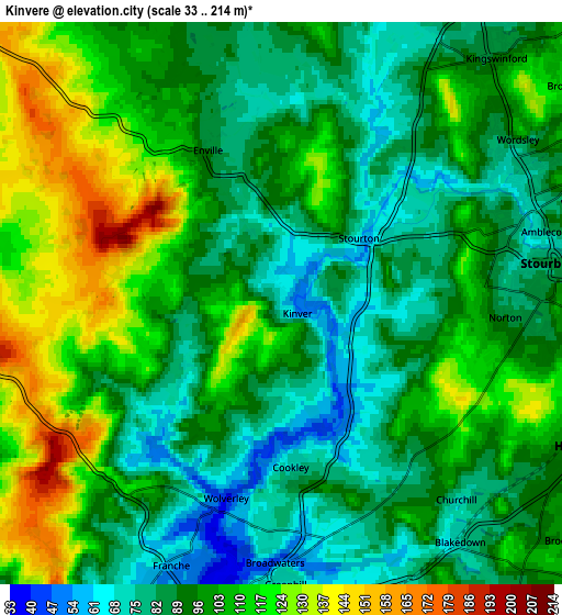
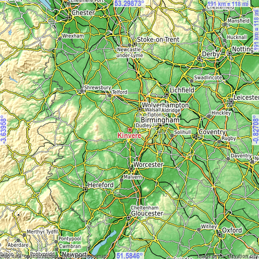
| \ | Map #1 | Map #2 | Topo.Map |
| Scale [m] | 42..202 m | 33..214 m | × |
| Scale [ft] | 138..663 ft | 108..702 ft | × |
| Average | 87.1 m = 286 ft | 98.6 m = 323 ft | × |
| Width | 5.96 km = 3.7 mi | 11.91 km = 7.4 mi | 190.6 km = 118.4 mi |
| Height | 5.96 km = 3.7 mi | 11.91 km = 7.4 mi | 190.6 km = 118.4 mi |
| ↑Max Latitude | 52.476774° | 52.503533° | 53.29873° |
| Latitude at center | 52.45° | 52.45° | 52.45° |
| ↓Min Latitude | 52.423209° | 52.396402° | 51.5846° |
| ← Min Longitude | -2.277275° | -2.321221° | -3.63958° |
| Longitude center | -2.23333° | -2.23333° | -2.23333° |
| →Max Longitude | -2.189385° | -2.145439° | -0.82708° |
Nearby cities:
Cities around Kinvere sort by population:
• Kidderminster elevation 37 m
7 km,  189°
189°
• Stourbridge 86 m
6.1 km,  83°
83°
• Brierley Hill 152 m
8.4 km,  65°
65°
• Kingswinford 85 m
6.9 km,  39°
39°
• Wombourn 90 m
9.9 km,  20°
20°
• Bewdley 40 m
10.1 km,  214°
214°
• Hagley 133 m
7.6 km,  110°
110°
• Cradley Heath 109 m
10.5 km, 76°
• Highley 108 m
10.1 km,  269°
269°
• Alveley 115 m
8.2 km,  275°
275°
• Belbroughton 116 m
10.1 km,  129°
129°
• Romsley 133 m
5.6 km, 270°
Multilingual:
 En español:
Kinvere elevación 64 m.
 En France:
Kinvere élévation 64 m.


Sources and notes:
- [note 1] Map square and city borders are not equal. Map elevation data is calculated only from area inside that square.
- [src 1] Elevation data from geonames database provided with same terms of usage.
- [src 2] The elevation map of Kinvere is generated using elevation data from NASA's 3 arcsec (90m) resolution SRTM data.
- [src 3] Base (background) map © OpenStreetMap contributors tiles are generated by Geofabrik and OpenTopoMap.
Copyright & License:
This Kinvere Elevation Map is licensed under CC BY-SA. You may reuse any part from this page, if you give a proper credit by linking to this URL:
 More info on terms of use page.