Axminster elevation
Axminster (England, Devon), United Kingdom elevation is 44 meters and Axminster elevation in feet is 144 ft above sea level [src 1]. Axminster is a populated place (feature code) with elevation that is 28 meters (92 ft) smaller than average city elevation in United Kingdom.
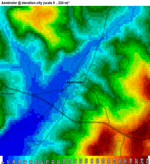
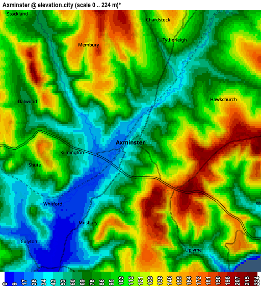
Below is the Elevation map of Axminster, which displays elevation range with different colors. Scale of the first map is from 9 to 224 m (30 to 735 ft) with average elevation of 80.1 meters (=263 ft) [note 1]
These maps also provides idea of topography and contour of this city, they are displayed at different zoom levels. More info about maps, scale and edge coordinates you can find below images.
| \ | Map #1 | Map #2 | Topo.Map |
| Scale [m] | 9..224 m | 0..224 m | × |
| Scale [ft] | 30..735 ft | 0..735 ft | × |
| Average | 80.1 m = 263 ft | 97.3 m = 319 ft | × |
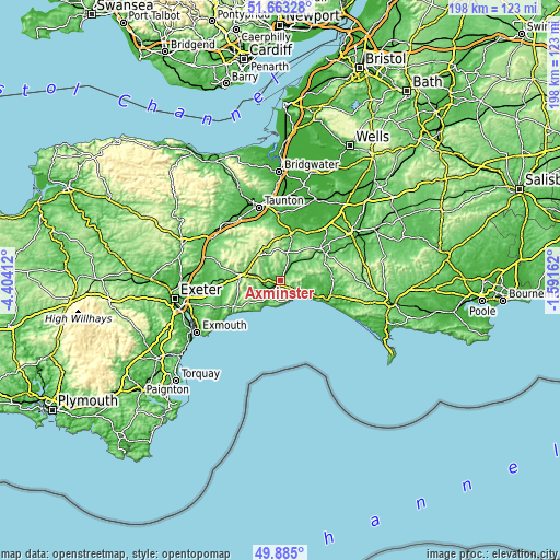
| Width | 6.18 km = 3.8 mi | 12.36 km = 7.7 mi | 197.7 km = 122.8 mi |
| Height | 6.18 km = 3.8 mi | 12.36 km = 7.7 mi | 197.7 km = 122.8 mi |
| ↑Max Latitude | 50.810367° | 50.838127° | 51.66328° |
| Latitude at center | 50.78259° | 50.78259° | 50.78259° |
| ↓Min Latitude | 50.754797° | 50.726987° | 49.885° |
| ← Min Longitude | -3.041815° | -3.085761° | -4.40412° |
| Longitude center | -2.99787° | -2.99787° | -2.99787° |
| →Max Longitude | -2.953925° | -2.909979° | -1.59162° |
Nearby cities:
Cities around Axminster sort by population:
• Bridport elevation 16 m
17.7 km,  107°
107°
• Chard 118 m
10.3 km,  12°
12°
• Sidmouth 40 m
19.8 km,  239°
239°
• Honiton 113 m
13.6 km,  278°
278°
• Crewkerne 74 m
18.1 km,  51°
51°
• Ilminster 47 m
17.2 km,  21°
21°
• Ottery St Mary 81 m
19.2 km,  259°
259°
• Lyme Regis 15 m
7.7 km,  144°
144°
• Beaminster 58 m
18.4 km,  80°
80°
• Colyton 29 m
6.9 km,  227°
227°
• Dunkeswell 238 m
18.2 km,  299°
299°
• Charmouth 18 m
8.4 km,  125°
125°
Multilingual:
 En español:
Axminster elevación 44 m.
 En France:
Axminster élévation 44 m.
 Auf Deutsch:
Axminster höhe über dem Meeresspiegel ist 44 m.

Sources and notes:
- [note 1] Map square and city borders are not equal. Map elevation data is calculated only from area inside that square.
- [src 1] Elevation data from geonames database provided with same terms of usage.
- [src 2] The elevation map of Axminster is generated using elevation data from NASA's 3 arcsec (90m) resolution SRTM data.
- [src 3] Base (background) map © OpenStreetMap contributors tiles are generated by Geofabrik and OpenTopoMap.
Copyright & License:
This Axminster Elevation Map is licensed under CC BY-SA. You may reuse any part from this page, if you give a proper credit by linking to this URL:
 More info on terms of use page.