Ilminster elevation
Ilminster (England, Somerset), United Kingdom elevation is 47 meters and Ilminster elevation in feet is 154 ft above sea level [src 1]. Ilminster is a populated place (feature code) with elevation that is 25 meters (82 ft) smaller than average city elevation in United Kingdom.
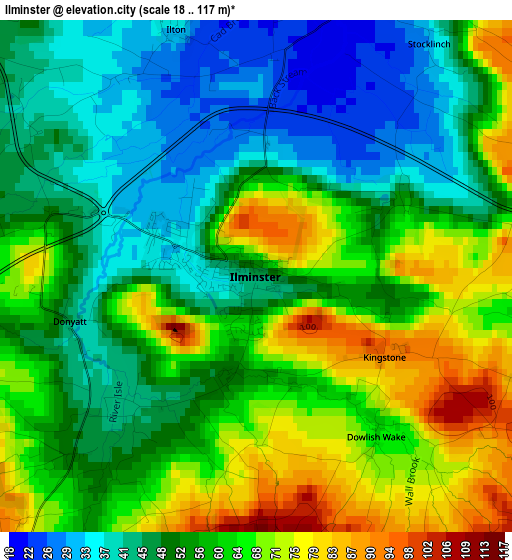
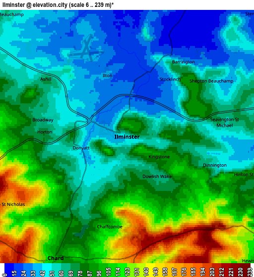
Below is the Elevation map of Ilminster, which displays elevation range with different colors. Scale of the first map is from 18 to 117 m (59 to 384 ft) with average elevation of 56.4 meters (=185 ft) [note 1]
These maps also provides idea of topography and contour of this city, they are displayed at different zoom levels. More info about maps, scale and edge coordinates you can find below images.
| \ | Map #1 | Map #2 | Topo.Map |
| Scale [m] | 18..117 m | 6..239 m | × |
| Scale [ft] | 59..384 ft | 20..784 ft | × |
| Average | 56.4 m = 185 ft | 76.7 m = 252 ft | × |
| Width | 6.16 km = 3.8 mi | 12.32 km = 7.7 mi | 197.1 km = 122.5 mi |
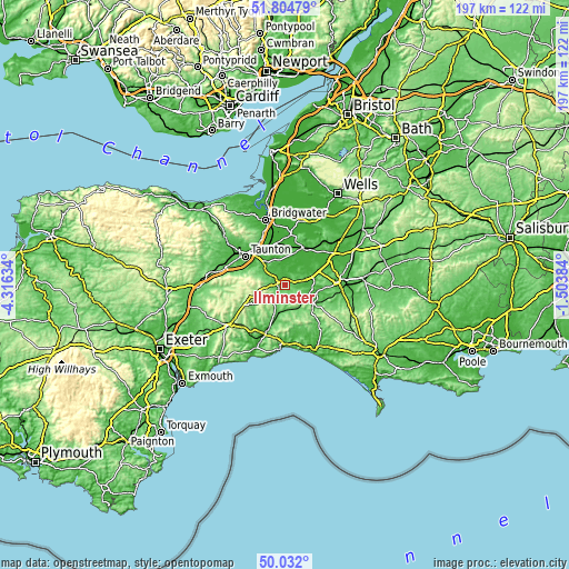
| Height | 6.16 km = 3.8 mi | 12.32 km = 7.7 mi | 197.1 km = 122.5 mi |
| ↑Max Latitude | 50.954531° | 50.982206° | 51.80479° |
| Latitude at center | 50.92684° | 50.92684° | 50.92684° |
| ↓Min Latitude | 50.899132° | 50.871408° | 50.032° |
| ← Min Longitude | -2.954035° | -2.997981° | -4.31634° |
| Longitude center | -2.91009° | -2.91009° | -2.91009° |
| →Max Longitude | -2.866145° | -2.822199° | -1.50384° |
Nearby cities:
Cities around Ilminster sort by population:
• Taunton elevation 22 m
16.7 km,  305°
305°
• Chard 118 m
7.2 km,  213°
213°
• Crewkerne 74 m
9.4 km,  121°
121°
• Axminster 44 m
17.2 km,  201°
201°
• Martock 21 m
11.3 km,  62°
62°
• South Petherton 41 m
7.6 km,  71°
71°
• Langport 15 m
13.6 km,  24°
24°
• Stoke-sub-Hamdon 53 m
11.6 km, 74°
• Merriott 59 m
8.2 km,  101°
101°
• Curry Rivel 43 m
11.1 km, 15°
• Creech Saint Michael 11 m
14 km,  320°
320°
• West Coker 74 m
15.7 km,  93°
93°
Multilingual:
 En español:
Ilminster elevación 47 m.
 En France:
Ilminster élévation 47 m.
 Auf Deutsch:
Ilminster höhe über dem Meeresspiegel ist 47 m.

Sources and notes:
- [note 1] Map square and city borders are not equal. Map elevation data is calculated only from area inside that square.
- [src 1] Elevation data from geonames database provided with same terms of usage.
- [src 2] The elevation map of Ilminster is generated using elevation data from NASA's 3 arcsec (90m) resolution SRTM data.
- [src 3] Base (background) map © OpenStreetMap contributors tiles are generated by Geofabrik and OpenTopoMap.
Copyright & License:
This Ilminster Elevation Map is licensed under CC BY-SA. You may reuse any part from this page, if you give a proper credit by linking to this URL:
 More info on terms of use page.