Broxburn elevation
Broxburn (Scotland, West Lothian), United Kingdom elevation is 70 meters and Broxburn elevation in feet is 230 ft above sea level [src 1]. Broxburn is a populated place (feature code) with elevation that is 2 meters (7 ft) smaller than average city elevation in United Kingdom.
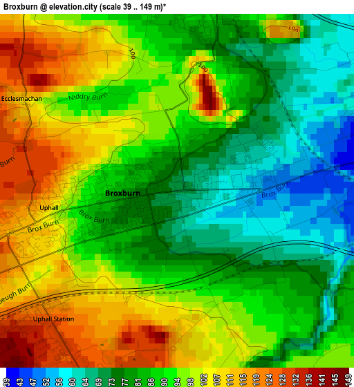
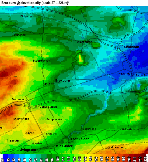
Below is the Elevation map of Broxburn, which displays elevation range with different colors. Scale of the first map is from 39 to 149 m (128 to 489 ft) with average elevation of 90.5 meters (=297 ft) [note 1]
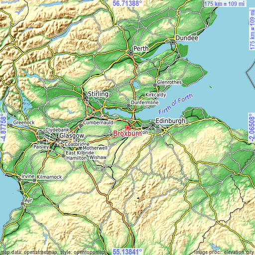
These maps also provides idea of topography and contour of this city, they are displayed at different zoom levels. More info about maps, scale and edge coordinates you can find below images.
| \ | Map #1 | Map #2 | Topo.Map |
| Scale [m] | 39..149 m | 27..226 m | × |
| Scale [ft] | 128..489 ft | 89..741 ft | × |
| Average | 90.5 m = 297 ft | 101.9 m = 334 ft | × |
| Width | 5.47 km = 3.4 mi | 10.95 km = 6.8 mi | 175.2 km = 108.9 mi |
| Height | 5.47 km = 3.4 mi | 10.95 km = 6.8 mi | 175.2 km = 108.9 mi |
| ↑Max Latitude | 55.958758° | 55.98335° | 56.71388° |
| Latitude at center | 55.93415° | 55.93415° | 55.93415° |
| ↓Min Latitude | 55.909526° | 55.884887° | 55.13841° |
| ← Min Longitude | -3.515275° | -3.559221° | -4.87758° |
| Longitude center | -3.47133° | -3.47133° | -3.47133° |
| →Max Longitude | -3.427385° | -3.383439° | -2.06508° |
Nearby cities:
Cities around Broxburn sort by population:
• Livingston elevation 157 m
4.7 km,  222°
222°
• Linlithgow 51 m
9.5 km,  299°
299°
• Queensferry 9 m
7.8 km,  35°
35°
• East Calder 125 m
4.7 km,  174°
174°
• Kirkliston 37 m
4.8 km,  63°
63°
• Mid Calder 110 m
4.7 km,  186°
186°
• Winchburgh 85 m
2.7 km,  8°
8°
• Polbeth 165 m
9.5 km,  210°
210°
• Kirknewton 171 m
6.1 km,  147°
147°
• Ratho 89 m
5.8 km,  103°
103°
• Ratho Station 45 m
5.1 km,  86°
86°
• Newbridge 62 m
4.4 km, 91°
Multilingual:
 En español:
Broxburn elevación 70 m.
 En France:
Broxburn élévation 70 m.


Sources and notes:
- [note 1] Map square and city borders are not equal. Map elevation data is calculated only from area inside that square.
- [src 1] Elevation data from geonames database provided with same terms of usage.
- [src 2] The elevation map of Broxburn is generated using elevation data from NASA's 3 arcsec (90m) resolution SRTM data.
- [src 3] Base (background) map © OpenStreetMap contributors tiles are generated by Geofabrik and OpenTopoMap.
Copyright & License:
This Broxburn Elevation Map is licensed under CC BY-SA. You may reuse any part from this page, if you give a proper credit by linking to this URL:
 More info on terms of use page.