Linlithgow elevation
Linlithgow (Scotland, West Lothian), United Kingdom elevation is 51 meters and Linlithgow elevation in feet is 167 ft above sea level [src 1]. Linlithgow is a populated place (feature code) with elevation that is 21 meters (69 ft) smaller than average city elevation in United Kingdom.
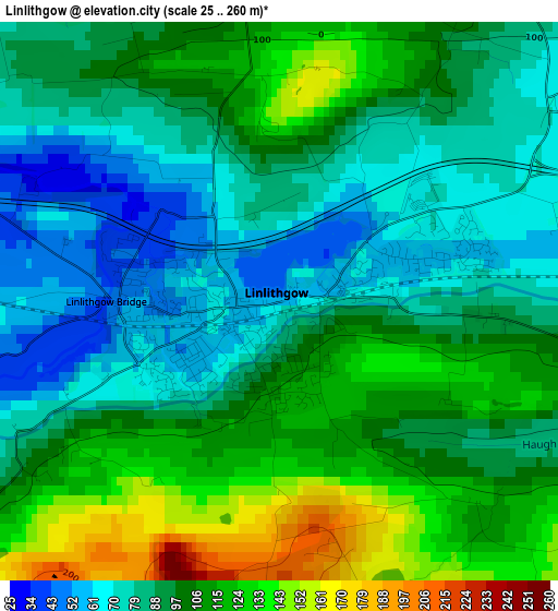
Below is the Elevation map of Linlithgow, which displays elevation range with different colors. Scale of the first map is from 25 to 260 m (82 to 853 ft) with average elevation of 97.3 meters (=319 ft) [note 1]
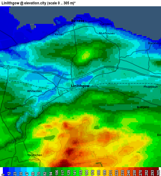
These maps also provides idea of topography and contour of this city, they are displayed at different zoom levels. More info about maps, scale and edge coordinates you can find below images.
| \ | Map #1 | Map #2 | Topo.Map |
| Scale [m] | 25..260 m | 0..305 m | × |
| Scale [ft] | 82..853 ft | 0..1001 ft | × |
| Average | 97.3 m = 319 ft | 104.1 m = 342 ft | × |
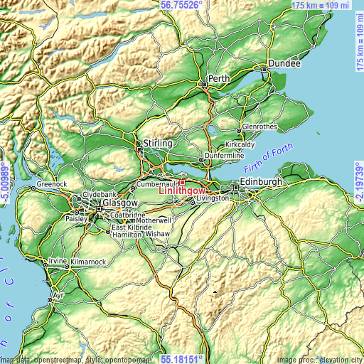
| Width | 5.47 km = 3.4 mi | 10.94 km = 6.8 mi | 175 km = 108.7 mi |
| Height | 5.47 km = 3.4 mi | 10.94 km = 6.8 mi | 175 km = 108.7 mi |
| ↑Max Latitude | 56.000971° | 56.025537° | 56.75526° |
| Latitude at center | 55.97639° | 55.97639° | 55.97639° |
| ↓Min Latitude | 55.951793° | 55.927181° | 55.18151° |
| ← Min Longitude | -3.647585° | -3.691531° | -5.00989° |
| Longitude center | -3.60364° | -3.60364° | -3.60364° |
| →Max Longitude | -3.559695° | -3.515749° | -2.19739° |
Nearby cities:
Cities around Linlithgow sort by population:
• Bathgate elevation 141 m
8.6 km,  196°
196°
• Grangemouth 6 m
8.3 km,  297°
297°
• Broxburn 70 m
9.5 km,  119°
119°
• Bo’ness 3 m
4.6 km,  349°
349°
• Polmont 46 m
6.6 km,  283°
283°
• Brightons 101 m
7 km,  273°
273°
• Maddiston 108 m
5.9 km, 267°
• Laurieston 41 m
9.2 km, 283°
• Redding 72 m
8.1 km, 279°
• Winchburgh 85 m
8.9 km,  103°
103°
• Reddingmuirhead 117 m
9 km, 272°
• Westquarter 41 m
8.7 km, 281°
Multilingual:
 En español:
Linlithgow elevación 51 m.
 En France:
Linlithgow élévation 51 m.
 Auf Deutsch:
Linlithgow höhe über dem Meeresspiegel ist 51 m.

Sources and notes:
- [note 1] Map square and city borders are not equal. Map elevation data is calculated only from area inside that square.
- [src 1] Elevation data from geonames database provided with same terms of usage.
- [src 2] The elevation map of Linlithgow is generated using elevation data from NASA's 3 arcsec (90m) resolution SRTM data.
- [src 3] Base (background) map © OpenStreetMap contributors tiles are generated by Geofabrik and OpenTopoMap.
Copyright & License:
This Linlithgow Elevation Map is licensed under CC BY-SA. You may reuse any part from this page, if you give a proper credit by linking to this URL:
 More info on terms of use page.