Bathgate elevation
Bathgate (Scotland, West Lothian), United Kingdom elevation is 141 meters and Bathgate elevation in feet is 463 ft above sea level [src 1]. Bathgate is a populated place (feature code) with elevation that is 69 meters (226 ft) bigger than average city elevation in United Kingdom.
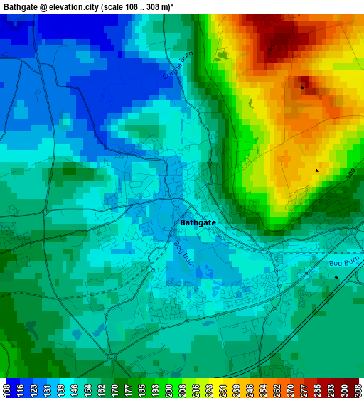
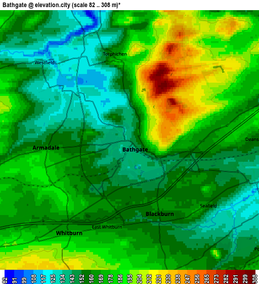
Below is the Elevation map of Bathgate, which displays elevation range with different colors. Scale of the first map is from 108 to 308 m (354 to 1010 ft) with average elevation of 166.3 meters (=546 ft) [note 1]
These maps also provides idea of topography and contour of this city, they are displayed at different zoom levels. More info about maps, scale and edge coordinates you can find below images.
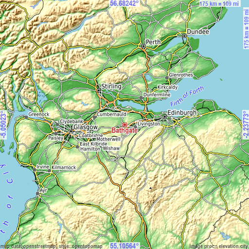
| \ | Map #1 | Map #2 | Topo.Map |
| Scale [m] | 108..308 m | 82..308 m | × |
| Scale [ft] | 354..1010 ft | 269..1010 ft | × |
| Average | 166.3 m = 546 ft | 168.7 m = 553 ft | × |
| Width | 5.48 km = 3.4 mi | 10.96 km = 6.8 mi | 175.3 km = 108.9 mi |
| Height | 5.48 km = 3.4 mi | 10.96 km = 6.8 mi | 175.3 km = 108.9 mi |
| ↑Max Latitude | 55.926668° | 55.951281° | 56.68242° |
| Latitude at center | 55.90204° | 55.90204° | 55.90204° |
| ↓Min Latitude | 55.877396° | 55.852736° | 55.10564° |
| ← Min Longitude | -3.687925° | -3.731871° | -5.05023° |
| Longitude center | -3.64398° | -3.64398° | -3.64398° |
| →Max Longitude | -3.600035° | -3.556089° | -2.23773° |
Nearby cities:
Cities around Bathgate sort by population:
• Livingston elevation 157 m
7.6 km,  89°
89°
• Armadale 187 m
4.1 km,  239°
239°
• Whitburn 173 m
4.6 km,  211°
211°
• Blackburn 160 m
4 km,  170°
170°
• Harthill 197 m
8.1 km, 235°
• West Calder 177 m
7.2 km,  140°
140°
• Polbeth 165 m
7.5 km,  127°
127°
• Stoneyburn 189 m
6.5 km,  177°
177°
• Blackridge 198 m
8.4 km,  257°
257°
• Addiebrownhill 198 m
6.8 km, 165°
• Seafield 155 m
4.4 km, 127°
• East Whitburn 167 m
3.9 km,  197°
197°
Multilingual:
 En español:
Bathgate elevación 141 m.
 En France:
Bathgate élévation 141 m.
 Auf Deutsch:
Bathgate höhe über dem Meeresspiegel ist 141 m.

Sources and notes:
- [note 1] Map square and city borders are not equal. Map elevation data is calculated only from area inside that square.
- [src 1] Elevation data from geonames database provided with same terms of usage.
- [src 2] The elevation map of Bathgate is generated using elevation data from NASA's 3 arcsec (90m) resolution SRTM data.
- [src 3] Base (background) map © OpenStreetMap contributors tiles are generated by Geofabrik and OpenTopoMap.
Copyright & License:
This Bathgate Elevation Map is licensed under CC BY-SA. You may reuse any part from this page, if you give a proper credit by linking to this URL:
 More info on terms of use page.