Queensferry elevation
Queensferry (Scotland, City of Edinburgh), United Kingdom elevation is 9 meters and Queensferry elevation in feet is 30 ft above sea level [src 1]. Queensferry is a populated place (feature code) with elevation that is 63 meters (207 ft) smaller than average city elevation in United Kingdom.
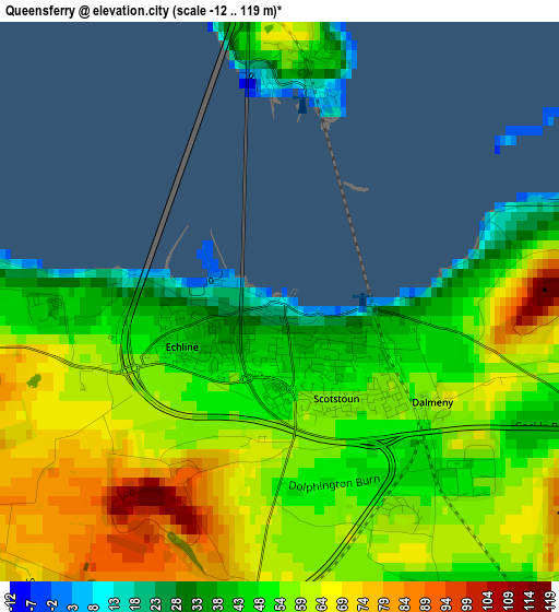
Below is the Elevation map of Queensferry, which displays elevation range with different colors. Scale of the first map is from -12 to 119 m (-39 to 390 ft) with average elevation of 56.1 meters (=184 ft) [note 1]
These maps also provides idea of topography and contour of this city, they are displayed at different zoom levels. More info about maps, scale and edge coordinates you can find below images.
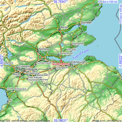
| \ | Map #1 | Map #2 | Topo.Map |
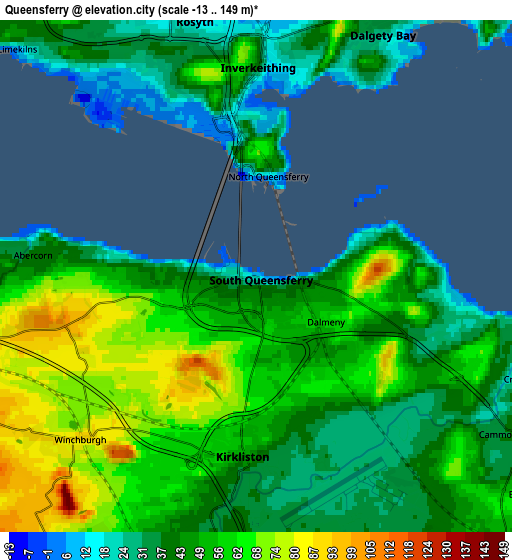
| Scale [m] | -12..119 m | -13..149 m | × |
| Scale [ft] | -39..390 ft | -43..489 ft | × |
| Average | 56.1 m = 184 ft | 49.3 m = 162 ft | × |
| Width | 5.47 km = 3.4 mi | 10.93 km = 6.8 mi | 174.9 km = 108.7 mi |
| Height | 5.47 km = 3.4 mi | 10.93 km = 6.8 mi | 174.9 km = 108.7 mi |
| ↑Max Latitude | 56.015462° | 56.040018° | 56.76947° |
| Latitude at center | 55.99089° | 55.99089° | 55.99089° |
| ↓Min Latitude | 55.966302° | 55.941699° | 55.19631° |
| ← Min Longitude | -3.442415° | -3.486361° | -4.80472° |
| Longitude center | -3.39847° | -3.39847° | -3.39847° |
| →Max Longitude | -3.354525° | -3.310579° | -1.99222° |
Nearby cities:
Cities around Queensferry sort by population:
• Broxburn elevation 70 m
7.8 km,  215°
215°
• Rosyth 32 m
5.7 km,  334°
334°
• Dalgety Bay 13 m
5.7 km,  31°
31°
• Inverkeithing 20 m
4.7 km,  2°
2°
• Kirkliston 37 m
4.2 km,  183°
183°
• Winchburgh 85 m
5.5 km,  228°
228°
• Ratho 89 m
7.8 km,  171°
171°
• Aberdour 35 m
9.3 km,  40°
40°
• Limekilns 16 m
6.8 km,  314°
314°
• Ratho Station 45 m
6.1 km, 174°
• North Queensferry 7 m
2.1 km,  12°
12°
• Newbridge 62 m
6.4 km, 180°
Multilingual:
 En español:
Queensferry elevación 9 m.
 En France:
Queensferry élévation 9 m.
 Auf Deutsch:
Queensferry höhe über dem Meeresspiegel ist 9 m.

Sources and notes:
- [note 1] Map square and city borders are not equal. Map elevation data is calculated only from area inside that square.
- [src 1] Elevation data from geonames database provided with same terms of usage.
- [src 2] The elevation map of Queensferry is generated using elevation data from NASA's 3 arcsec (90m) resolution SRTM data.
- [src 3] Base (background) map © OpenStreetMap contributors tiles are generated by Geofabrik and OpenTopoMap.
Copyright & License:
This Queensferry Elevation Map is licensed under CC BY-SA. You may reuse any part from this page, if you give a proper credit by linking to this URL:
 More info on terms of use page.