Bures Saint Mary elevation
Bures Saint Mary (England, Suffolk), United Kingdom elevation is 23 meters and Bures Saint Mary elevation in feet is 75 ft above sea level [src 1]. Bures Saint Mary is a populated place (feature code) with elevation that is 49 meters (161 ft) smaller than average city elevation in United Kingdom.
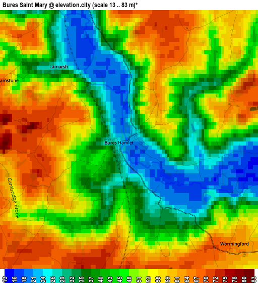
Below is the Elevation map of Bures Saint Mary, which displays elevation range with different colors. Scale of the first map is from 13 to 83 m (43 to 272 ft) with average elevation of 48 meters (=157 ft) [note 1]
These maps also provides idea of topography and contour of this city, they are displayed at different zoom levels. More info about maps, scale and edge coordinates you can find below images.
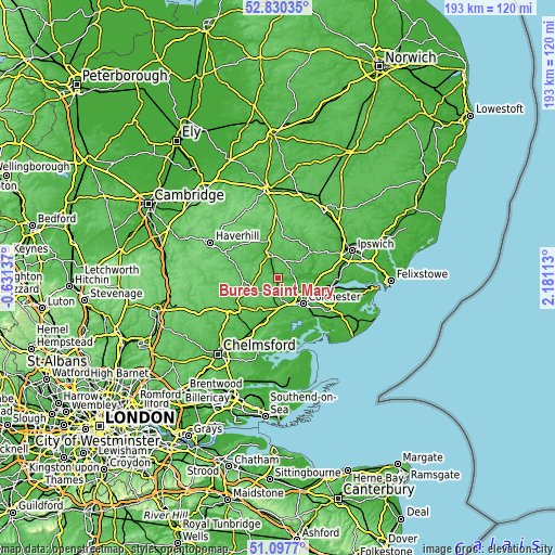
| \ | Map #1 | Topo.Map |
| Scale [m] | 13..83 m | × |
| Scale [ft] | 43..272 ft | × |
| Average | 48 m = 157 ft | × |
| Width | 6.02 km = 3.7 mi | 192.7 km = 119.7 mi |
| Height | 6.02 km = 3.7 mi | 192.6 km = 119.7 mi |
| ↑Max Latitude | 51.999464° | 52.83035° |
| Latitude at center | 51.9724° | 51.9724° |
| ↓Min Latitude | 51.94532° | 51.0977° |
| ← Min Longitude | 0.730935° | -0.63137° |
| Longitude center | 0.77488° | 0.77488° |
| →Max Longitude | 0.818825° | 2.18113° |
Nearby cities:
Cities around Bures Saint Mary sort by population:
• Sudbury elevation 36 m
8 km,  337°
337°
• Halstead 53 m
9.8 km,  251°
251°
• Earls Colne 54 m
7.1 km,  225°
225°
• Sible Hedingham 53 m
12.5 km,  272°
272°
• Marks Tey 42 m
10.7 km,  183°
183°
• West Bergholt 52 m
8.4 km,  142°
142°
• Long Melford 36 m
12.1 km, 340°
• Great Horkesley 53 m
7.9 km,  118°
118°
• Great Waldingfield 61 m
9.2 km,  359°
359°
• Eight Ash Green 46 m
9.1 km,  158°
158°
• Castle Hedingham 53 m
12.2 km,  279°
279°
• Boxted 47 m
9.6 km,  105°
105°
Multilingual:
 En español:
Bures Saint Mary elevación 23 m.
 En France:
Bures Saint Mary élévation 23 m.
 Auf Deutsch:
Bures Saint Mary höhe über dem Meeresspiegel ist 23 m.

Sources and notes:
- [note 1] Map square and city borders are not equal. Map elevation data is calculated only from area inside that square.
- [src 1] Elevation data from geonames database provided with same terms of usage.
- [src 2] The elevation map of Bures Saint Mary is generated using elevation data from NASA's 3 arcsec (90m) resolution SRTM data.
- [src 3] Base (background) map © OpenStreetMap contributors tiles are generated by Geofabrik and OpenTopoMap.
Copyright & License:
This Bures Saint Mary Elevation Map is licensed under CC BY-SA. You may reuse any part from this page, if you give a proper credit by linking to this URL:
 More info on terms of use page.