Halstead elevation
Halstead (England, Essex), United Kingdom elevation is 53 meters and Halstead elevation in feet is 174 ft above sea level [src 1]. Halstead is a populated place (feature code) with elevation that is 19 meters (62 ft) smaller than average city elevation in United Kingdom.
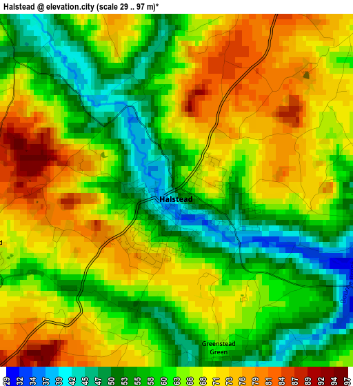
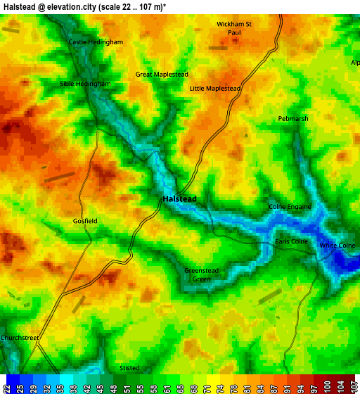
Below is the Elevation map of Halstead, which displays elevation range with different colors. Scale of the first map is from 29 to 97 m (95 to 318 ft) with average elevation of 64 meters (=210 ft) [note 1]
These maps also provides idea of topography and contour of this city, they are displayed at different zoom levels. More info about maps, scale and edge coordinates you can find below images.
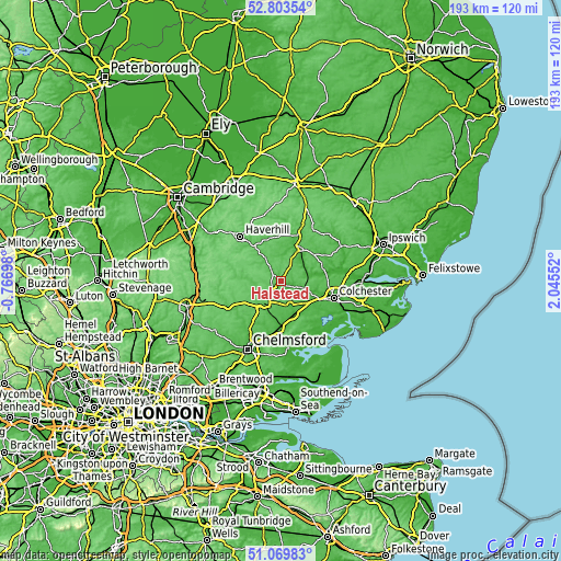
| \ | Map #1 | Map #2 | Topo.Map |
| Scale [m] | 29..97 m | 22..107 m | × |
| Scale [ft] | 95..318 ft | 72..351 ft | × |
| Average | 64 m = 210 ft | 67.1 m = 220 ft | × |
| Width | 6.02 km = 3.7 mi | 12.05 km = 7.5 mi | 192.8 km = 119.8 mi |
| Height | 6.02 km = 3.7 mi | 12.05 km = 7.5 mi | 192.8 km = 119.8 mi |
| ↑Max Latitude | 51.97214° | 51.999205° | 52.80354° |
| Latitude at center | 51.94506° | 51.94506° | 51.94506° |
| ↓Min Latitude | 51.917963° | 51.89085° | 51.06983° |
| ← Min Longitude | 0.595325° | 0.551379° | -0.76698° |
| Longitude center | 0.63927° | 0.63927° | 0.63927° |
| →Max Longitude | 0.683215° | 0.727161° | 2.04552° |
Nearby cities:
Cities around Halstead sort by population:
• Braintree elevation 68 m
9.5 km,  218°
218°
• Coggeshall 31 m
8.8 km,  159°
159°
• Earls Colne 54 m
4.7 km,  114°
114°
• Silver End 51 m
10.9 km,  185°
185°
• Sible Hedingham 53 m
4.8 km,  318°
318°
• Marks Tey 42 m
11.5 km,  131°
131°
• Rayne 69 m
9.5 km,  203°
203°
• Black Notley 51 m
11.3 km,  205°
205°
• Great Yeldham 55 m
9.1 km,  326°
326°
• Bures Saint Mary 23 m
9.8 km,  71°
71°
• Gosfield 72 m
3.4 km,  253°
253°
• Castle Hedingham 53 m
5.7 km, 331°
Multilingual:
 En español:
Halstead elevación 53 m.
 En France:
Halstead élévation 53 m.


Sources and notes:
- [note 1] Map square and city borders are not equal. Map elevation data is calculated only from area inside that square.
- [src 1] Elevation data from geonames database provided with same terms of usage.
- [src 2] The elevation map of Halstead is generated using elevation data from NASA's 3 arcsec (90m) resolution SRTM data.
- [src 3] Base (background) map © OpenStreetMap contributors tiles are generated by Geofabrik and OpenTopoMap.
Copyright & License:
This Halstead Elevation Map is licensed under CC BY-SA. You may reuse any part from this page, if you give a proper credit by linking to this URL:
 More info on terms of use page.