Marks Tey elevation
Marks Tey (England, Essex), United Kingdom elevation is 42 meters and Marks Tey elevation in feet is 138 ft above sea level [src 1]. Marks Tey is a populated place (feature code) with elevation that is 30 meters (98 ft) smaller than average city elevation in United Kingdom.
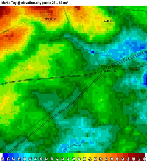
Below is the Elevation map of Marks Tey, which displays elevation range with different colors. Scale of the first map is from 23 to 69 m (75 to 226 ft) with average elevation of 41.3 meters (=135 ft) [note 1]
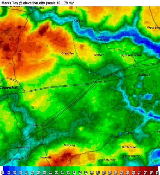
These maps also provides idea of topography and contour of this city, they are displayed at different zoom levels. More info about maps, scale and edge coordinates you can find below images.
| \ | Map #1 | Map #2 | Topo.Map |
| Scale [m] | 23..69 m | 10..79 m | × |
| Scale [ft] | 75..226 ft | 33..259 ft | × |
| Average | 41.3 m = 135 ft | 41.8 m = 137 ft | × |
| Width | 6.03 km = 3.7 mi | 12.07 km = 7.5 mi | 193.1 km = 120 mi |
| Height | 6.03 km = 3.7 mi | 12.07 km = 7.5 mi | 193 km = 119.9 mi |
| ↑Max Latitude | 51.903402° | 51.930508° | 52.73608° |
| Latitude at center | 51.87628° | 51.87628° | 51.87628° |
| ↓Min Latitude | 51.849142° | 51.821987° | 50.99971° |
| ← Min Longitude | 0.720295° | 0.676349° | -0.64201° |
| Longitude center | 0.76424° | 0.76424° | 0.76424° |
| →Max Longitude | 0.808185° | 0.852131° | 2.17049° |
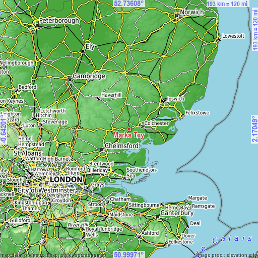
Nearby cities:
Cities around Marks Tey sort by population:
• Colchester elevation 29 m
9.7 km,  81°
81°
• Tiptree 56 m
7.2 km,  190°
190°
• Kelvedon 25 m
5.7 km,  224°
224°
• Coggeshall 31 m
5.4 km,  263°
263°
• Earls Colne 54 m
7.2 km,  322°
322°
• Silver End 51 m
10.2 km,  251°
251°
• West Bergholt 52 m
7.1 km,  55°
55°
• Great Horkesley 53 m
10.3 km,  47°
47°
• Layer de la Haye 40 m
7.2 km,  117°
117°
• Bures Saint Mary 23 m
10.7 km,  3°
3°
• Eight Ash Green 46 m
4.6 km, 61°
• Tolleshunt Knights 52 m
8.7 km,  174°
174°
Multilingual:
 En español:
Marks Tey elevación 42 m.
 En France:
Marks Tey élévation 42 m.
 Auf Deutsch:
Marks Tey höhe über dem Meeresspiegel ist 42 m.

Sources and notes:
- [note 1] Map square and city borders are not equal. Map elevation data is calculated only from area inside that square.
- [src 1] Elevation data from geonames database provided with same terms of usage.
- [src 2] The elevation map of Marks Tey is generated using elevation data from NASA's 3 arcsec (90m) resolution SRTM data.
- [src 3] Base (background) map © OpenStreetMap contributors tiles are generated by Geofabrik and OpenTopoMap.
Copyright & License:
This Marks Tey Elevation Map is licensed under CC BY-SA. You may reuse any part from this page, if you give a proper credit by linking to this URL:
 More info on terms of use page.