Crowthorne elevation
Crowthorne (England, Bracknell Forest), United Kingdom elevation is 97 meters and Crowthorne elevation in feet is 318 ft above sea level [src 1]. Crowthorne is a populated place (feature code) with elevation that is 25 meters (82 ft) bigger than average city elevation in United Kingdom.
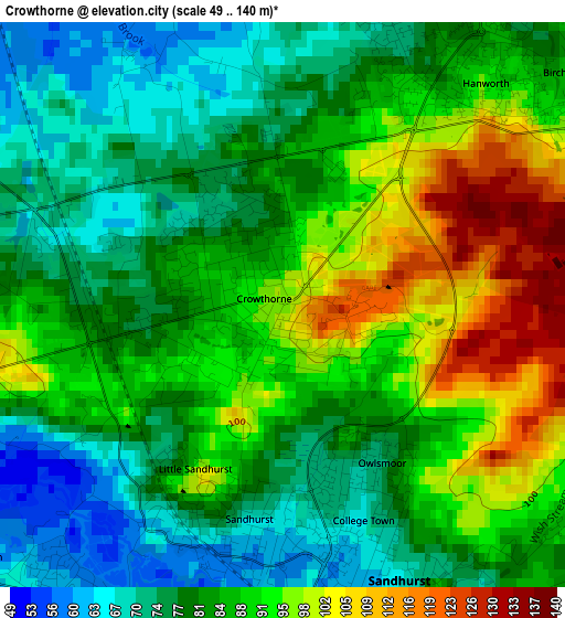
Below is the Elevation map of Crowthorne, which displays elevation range with different colors. Scale of the first map is from 49 to 140 m (161 to 459 ft) with average elevation of 84.5 meters (=277 ft) [note 1]
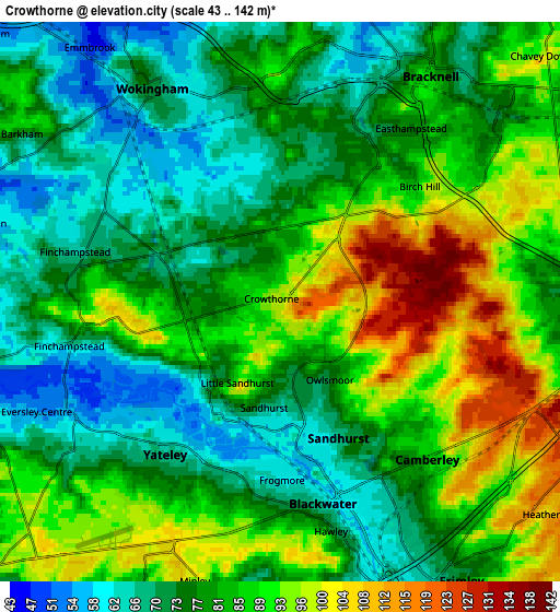
These maps also provides idea of topography and contour of this city, they are displayed at different zoom levels. More info about maps, scale and edge coordinates you can find below images.
| \ | Map #1 | Map #2 | Topo.Map |
| Scale [m] | 49..140 m | 43..142 m | × |
| Scale [ft] | 161..459 ft | 141..466 ft | × |
| Average | 84.5 m = 277 ft | 81.7 m = 268 ft | × |
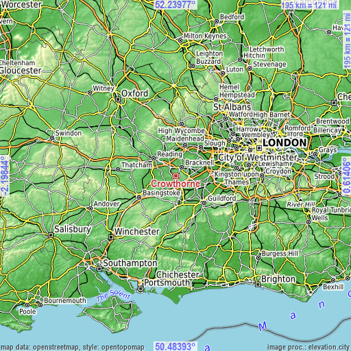
| Width | 6.1 km = 3.8 mi | 12.2 km = 7.6 mi | 195.2 km = 121.3 mi |
| Height | 6.1 km = 3.8 mi | 12.2 km = 7.6 mi | 195.2 km = 121.3 mi |
| ↑Max Latitude | 51.397696° | 51.425106° | 52.23977° |
| Latitude at center | 51.37027° | 51.37027° | 51.37027° |
| ↓Min Latitude | 51.342827° | 51.315368° | 50.48393° |
| ← Min Longitude | -0.836135° | -0.880081° | -2.19844° |
| Longitude center | -0.79219° | -0.79219° | -0.79219° |
| →Max Longitude | -0.748245° | -0.704299° | 0.61406° |
Nearby cities:
Cities around Crowthorne sort by population:
• Bracknell elevation 81 m
5.6 km,  30°
30°
• Wokingham 72 m
5.5 km,  326°
326°
• Camberley 84 m
5 km,  137°
137°
• Yateley 61 m
4 km,  220°
220°
• Frimley 64 m
6.8 km,  151°
151°
• Lightwater 55 m
8.7 km,  106°
106°
• Bagshot 57 m
7.3 km,  98°
98°
• Eversley 49 m
7 km,  254°
254°
• Finchampstead 68 m
4.6 km,  257°
257°
• Binfield 74 m
6.8 km,  2°
2°
• Barkham 71 m
6.6 km,  298°
298°
• Sandhurst 66 m
2.6 km,  171°
171°
Multilingual:
 En español:
Crowthorne elevación 97 m.
 En France:
Crowthorne élévation 97 m.
 Auf Deutsch:
Crowthorne höhe über dem Meeresspiegel ist 97 m.

Sources and notes:
- [note 1] Map square and city borders are not equal. Map elevation data is calculated only from area inside that square.
- [src 1] Elevation data from geonames database provided with same terms of usage.
- [src 2] The elevation map of Crowthorne is generated using elevation data from NASA's 3 arcsec (90m) resolution SRTM data.
- [src 3] Base (background) map © OpenStreetMap contributors tiles are generated by Geofabrik and OpenTopoMap.
Copyright & License:
This Crowthorne Elevation Map is licensed under CC BY-SA. You may reuse any part from this page, if you give a proper credit by linking to this URL:
 More info on terms of use page.