Bagshot elevation
Bagshot (England, Surrey), United Kingdom elevation is 57 meters and Bagshot elevation in feet is 187 ft above sea level [src 1]. Bagshot is a populated place (feature code) with elevation that is 15 meters (49 ft) smaller than average city elevation in United Kingdom.
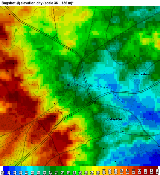
Below is the Elevation map of Bagshot, which displays elevation range with different colors. Scale of the first map is from 36 to 136 m (118 to 446 ft) with average elevation of 82.5 meters (=271 ft) [note 1]
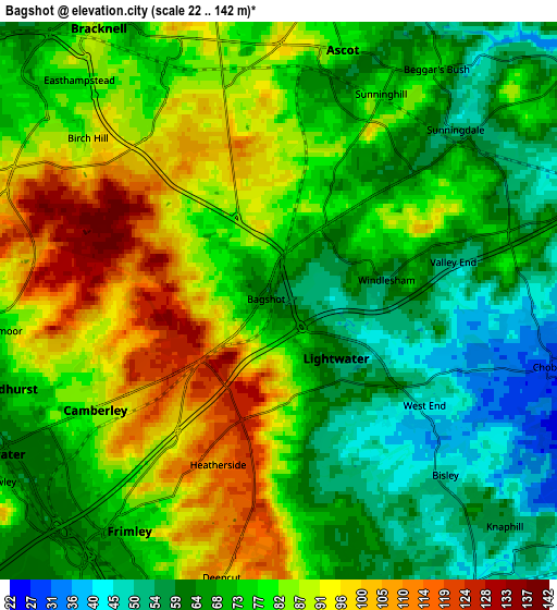
These maps also provides idea of topography and contour of this city, they are displayed at different zoom levels. More info about maps, scale and edge coordinates you can find below images.
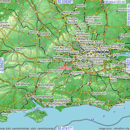
| \ | Map #1 | Map #2 | Topo.Map |
| Scale [m] | 36..136 m | 22..142 m | × |
| Scale [ft] | 118..446 ft | 72..466 ft | × |
| Average | 82.5 m = 271 ft | 76.6 m = 251 ft | × |
| Width | 6.1 km = 3.8 mi | 12.2 km = 7.6 mi | 195.3 km = 121.4 mi |
| Height | 6.1 km = 3.8 mi | 12.2 km = 7.6 mi | 195.3 km = 121.4 mi |
| ↑Max Latitude | 51.388122° | 51.415537° | 52.23038° |
| Latitude at center | 51.36069° | 51.36069° | 51.36069° |
| ↓Min Latitude | 51.333242° | 51.305777° | 50.47417° |
| ← Min Longitude | -0.731965° | -0.775911° | -2.09427° |
| Longitude center | -0.68802° | -0.68802° | -0.68802° |
| →Max Longitude | -0.644075° | -0.600129° | 0.71823° |
Nearby cities:
Cities around Bagshot sort by population:
• Bracknell elevation 81 m
7.3 km,  323°
323°
• Farnborough 69 m
8.8 km,  212°
212°
• Camberley 84 m
4.6 km,  235°
235°
• Crowthorne 97 m
7.3 km,  278°
278°
• Ascot 86 m
5.6 km,  9°
9°
• Frimley 64 m
6.3 km,  219°
219°
• Knaphill 57 m
6.7 km,  131°
131°
• Lightwater 55 m
1.8 km,  139°
139°
• Windlesham 54 m
2.4 km,  78°
78°
• Chobham 28 m
5.8 km,  103°
103°
• Sandhurst 66 m
7 km,  257°
257°
• Sunningdale 48 m
5.9 km,  43°
43°
Multilingual:
 En español:
Bagshot elevación 57 m.
 En France:
Bagshot élévation 57 m.


Sources and notes:
- [note 1] Map square and city borders are not equal. Map elevation data is calculated only from area inside that square.
- [src 1] Elevation data from geonames database provided with same terms of usage.
- [src 2] The elevation map of Bagshot is generated using elevation data from NASA's 3 arcsec (90m) resolution SRTM data.
- [src 3] Base (background) map © OpenStreetMap contributors tiles are generated by Geofabrik and OpenTopoMap.
Copyright & License:
This Bagshot Elevation Map is licensed under CC BY-SA. You may reuse any part from this page, if you give a proper credit by linking to this URL:
 More info on terms of use page.