Binfield elevation
Binfield (England, Bracknell Forest), United Kingdom elevation is 74 meters and Binfield elevation in feet is 243 ft above sea level [src 1]. Binfield is a seat of a third-order administrative division (feature code) with elevation that is 2 meters (7 ft) bigger than average city elevation in United Kingdom.
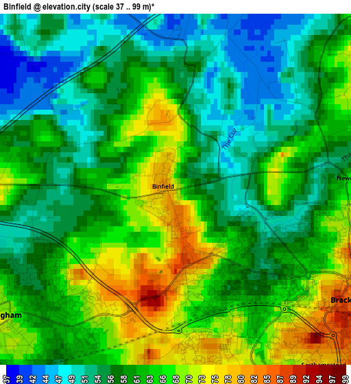
Below is the Elevation map of Binfield, which displays elevation range with different colors. Scale of the first map is from 37 to 99 m (121 to 325 ft) with average elevation of 60.9 meters (=200 ft) [note 1]
These maps also provides idea of topography and contour of this city, they are displayed at different zoom levels. More info about maps, scale and edge coordinates you can find below images.
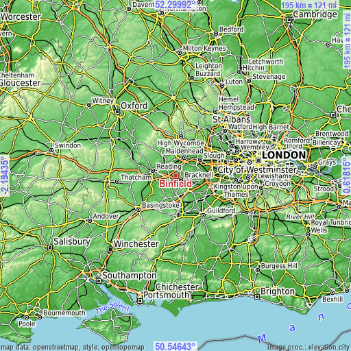
| \ | Map #1 | Topo.Map |
| Scale [m] | 37..99 m | × |
| Scale [ft] | 121..325 ft | × |
| Average | 60.9 m = 200 ft | × |
| Width | 6.09 km = 3.8 mi | 195 km = 121.2 mi |
| Height | 6.09 km = 3.8 mi | 195 km = 121.2 mi |
| ↑Max Latitude | 51.458979° | 52.29992° |
| Latitude at center | 51.43159° | 51.43159° |
| ↓Min Latitude | 51.404184° | 50.54643° |
| ← Min Longitude | -0.832045° | -2.19435° |
| Longitude center | -0.7881° | -0.7881° |
| →Max Longitude | -0.744155° | 0.61815° |
Nearby cities:
Cities around Binfield sort by population:
• Bracknell elevation 81 m
3.3 km,  127°
127°
• Wokingham 72 m
4 km,  235°
235°
• Crowthorne 97 m
6.8 km,  182°
182°
• Ascot 86 m
8.2 km,  106°
106°
• Twyford 51 m
7 km,  314°
314°
• Charvil 38 m
8.4 km, 305°
• Hurst 40 m
5.3 km,  303°
303°
• White Waltham 33 m
6.8 km,  9°
9°
• Barkham 71 m
7.1 km, 238°
• Woodley 44 m
6.9 km,  287°
287°
• Winnersh 50 m
6.4 km,  265°
265°
• Warfield 60 m
4.3 km,  74°
74°
Multilingual:
 En español:
Binfield elevación 74 m.
 En France:
Binfield élévation 74 m.


Sources and notes:
- [note 1] Map square and city borders are not equal. Map elevation data is calculated only from area inside that square.
- [src 1] Elevation data from geonames database provided with same terms of usage.
- [src 2] The elevation map of Binfield is generated using elevation data from NASA's 3 arcsec (90m) resolution SRTM data.
- [src 3] Base (background) map © OpenStreetMap contributors tiles are generated by Geofabrik and OpenTopoMap.
Copyright & License:
This Binfield Elevation Map is licensed under CC BY-SA. You may reuse any part from this page, if you give a proper credit by linking to this URL:
 More info on terms of use page.