Darvel elevation
Darvel (Scotland, East Ayrshire), United Kingdom elevation is 104 meters and Darvel elevation in feet is 341 ft above sea level [src 1]. Darvel is a populated place (feature code) with elevation that is 32 meters (105 ft) bigger than average city elevation in United Kingdom.
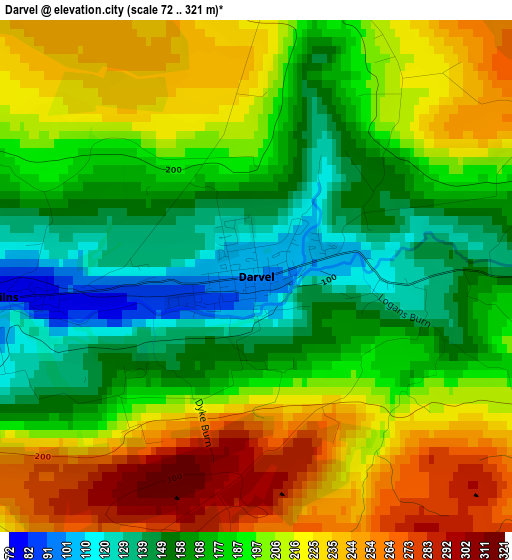
Below is the Elevation map of Darvel, which displays elevation range with different colors. Scale of the first map is from 72 to 321 m (236 to 1053 ft) with average elevation of 192.9 meters (=633 ft) [note 1]
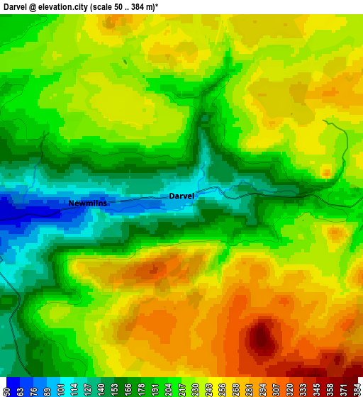
These maps also provides idea of topography and contour of this city, they are displayed at different zoom levels. More info about maps, scale and edge coordinates you can find below images.
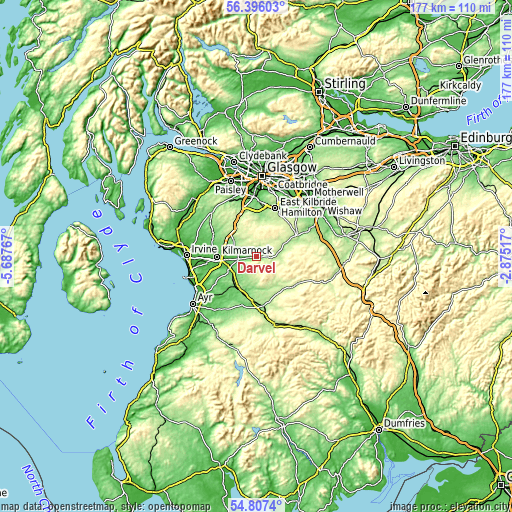
| \ | Map #1 | Map #2 | Topo.Map |
| Scale [m] | 72..321 m | 50..384 m | × |
| Scale [ft] | 236..1053 ft | 164..1260 ft | × |
| Average | 192.9 m = 633 ft | 220.2 m = 722 ft | × |
| Width | 5.52 km = 3.4 mi | 11.04 km = 6.9 mi | 176.6 km = 109.7 mi |
| Height | 5.52 km = 3.4 mi | 11.04 km = 6.9 mi | 176.6 km = 109.7 mi |
| ↑Max Latitude | 55.634574° | 55.659372° | 56.39603° |
| Latitude at center | 55.60976° | 55.60976° | 55.60976° |
| ↓Min Latitude | 55.584931° | 55.560086° | 54.8074° |
| ← Min Longitude | -4.325365° | -4.369311° | -5.68767° |
| Longitude center | -4.28142° | -4.28142° | -4.28142° |
| →Max Longitude | -4.237475° | -4.193529° | -2.87517° |
Nearby cities:
Cities around Darvel sort by population:
• Kilmarnock elevation 39 m
13.5 km,  270°
270°
• Strathaven 182 m
15.4 km,  60°
60°
• Stewarton 97 m
16.6 km,  298°
298°
• Galston 52 m
6.4 km,  261°
261°
• Mauchline 145 m
12.1 km,  210°
210°
• Auchinleck 157 m
15.4 km,  182°
182°
• Eaglesham 163 m
14.6 km,  1°
1°
• Newmilns 73 m
2.7 km, 264°
• Kilmaurs 61 m
15.8 km,  281°
281°
• Catrine 96 m
12.1 km,  194°
194°
• Muirkirk 228 m
16.7 km,  125°
125°
• Fenwick 137 m
11.5 km, 297°
Multilingual:
 En español:
Darvel elevación 104 m.
 En France:
Darvel élévation 104 m.


Sources and notes:
- [note 1] Map square and city borders are not equal. Map elevation data is calculated only from area inside that square.
- [src 1] Elevation data from geonames database provided with same terms of usage.
- [src 2] The elevation map of Darvel is generated using elevation data from NASA's 3 arcsec (90m) resolution SRTM data.
- [src 3] Base (background) map © OpenStreetMap contributors tiles are generated by Geofabrik and OpenTopoMap.
Copyright & License:
This Darvel Elevation Map is licensed under CC BY-SA. You may reuse any part from this page, if you give a proper credit by linking to this URL:
 More info on terms of use page.