Strathaven elevation
Strathaven (Scotland, South Lanarkshire), United Kingdom elevation is 182 meters and Strathaven elevation in feet is 597 ft above sea level [src 1]. Strathaven is a populated place (feature code) with elevation that is 110 meters (361 ft) bigger than average city elevation in United Kingdom.
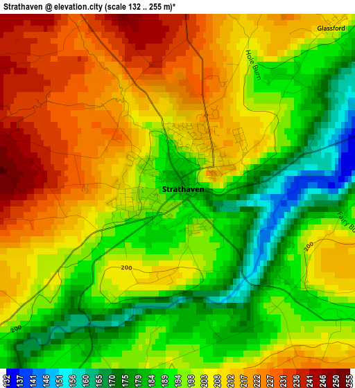
Below is the Elevation map of Strathaven, which displays elevation range with different colors. Scale of the first map is from 132 to 255 m (433 to 837 ft) with average elevation of 201.7 meters (=662 ft) [note 1]
These maps also provides idea of topography and contour of this city, they are displayed at different zoom levels. More info about maps, scale and edge coordinates you can find below images.
| \ | Map #1 | Map #2 | Topo.Map |
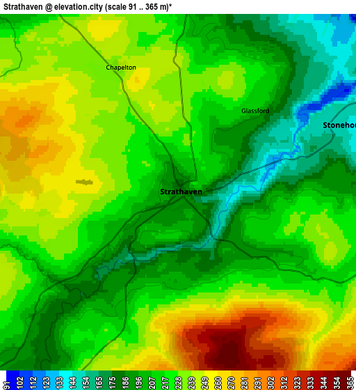
| Scale [m] | 132..255 m | 91..365 m | × |
| Scale [ft] | 433..837 ft | 299..1198 ft | × |
| Average | 201.7 m = 662 ft | 220.4 m = 723 ft | × |
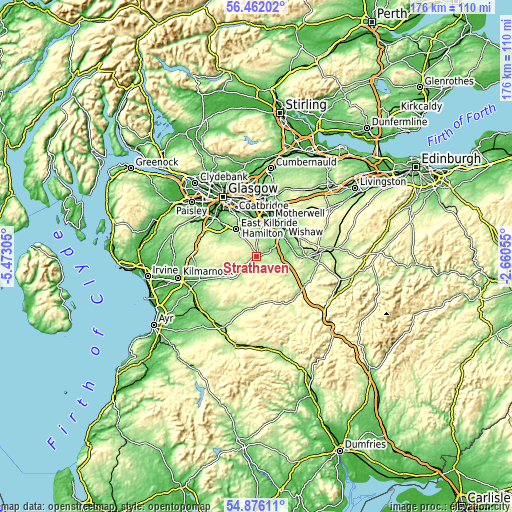
| Width | 5.51 km = 3.4 mi | 11.02 km = 6.8 mi | 176.3 km = 109.5 mi |
| Height | 5.51 km = 3.4 mi | 11.02 km = 6.8 mi | 176.3 km = 109.5 mi |
| ↑Max Latitude | 55.701871° | 55.726626° | 56.46202° |
| Latitude at center | 55.6771° | 55.6771° | 55.6771° |
| ↓Min Latitude | 55.652313° | 55.627511° | 54.87611° |
| ← Min Longitude | -4.110745° | -4.154691° | -5.47305° |
| Longitude center | -4.0668° | -4.0668° | -4.0668° |
| →Max Longitude | -4.022855° | -3.978909° | -2.66055° |
Nearby cities:
Cities around Strathaven sort by population:
• East Kilbride elevation 161 m
11.9 km,  324°
324°
• Hamilton 68 m
10.2 km,  11°
11°
• Motherwell 83 m
13.3 km,  20°
20°
• Dalserf 54 m
11.3 km,  56°
56°
• Blantyre 68 m
13.4 km,  352°
352°
• High Blantyre 78 m
12.1 km, 350°
• Larkhall 117 m
8.9 km,  45°
45°
• Stonehouse 153 m
5.3 km,  68°
68°
• Lesmahagow 176 m
12.1 km,  111°
111°
• Overtown 138 m
13 km, 46°
• Blackwood 175 m
9.5 km,  97°
97°
• Ashgill 103 m
10.5 km, 54°
Multilingual:
 En español:
Strathaven elevación 182 m.
 En France:
Strathaven élévation 182 m.
 Auf Deutsch:
Strathaven höhe über dem Meeresspiegel ist 182 m.

Sources and notes:
- [note 1] Map square and city borders are not equal. Map elevation data is calculated only from area inside that square.
- [src 1] Elevation data from geonames database provided with same terms of usage.
- [src 2] The elevation map of Strathaven is generated using elevation data from NASA's 3 arcsec (90m) resolution SRTM data.
- [src 3] Base (background) map © OpenStreetMap contributors tiles are generated by Geofabrik and OpenTopoMap.
Copyright & License:
This Strathaven Elevation Map is licensed under CC BY-SA. You may reuse any part from this page, if you give a proper credit by linking to this URL:
 More info on terms of use page.