Fazeley elevation
Fazeley (England, Staffordshire), United Kingdom elevation is 64 meters and Fazeley elevation in feet is 210 ft above sea level [src 1]. Fazeley is a populated place (feature code) with elevation that is 8 meters (26 ft) smaller than average city elevation in United Kingdom.
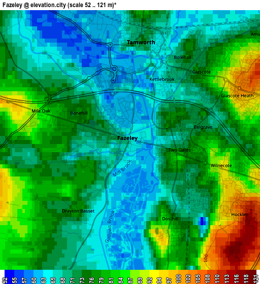
Below is the Elevation map of Fazeley, which displays elevation range with different colors. Scale of the first map is from 52 to 121 m (171 to 397 ft) with average elevation of 74.3 meters (=244 ft) [note 1]
These maps also provides idea of topography and contour of this city, they are displayed at different zoom levels. More info about maps, scale and edge coordinates you can find below images.
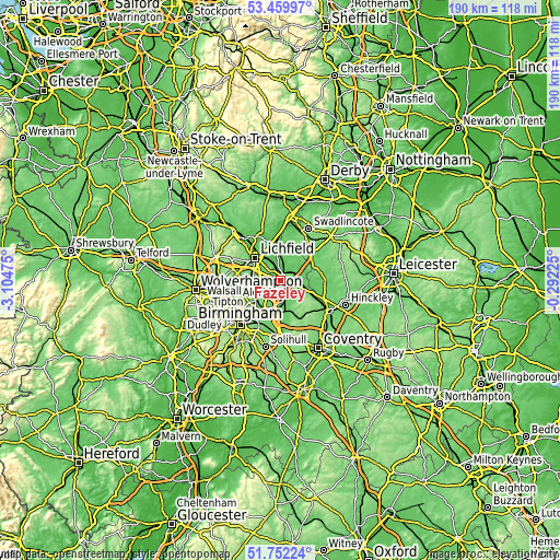
| \ | Map #1 | Map #2 | Topo.Map |
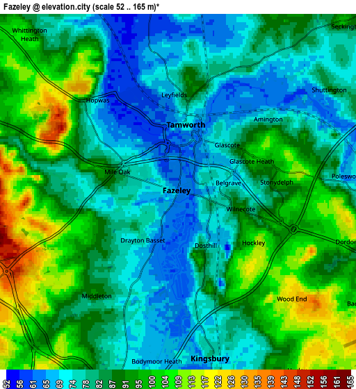
| Scale [m] | 52..121 m | 52..165 m | × |
| Scale [ft] | 171..397 ft | 171..541 ft | × |
| Average | 74.3 m = 244 ft | 86.5 m = 284 ft | × |
| Width | 5.93 km = 3.7 mi | 11.87 km = 7.4 mi | 189.9 km = 118 mi |
| Height | 5.93 km = 3.7 mi | 11.87 km = 7.4 mi | 189.9 km = 118 mi |
| ↑Max Latitude | 52.641104° | 52.667763° | 53.45997° |
| Latitude at center | 52.61443° | 52.61443° | 52.61443° |
| ↓Min Latitude | 52.587739° | 52.561032° | 51.75224° |
| ← Min Longitude | -1.742445° | -1.786391° | -3.10475° |
| Longitude center | -1.6985° | -1.6985° | -1.6985° |
| →Max Longitude | -1.654555° | -1.610609° | -0.29225° |
Nearby cities:
Cities around Fazeley sort by population:
• Sutton Coldfield elevation 119 m
9.6 km,  236°
236°
• Tamworth 73 m
2.2 km,  4°
4°
• Lichfield 87 m
11.4 km,  311°
311°
• Streetly 164 m
13 km,  254°
254°
• Atherstone 89 m
11.1 km,  112°
112°
• Castle Vale 89 m
12.5 km,  212°
212°
• Polesworth 71 m
6 km,  84°
84°
• Kingsbury 77 m
6.1 km,  167°
167°
• Water Orton 86 m
11.3 km,  194°
194°
• Shenstone 104 m
10 km,  285°
285°
• Whittington 67 m
7.8 km,  327°
327°
• Curdworth 89 m
9.3 km,  196°
196°
Multilingual:
 En español:
Fazeley elevación 64 m.
 En France:
Fazeley élévation 64 m.


Sources and notes:
- [note 1] Map square and city borders are not equal. Map elevation data is calculated only from area inside that square.
- [src 1] Elevation data from geonames database provided with same terms of usage.
- [src 2] The elevation map of Fazeley is generated using elevation data from NASA's 3 arcsec (90m) resolution SRTM data.
- [src 3] Base (background) map © OpenStreetMap contributors tiles are generated by Geofabrik and OpenTopoMap.
Copyright & License:
This Fazeley Elevation Map is licensed under CC BY-SA. You may reuse any part from this page, if you give a proper credit by linking to this URL:
 More info on terms of use page.