Lichfield elevation
Lichfield (England, Staffordshire), United Kingdom elevation is 87 meters and Lichfield elevation in feet is 285 ft above sea level [src 1]. Lichfield is a populated place (feature code) with elevation that is 15 meters (49 ft) bigger than average city elevation in United Kingdom.
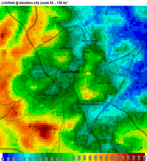
Below is the Elevation map of Lichfield, which displays elevation range with different colors. Scale of the first map is from 63 to 138 m (207 to 453 ft) with average elevation of 92.6 meters (=304 ft) [note 1]
These maps also provides idea of topography and contour of this city, they are displayed at different zoom levels. More info about maps, scale and edge coordinates you can find below images.
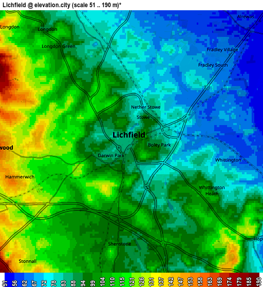
| \ | Map #1 | Map #2 | Topo.Map |
| Scale [m] | 63..138 m | 51..190 m | × |
| Scale [ft] | 207..453 ft | 167..623 ft | × |
| Average | 92.6 m = 304 ft | 95.6 m = 314 ft | × |
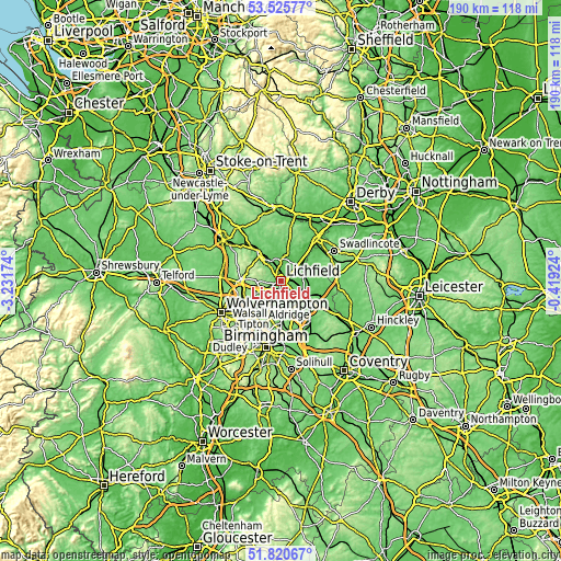
| Width | 5.92 km = 3.7 mi | 11.85 km = 7.4 mi | 189.6 km = 117.8 mi |
| Height | 5.92 km = 3.7 mi | 11.85 km = 7.4 mi | 189.6 km = 117.8 mi |
| ↑Max Latitude | 52.708173° | 52.734791° | 53.52577° |
| Latitude at center | 52.68154° | 52.68154° | 52.68154° |
| ↓Min Latitude | 52.65489° | 52.628224° | 51.82067° |
| ← Min Longitude | -1.869435° | -1.913381° | -3.23174° |
| Longitude center | -1.82549° | -1.82549° | -1.82549° |
| →Max Longitude | -1.781545° | -1.737599° | -0.41924° |
Nearby cities:
Cities around Lichfield sort by population:
• Tamworth elevation 73 m
10.2 km,  121°
121°
• Burntwood 173 m
6.9 km,  269°
269°
• Brownhills 143 m
9 km,  233°
233°
• Aldridge 162 m
10.5 km,  216°
216°
• Pelsall 146 m
11.2 km,  238°
238°
• Chasetown 156 m
6.8 km,  261°
261°
• Norton Canes 151 m
9.3 km, 263°
• Armitage 84 m
7.7 km,  330°
330°
• Alrewas 56 m
7.7 km,  41°
41°
• Shenstone 104 m
5 km,  192°
192°
• Whittington 67 m
4.4 km,  101°
101°
• Yoxall 66 m
9.7 km,  13°
13°
Multilingual:
 En español:
Lichfield elevación 87 m.
 En France:
Lichfield élévation 87 m.
 Auf Deutsch:
Lichfield höhe über dem Meeresspiegel ist 87 m.

Sources and notes:
- [note 1] Map square and city borders are not equal. Map elevation data is calculated only from area inside that square.
- [src 1] Elevation data from geonames database provided with same terms of usage.
- [src 2] The elevation map of Lichfield is generated using elevation data from NASA's 3 arcsec (90m) resolution SRTM data.
- [src 3] Base (background) map © OpenStreetMap contributors tiles are generated by Geofabrik and OpenTopoMap.
Copyright & License:
This Lichfield Elevation Map is licensed under CC BY-SA. You may reuse any part from this page, if you give a proper credit by linking to this URL:
 More info on terms of use page.