Hitchin elevation
Hitchin (England, Hertfordshire), United Kingdom elevation is 77 meters and Hitchin elevation in feet is 253 ft above sea level [src 1]. Hitchin is a populated place (feature code) with elevation that is 5 meters (16 ft) bigger than average city elevation in United Kingdom.
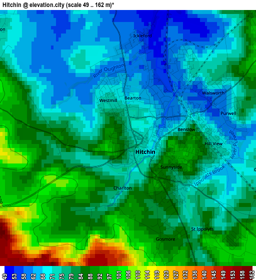
Below is the Elevation map of Hitchin, which displays elevation range with different colors. Scale of the first map is from 49 to 162 m (161 to 531 ft) with average elevation of 80 meters (=262 ft) [note 1]
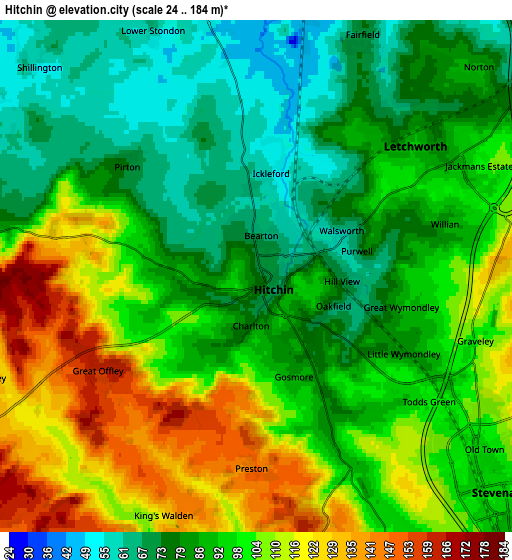
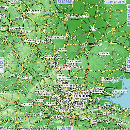
These maps also provides idea of topography and contour of this city, they are displayed at different zoom levels. More info about maps, scale and edge coordinates you can find below images.
| \ | Map #1 | Map #2 | Topo.Map |
| Scale [m] | 49..162 m | 24..184 m | × |
| Scale [ft] | 161..531 ft | 79..604 ft | × |
| Average | 80 m = 262 ft | 94.7 m = 311 ft | × |
| Width | 6.02 km = 3.7 mi | 12.05 km = 7.5 mi | 192.8 km = 119.8 mi |
| Height | 6.02 km = 3.7 mi | 12.05 km = 7.5 mi | 192.7 km = 119.7 mi |
| ↑Max Latitude | 51.976318° | 52.003379° | 52.80764° |
| Latitude at center | 51.94924° | 51.94924° | 51.94924° |
| ↓Min Latitude | 51.922146° | 51.895035° | 51.07409° |
| ← Min Longitude | -0.328905° | -0.372851° | -1.69121° |
| Longitude center | -0.28496° | -0.28496° | -0.28496° |
| →Max Longitude | -0.241015° | -0.197069° | 1.12129° |
Nearby cities:
Cities around Hitchin sort by population:
• Stevenage elevation 95 m
7.7 km,  132°
132°
• Letchworth Garden City 84 m
5.2 km,  50°
50°
• Letchworth 87 m
5.1 km, 49°
• Henlow 43 m
9 km,  359°
359°
• Baldock 68 m
7.9 km,  57°
57°
• Stotfold 48 m
8.3 km,  25°
25°
• Arlesey 43 m
6.6 km,  11°
11°
• Meppershall 71 m
8.4 km,  333°
333°
• Shillington 54 m
7.1 km,  313°
313°
• Pirton 79 m
4.2 km, 306°
• Gravenhurst 49 m
8.8 km,  318°
318°
• Stondon 61 m
6.3 km,  337°
337°
Multilingual:
 En español:
Hitchin elevación 77 m.
 En France:
Hitchin élévation 77 m.


Sources and notes:
- [note 1] Map square and city borders are not equal. Map elevation data is calculated only from area inside that square.
- [src 1] Elevation data from geonames database provided with same terms of usage.
- [src 2] The elevation map of Hitchin is generated using elevation data from NASA's 3 arcsec (90m) resolution SRTM data.
- [src 3] Base (background) map © OpenStreetMap contributors tiles are generated by Geofabrik and OpenTopoMap.
Copyright & License:
This Hitchin Elevation Map is licensed under CC BY-SA. You may reuse any part from this page, if you give a proper credit by linking to this URL:
 More info on terms of use page.