Stotfold elevation
Stotfold (England, Central Bedfordshire), United Kingdom elevation is 48 meters and Stotfold elevation in feet is 157 ft above sea level [src 1]. Stotfold is a seat of a third-order administrative division (feature code) with elevation that is 24 meters (79 ft) smaller than average city elevation in United Kingdom.
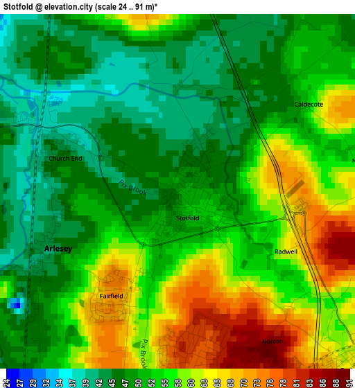
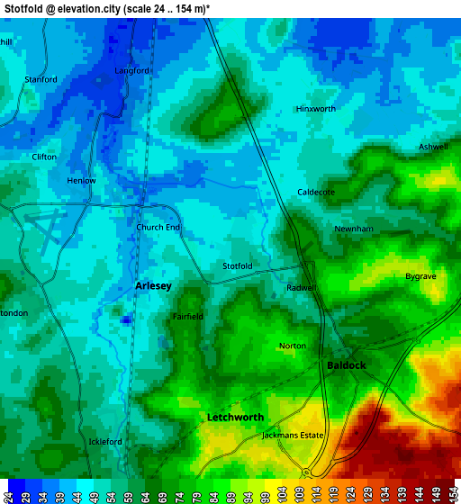
Below is the Elevation map of Stotfold, which displays elevation range with different colors. Scale of the first map is from 24 to 91 m (79 to 299 ft) with average elevation of 53.7 meters (=176 ft) [note 1]
These maps also provides idea of topography and contour of this city, they are displayed at different zoom levels. More info about maps, scale and edge coordinates you can find below images.
| \ | Map #1 | Map #2 | Topo.Map |
| Scale [m] | 24..91 m | 24..154 m | × |
| Scale [ft] | 79..299 ft | 79..505 ft | × |
| Average | 53.7 m = 176 ft | 60.6 m = 199 ft | × |
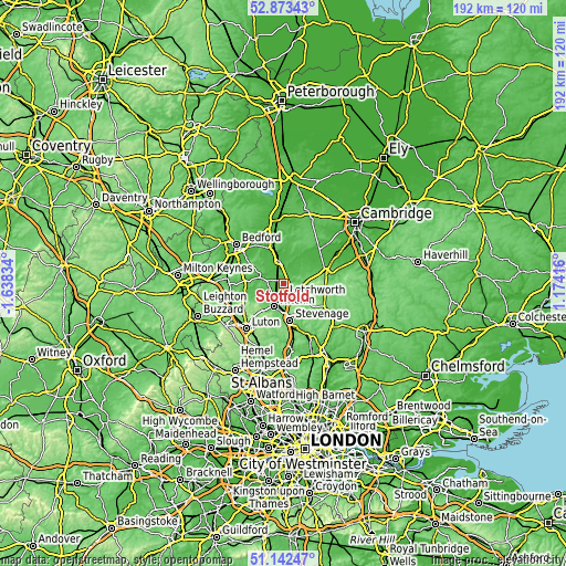
| Width | 6.01 km = 3.7 mi | 12.03 km = 7.5 mi | 192.5 km = 119.6 mi |
| Height | 6.01 km = 3.7 mi | 12.03 km = 7.5 mi | 192.4 km = 119.6 mi |
| ↑Max Latitude | 52.043357° | 52.070378° | 52.87343° |
| Latitude at center | 52.01632° | 52.01632° | 52.01632° |
| ↓Min Latitude | 51.989266° | 51.962196° | 51.14247° |
| ← Min Longitude | -0.276035° | -0.319981° | -1.63834° |
| Longitude center | -0.23209° | -0.23209° | -0.23209° |
| →Max Longitude | -0.188145° | -0.144199° | 1.17416° |
Nearby cities:
Cities around Stotfold sort by population:
• Letchworth Garden City elevation 84 m
4.1 km,  174°
174°
• Letchworth 87 m
4.1 km,  176°
176°
• Henlow 43 m
4 km,  292°
292°
• Baldock 68 m
4.4 km,  136°
136°
• Arlesey 43 m
2.5 km,  246°
246°
• Langford 36 m
5 km,  327°
327°
• Ashwell 66 m
5.9 km,  65°
65°
• Meppershall 71 m
7.4 km,  270°
270°
• Stondon 61 m
6.2 km, 254°
• Clifton 44 m
5.4 km,  299°
299°
• Edworth 46 m
4.5 km,  13°
13°
• Astwick 43 m
1.8 km,  1°
1°
Multilingual:
 En español:
Stotfold elevación 48 m.
 En France:
Stotfold élévation 48 m.


Sources and notes:
- [note 1] Map square and city borders are not equal. Map elevation data is calculated only from area inside that square.
- [src 1] Elevation data from geonames database provided with same terms of usage.
- [src 2] The elevation map of Stotfold is generated using elevation data from NASA's 3 arcsec (90m) resolution SRTM data.
- [src 3] Base (background) map © OpenStreetMap contributors tiles are generated by Geofabrik and OpenTopoMap.
Copyright & License:
This Stotfold Elevation Map is licensed under CC BY-SA. You may reuse any part from this page, if you give a proper credit by linking to this URL:
 More info on terms of use page.