Letchworth elevation
Letchworth (England, Hertfordshire), United Kingdom elevation is 87 meters and Letchworth elevation in feet is 285 ft above sea level [src 1]. Letchworth is a populated place (feature code) with elevation that is 15 meters (49 ft) bigger than average city elevation in United Kingdom.
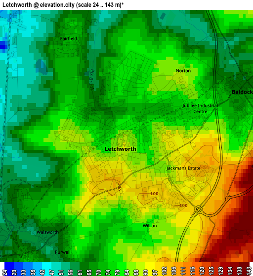
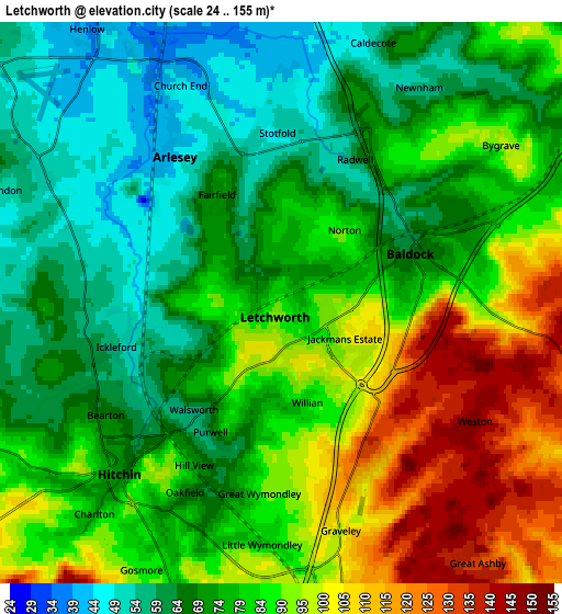
Below is the Elevation map of Letchworth, which displays elevation range with different colors. Scale of the first map is from 24 to 143 m (79 to 469 ft) with average elevation of 77.9 meters (=256 ft) [note 1]
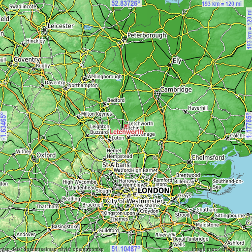
These maps also provides idea of topography and contour of this city, they are displayed at different zoom levels. More info about maps, scale and edge coordinates you can find below images.
| \ | Map #1 | Map #2 | Topo.Map |
| Scale [m] | 24..143 m | 24..155 m | × |
| Scale [ft] | 79..469 ft | 79..509 ft | × |
| Average | 77.9 m = 256 ft | 80.7 m = 265 ft | × |
| Width | 6.02 km = 3.7 mi | 12.04 km = 7.5 mi | 192.6 km = 119.7 mi |
| Height | 6.02 km = 3.7 mi | 12.04 km = 7.5 mi | 192.6 km = 119.7 mi |
| ↑Max Latitude | 52.0065° | 52.033543° | 52.83726° |
| Latitude at center | 51.97944° | 51.97944° | 51.97944° |
| ↓Min Latitude | 51.952364° | 51.925272° | 51.10487° |
| ← Min Longitude | -0.272345° | -0.316291° | -1.63465° |
| Longitude center | -0.2284° | -0.2284° | -0.2284° |
| →Max Longitude | -0.184455° | -0.140509° | 1.17785° |
Nearby cities:
Cities around Letchworth sort by population:
• Letchworth Garden City elevation 84 m
0.1 km,  93°
93°
• Hitchin 77 m
5.1 km,  229°
229°
• Henlow 43 m
6.9 km,  325°
325°
• Baldock 68 m
2.9 km,  71°
71°
• Stotfold 48 m
4.1 km,  356°
356°
• Arlesey 43 m
4 km,  320°
320°
• Ashwell 66 m
8.3 km,  37°
37°
• Pirton 79 m
7.3 km,  262°
262°
• Edworth 46 m
8.5 km,  5°
5°
• Clifton 44 m
8.3 km, 323°
• Stondon 61 m
6.7 km,  291°
291°
• Astwick 43 m
5.9 km, 358°
Multilingual:
 En español:
Letchworth elevación 87 m.
 En France:
Letchworth élévation 87 m.
 Auf Deutsch:
Letchworth höhe über dem Meeresspiegel ist 87 m.

Sources and notes:
- [note 1] Map square and city borders are not equal. Map elevation data is calculated only from area inside that square.
- [src 1] Elevation data from geonames database provided with same terms of usage.
- [src 2] The elevation map of Letchworth is generated using elevation data from NASA's 3 arcsec (90m) resolution SRTM data.
- [src 3] Base (background) map © OpenStreetMap contributors tiles are generated by Geofabrik and OpenTopoMap.
Copyright & License:
This Letchworth Elevation Map is licensed under CC BY-SA. You may reuse any part from this page, if you give a proper credit by linking to this URL:
 More info on terms of use page.