Stevenage elevation
Stevenage (England, Hertfordshire), United Kingdom elevation is 95 meters and Stevenage elevation in feet is 312 ft above sea level [src 1]. Stevenage is a populated place (feature code) with elevation that is 23 meters (75 ft) bigger than average city elevation in United Kingdom.
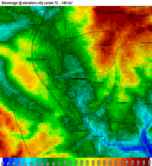
Below is the Elevation map of Stevenage, which displays elevation range with different colors. Scale of the first map is from 72 to 148 m (236 to 486 ft) with average elevation of 107.7 meters (=353 ft) [note 1]
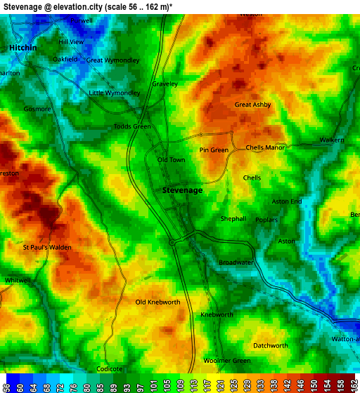
These maps also provides idea of topography and contour of this city, they are displayed at different zoom levels. More info about maps, scale and edge coordinates you can find below images.
| \ | Map #1 | Map #2 | Topo.Map |
| Scale [m] | 72..148 m | 56..162 m | × |
| Scale [ft] | 236..486 ft | 184..531 ft | × |
| Average | 107.7 m = 353 ft | 107.1 m = 351 ft | × |
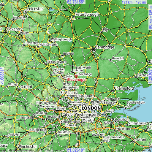
| Width | 6.03 km = 3.7 mi | 12.06 km = 7.5 mi | 193 km = 119.9 mi |
| Height | 6.03 km = 3.7 mi | 12.06 km = 7.5 mi | 192.9 km = 119.9 mi |
| ↑Max Latitude | 51.929346° | 51.956436° | 52.76155° |
| Latitude at center | 51.90224° | 51.90224° | 51.90224° |
| ↓Min Latitude | 51.875117° | 51.847978° | 51.02618° |
| ← Min Longitude | -0.246505° | -0.290451° | -1.60881° |
| Longitude center | -0.20256° | -0.20256° | -0.20256° |
| →Max Longitude | -0.158615° | -0.114669° | 1.20369° |
Nearby cities:
Cities around Stevenage sort by population:
• Welwyn Garden City elevation 92 m
11.2 km,  181°
181°
• Letchworth Garden City 84 m
8.7 km,  349°
349°
• Hitchin 77 m
7.7 km,  312°
312°
• Letchworth 87 m
8.8 km, 348°
• Codicote 106 m
6.2 km,  202°
202°
• Baldock 68 m
9.6 km,  5°
5°
• Knebworth 92 m
4.1 km,  162°
162°
• Welwyn 82 m
7.7 km,  185°
185°
• Watton at Stone 62 m
7.8 km,  128°
128°
• Walkern 88 m
5.5 km,  70°
70°
• Kimpton 90 m
8.8 km,  229°
229°
• Datchworth 112 m
6.4 km,  152°
152°
Multilingual:
 En español:
Stevenage elevación 95 m.
 En France:
Stevenage élévation 95 m.
 Auf Deutsch:
Stevenage höhe über dem Meeresspiegel ist 95 m.

Sources and notes:
- [note 1] Map square and city borders are not equal. Map elevation data is calculated only from area inside that square.
- [src 1] Elevation data from geonames database provided with same terms of usage.
- [src 2] The elevation map of Stevenage is generated using elevation data from NASA's 3 arcsec (90m) resolution SRTM data.
- [src 3] Base (background) map © OpenStreetMap contributors tiles are generated by Geofabrik and OpenTopoMap.
Copyright & License:
This Stevenage Elevation Map is licensed under CC BY-SA. You may reuse any part from this page, if you give a proper credit by linking to this URL:
 More info on terms of use page.