Keynsham elevation
Keynsham (England, Bath and North East Somerset), United Kingdom elevation is 25 meters and Keynsham elevation in feet is 82 ft above sea level [src 1]. Keynsham is a populated place (feature code) with elevation that is 47 meters (154 ft) smaller than average city elevation in United Kingdom.
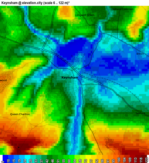
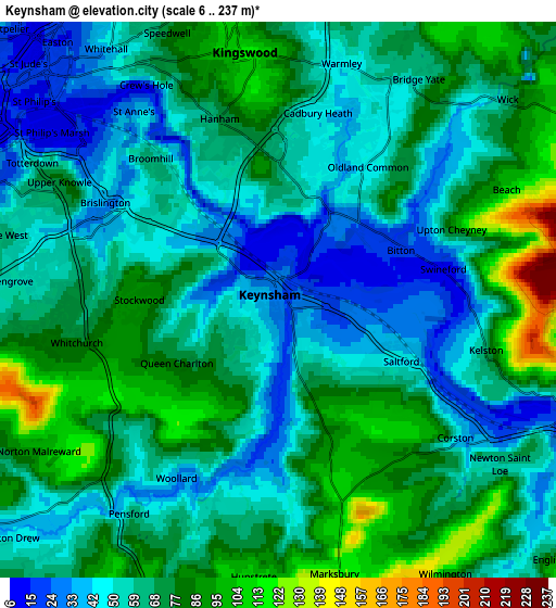
Below is the Elevation map of Keynsham, which displays elevation range with different colors. Scale of the first map is from 6 to 122 m (20 to 400 ft) with average elevation of 50 meters (=164 ft) [note 1]
These maps also provides idea of topography and contour of this city, they are displayed at different zoom levels. More info about maps, scale and edge coordinates you can find below images.
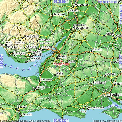
| \ | Map #1 | Map #2 | Topo.Map |
| Scale [m] | 6..122 m | 6..237 m | × |
| Scale [ft] | 20..400 ft | 20..778 ft | × |
| Average | 50 m = 164 ft | 65.4 m = 215 ft | × |
| Width | 6.09 km = 3.8 mi | 12.19 km = 7.6 mi | 195 km = 121.2 mi |
| Height | 6.09 km = 3.8 mi | 12.19 km = 7.6 mi | 195 km = 121.2 mi |
| ↑Max Latitude | 51.44127° | 51.468654° | 52.28254° |
| Latitude at center | 51.41387° | 51.41387° | 51.41387° |
| ↓Min Latitude | 51.386454° | 51.359021° | 50.52837° |
| ← Min Longitude | -2.541745° | -2.585691° | -3.90405° |
| Longitude center | -2.4978° | -2.4978° | -2.4978° |
| →Max Longitude | -2.453855° | -2.409909° | -1.09155° |
Nearby cities:
Cities around Keynsham sort by population:
• Bristol elevation 21 m
8.3 km,  303°
303°
• Kingswood 104 m
4.4 km,  350°
350°
• Mangotsfield 74 m
8.2 km,  356°
356°
• Saltford 44 m
3 km,  117°
117°
• Wick 74 m
6.7 km,  49°
49°
• Corston 35 m
5.1 km,  128°
128°
• Bitton 19 m
2.9 km,  65°
65°
• Stanton Drew 38 m
8 km,  230°
230°
• Siston 79 m
7.5 km,  26°
26°
• Publow 49 m
5 km,  219°
219°
• Whitchurch 77 m
4.6 km,  259°
259°
• Compton Dando 28 m
4 km,  196°
196°
Multilingual:
 En español:
Keynsham elevación 25 m.
 En France:
Keynsham élévation 25 m.


Sources and notes:
- [note 1] Map square and city borders are not equal. Map elevation data is calculated only from area inside that square.
- [src 1] Elevation data from geonames database provided with same terms of usage.
- [src 2] The elevation map of Keynsham is generated using elevation data from NASA's 3 arcsec (90m) resolution SRTM data.
- [src 3] Base (background) map © OpenStreetMap contributors tiles are generated by Geofabrik and OpenTopoMap.
Copyright & License:
This Keynsham Elevation Map is licensed under CC BY-SA. You may reuse any part from this page, if you give a proper credit by linking to this URL:
 More info on terms of use page.