Compton Dando elevation
Compton Dando (England, Bath and North East Somerset), United Kingdom elevation is 28 meters and Compton Dando elevation in feet is 92 ft above sea level [src 1]. Compton Dando is a seat of a third-order administrative division (feature code) with elevation that is 44 meters (144 ft) smaller than average city elevation in United Kingdom.
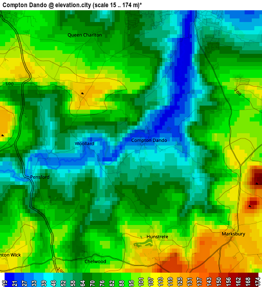
Below is the Elevation map of Compton Dando, which displays elevation range with different colors. Scale of the first map is from 15 to 174 m (49 to 571 ft) with average elevation of 77 meters (=253 ft) [note 1]
These maps also provides idea of topography and contour of this city, they are displayed at different zoom levels. More info about maps, scale and edge coordinates you can find below images.
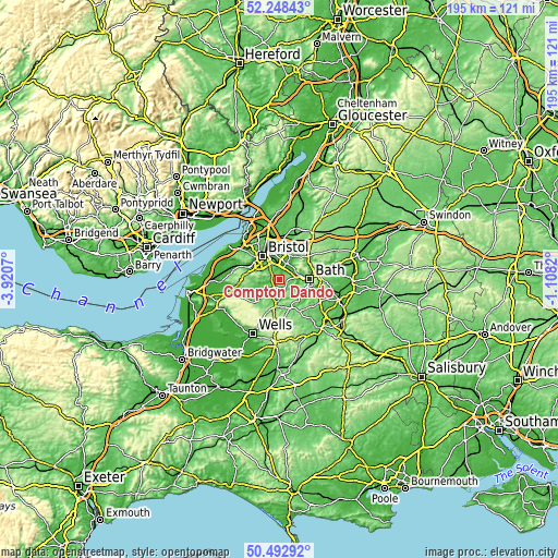
| \ | Map #1 | Topo.Map |
| Scale [m] | 15..174 m | × |
| Scale [ft] | 49..571 ft | × |
| Average | 77 m = 253 ft | × |
| Width | 6.1 km = 3.8 mi | 195.2 km = 121.3 mi |
| Height | 6.1 km = 3.8 mi | 195.2 km = 121.3 mi |
| ↑Max Latitude | 51.406511° | 52.24843° |
| Latitude at center | 51.37909° | 51.37909° |
| ↓Min Latitude | 51.351653° | 50.49292° |
| ← Min Longitude | -2.558395° | -3.9207° |
| Longitude center | -2.51445° | -2.51445° |
| →Max Longitude | -2.470505° | -1.1082° |
Nearby cities:
Cities around Compton Dando sort by population:
• Keynsham elevation 25 m
4 km,  16°
16°
• Saltford 44 m
4.6 km,  56°
56°
• Clutton 120 m
5.9 km,  199°
199°
• Timsbury 141 m
6.6 km,  158°
158°
• Bishop Sutton 69 m
7.5 km,  228°
228°
• Chew Magna 50 m
6.8 km,  257°
257°
• Corston 35 m
5.2 km,  82°
82°
• Bitton 19 m
6.3 km,  36°
36°
• Priston 86 m
6.6 km,  127°
127°
• Stanton Drew 38 m
5.2 km, 255°
• Whitchurch 77 m
4.5 km,  311°
311°
• Publow 49 m
2 km,  268°
268°
Multilingual:
 En español:
Compton Dando elevación 28 m.
 En France:
Compton Dando élévation 28 m.
 Auf Deutsch:
Compton Dando höhe über dem Meeresspiegel ist 28 m.

Sources and notes:
- [note 1] Map square and city borders are not equal. Map elevation data is calculated only from area inside that square.
- [src 1] Elevation data from geonames database provided with same terms of usage.
- [src 2] The elevation map of Compton Dando is generated using elevation data from NASA's 3 arcsec (90m) resolution SRTM data.
- [src 3] Base (background) map © OpenStreetMap contributors tiles are generated by Geofabrik and OpenTopoMap.
Copyright & License:
This Compton Dando Elevation Map is licensed under CC BY-SA. You may reuse any part from this page, if you give a proper credit by linking to this URL:
 More info on terms of use page.