Kidsgrove elevation
Kidsgrove (England, Staffordshire), United Kingdom elevation is 148 meters and Kidsgrove elevation in feet is 486 ft above sea level [src 1]. Kidsgrove is a populated place (feature code) with elevation that is 76 meters (249 ft) bigger than average city elevation in United Kingdom.
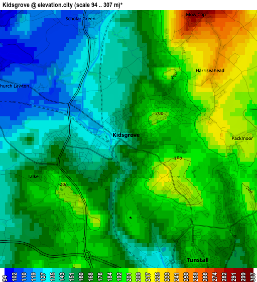
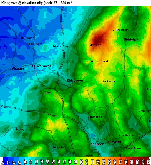
Below is the Elevation map of Kidsgrove, which displays elevation range with different colors. Scale of the first map is from 94 to 307 m (308 to 1007 ft) with average elevation of 169.1 meters (=555 ft) [note 1]
These maps also provides idea of topography and contour of this city, they are displayed at different zoom levels. More info about maps, scale and edge coordinates you can find below images.
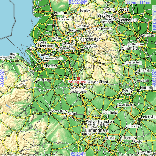
| \ | Map #1 | Map #2 | Topo.Map |
| Scale [m] | 94..307 m | 67..326 m | × |
| Scale [ft] | 308..1007 ft | 220..1070 ft | × |
| Average | 169.1 m = 555 ft | 153 m = 502 ft | × |
| Width | 5.87 km = 3.6 mi | 11.74 km = 7.3 mi | 187.8 km = 116.7 mi |
| Height | 5.87 km = 3.6 mi | 11.74 km = 7.3 mi | 187.8 km = 116.7 mi |
| ↑Max Latitude | 53.113296° | 53.139665° | 53.92324° |
| Latitude at center | 53.08691° | 53.08691° | 53.08691° |
| ↓Min Latitude | 53.060508° | 53.03409° | 52.234° |
| ← Min Longitude | -2.281715° | -2.325661° | -3.64402° |
| Longitude center | -2.23777° | -2.23777° | -2.23777° |
| →Max Longitude | -2.193825° | -2.149879° | -0.83152° |
Nearby cities:
Cities around Kidsgrove sort by population:
• Stoke-on-Trent elevation 114 m
9.8 km,  159°
159°
• Newcastle under Lyme 160 m
9.7 km,  178°
178°
• Congleton 90 m
8.6 km,  11°
11°
• Sandbach 69 m
10.5 km,  307°
307°
• Biddulph 173 m
5.3 km,  50°
50°
• Alsager 95 m
4.7 km,  282°
282°
• Tunstall 152 m
3.6 km,  151°
151°
• Audley 143 m
5.8 km,  225°
225°
• Keele 183 m
9.8 km,  199°
199°
• Rode Heath 92 m
4.7 km, 309°
• Betley 84 m
10.5 km,  236°
236°
• Eaton 118 m
11 km, 13°
Multilingual:
 En español:
Kidsgrove elevación 148 m.
 En France:
Kidsgrove élévation 148 m.
 Auf Deutsch:
Kidsgrove höhe über dem Meeresspiegel ist 148 m.

Sources and notes:
- [note 1] Map square and city borders are not equal. Map elevation data is calculated only from area inside that square.
- [src 1] Elevation data from geonames database provided with same terms of usage.
- [src 2] The elevation map of Kidsgrove is generated using elevation data from NASA's 3 arcsec (90m) resolution SRTM data.
- [src 3] Base (background) map © OpenStreetMap contributors tiles are generated by Geofabrik and OpenTopoMap.
Copyright & License:
This Kidsgrove Elevation Map is licensed under CC BY-SA. You may reuse any part from this page, if you give a proper credit by linking to this URL:
 More info on terms of use page.