Alsager elevation
Alsager (England, Cheshire East), United Kingdom elevation is 95 meters and Alsager elevation in feet is 312 ft above sea level [src 1]. Alsager is a populated place (feature code) with elevation that is 23 meters (75 ft) bigger than average city elevation in United Kingdom.
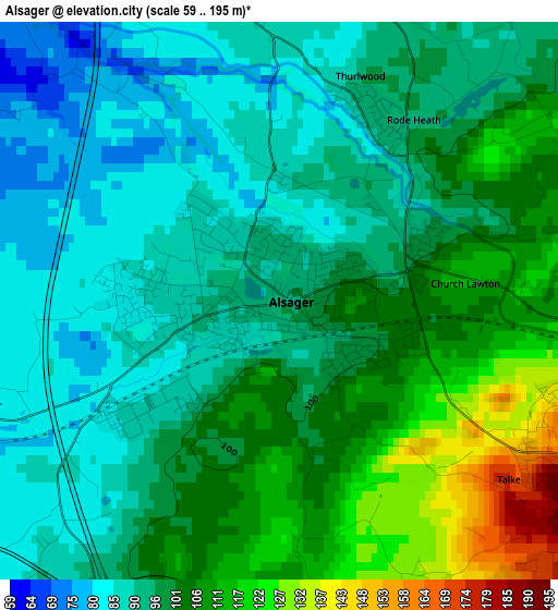
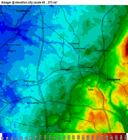
Below is the Elevation map of Alsager, which displays elevation range with different colors. Scale of the first map is from 59 to 195 m (194 to 640 ft) with average elevation of 98.5 meters (=323 ft) [note 1]
These maps also provides idea of topography and contour of this city, they are displayed at different zoom levels. More info about maps, scale and edge coordinates you can find below images.
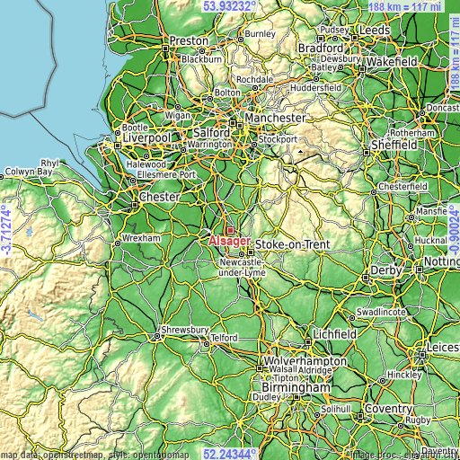
| \ | Map #1 | Map #2 | Topo.Map |
| Scale [m] | 59..195 m | 45..273 m | × |
| Scale [ft] | 194..640 ft | 148..896 ft | × |
| Average | 98.5 m = 323 ft | 106.6 m = 350 ft | × |
| Width | 5.87 km = 3.6 mi | 11.74 km = 7.3 mi | 187.8 km = 116.7 mi |
| Height | 5.87 km = 3.6 mi | 11.74 km = 7.3 mi | 187.8 km = 116.7 mi |
| ↑Max Latitude | 53.12255° | 53.148914° | 53.93232° |
| Latitude at center | 53.09617° | 53.09617° | 53.09617° |
| ↓Min Latitude | 53.069774° | 53.043362° | 52.24344° |
| ← Min Longitude | -2.350435° | -2.394381° | -3.71274° |
| Longitude center | -2.30649° | -2.30649° | -2.30649° |
| →Max Longitude | -2.262545° | -2.218599° | -0.90024° |
Nearby cities:
Cities around Alsager sort by population:
• Crewe elevation 60 m
9 km,  271°
271°
• Kidsgrove 148 m
4.7 km,  102°
102°
• Congleton 90 m
9.7 km,  40°
40°
• Sandbach 69 m
6.6 km,  325°
325°
• Biddulph 173 m
9 km,  74°
74°
• Tunstall 152 m
7.6 km,  123°
123°
• Audley 143 m
5.2 km,  175°
175°
• Keele 183 m
10.3 km,  172°
172°
• Rode Heath 92 m
2.2 km,  26°
26°
• Betley 84 m
8 km,  211°
211°
• Weston 68 m
7.1 km,  242°
242°
• Chorlton 59 m
8.3 km,  232°
232°
Multilingual:
 En español:
Alsager elevación 95 m.
 En France:
Alsager élévation 95 m.


Sources and notes:
- [note 1] Map square and city borders are not equal. Map elevation data is calculated only from area inside that square.
- [src 1] Elevation data from geonames database provided with same terms of usage.
- [src 2] The elevation map of Alsager is generated using elevation data from NASA's 3 arcsec (90m) resolution SRTM data.
- [src 3] Base (background) map © OpenStreetMap contributors tiles are generated by Geofabrik and OpenTopoMap.
Copyright & License:
This Alsager Elevation Map is licensed under CC BY-SA. You may reuse any part from this page, if you give a proper credit by linking to this URL:
 More info on terms of use page.