Leicester elevation
Leicester (England, City of Leicester), United Kingdom elevation is 65 meters and Leicester elevation in feet is 213 ft above sea level [src 1]. Leicester is a seat of a second-order administrative division (feature code) with elevation that is 7 meters (23 ft) smaller than average city elevation in United Kingdom.
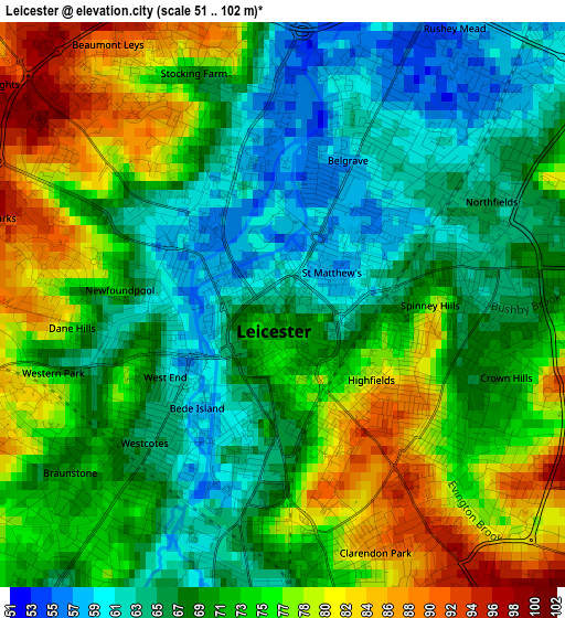
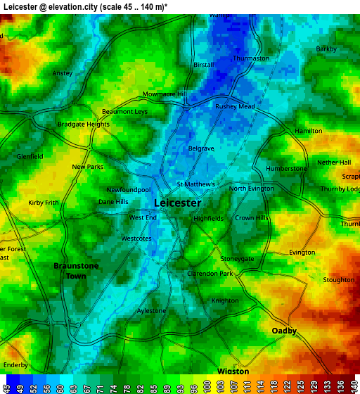
Below is the Elevation map of Leicester, which displays elevation range with different colors. Scale of the first map is from 51 to 102 m (167 to 335 ft) with average elevation of 71.1 meters (=233 ft) [note 1]
These maps also provides idea of topography and contour of this city, they are displayed at different zoom levels. More info about maps, scale and edge coordinates you can find below images.
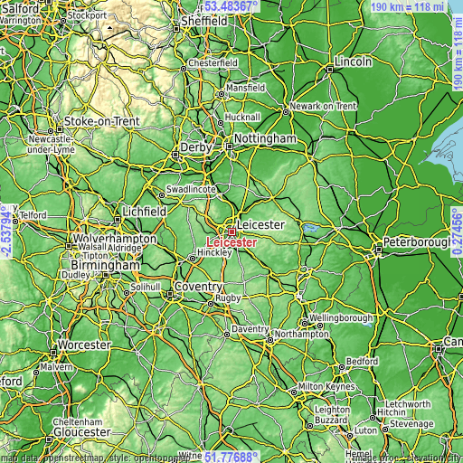
| \ | Map #1 | Map #2 | Topo.Map |
| Scale [m] | 51..102 m | 45..140 m | × |
| Scale [ft] | 167..335 ft | 148..459 ft | × |
| Average | 71.1 m = 233 ft | 81.8 m = 268 ft | × |
| Width | 5.93 km = 3.7 mi | 11.86 km = 7.4 mi | 189.8 km = 117.9 mi |
| Height | 5.93 km = 3.7 mi | 11.86 km = 7.4 mi | 189.8 km = 117.9 mi |
| ↑Max Latitude | 52.66526° | 52.691903° | 53.48367° |
| Latitude at center | 52.6386° | 52.6386° | 52.6386° |
| ↓Min Latitude | 52.611924° | 52.585232° | 51.77688° |
| ← Min Longitude | -1.175635° | -1.219581° | -2.53794° |
| Longitude center | -1.13169° | -1.13169° | -1.13169° |
| →Max Longitude | -1.087745° | -1.043799° | 0.27456° |
Nearby cities:
Cities around Leicester sort by population:
• Wigston Magna elevation 104 m
6.9 km,  157°
157°
• Oadby 104 m
4.9 km,  137°
137°
• Mountsorrel 72 m
8.8 km,  351°
351°
• Syston 63 m
6.6 km,  41°
41°
• Glenfield 98 m
4.4 km,  281°
281°
• Kirby Muxloe 94 m
6.5 km,  261°
261°
• Enderby 95 m
7.6 km,  221°
221°
• Anstey 70 m
5.5 km,  315°
315°
• Narborough 70 m
9.2 km,  209°
209°
• Blaby 72 m
7.3 km,  197°
197°
• Ratby 101 m
7.5 km, 279°
• Rothley 59 m
7.9 km,  357°
357°
Multilingual:
 En español:
Leicester elevación 65 m.
 En France:
Leicester élévation 65 m.
 Auf Deutsch:
Leicester höhe über dem Meeresspiegel ist 65 m.

Sources and notes:
- [note 1] Map square and city borders are not equal. Map elevation data is calculated only from area inside that square.
- [src 1] Elevation data from geonames database provided with same terms of usage.
- [src 2] The elevation map of Leicester is generated using elevation data from NASA's 3 arcsec (90m) resolution SRTM data.
- [src 3] Base (background) map © OpenStreetMap contributors tiles are generated by Geofabrik and OpenTopoMap.
Copyright & License:
This Leicester Elevation Map is licensed under CC BY-SA. You may reuse any part from this page, if you give a proper credit by linking to this URL:
 More info on terms of use page.