Ratby elevation
Ratby (England, Leicestershire), United Kingdom elevation is 101 meters and Ratby elevation in feet is 331 ft above sea level [src 1]. Ratby is a populated place (feature code) with elevation that is 29 meters (95 ft) bigger than average city elevation in United Kingdom.
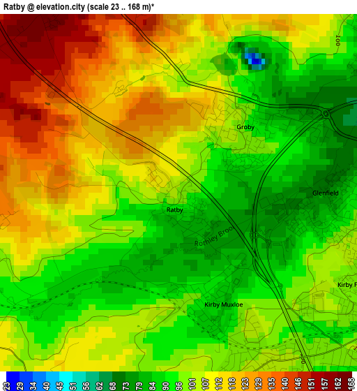
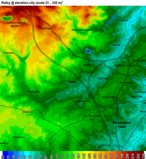
Below is the Elevation map of Ratby, which displays elevation range with different colors. Scale of the first map is from 23 to 168 m (75 to 551 ft) with average elevation of 103.6 meters (=340 ft) [note 1]
These maps also provides idea of topography and contour of this city, they are displayed at different zoom levels. More info about maps, scale and edge coordinates you can find below images.
| \ | Map #1 | Map #2 | Topo.Map |
| Scale [m] | 23..168 m | 23..230 m | × |
| Scale [ft] | 75..551 ft | 75..755 ft | × |
| Average | 103.6 m = 340 ft | 112.1 m = 368 ft | × |
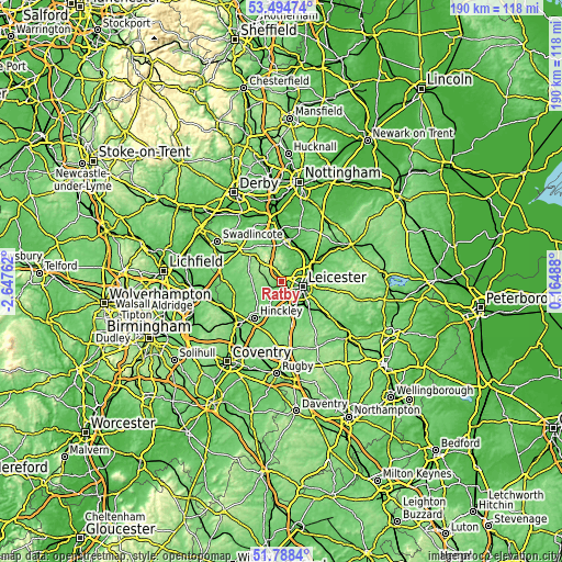
| Width | 5.93 km = 3.7 mi | 11.86 km = 7.4 mi | 189.7 km = 117.9 mi |
| Height | 5.93 km = 3.7 mi | 11.86 km = 7.4 mi | 189.7 km = 117.9 mi |
| ↑Max Latitude | 52.676543° | 52.703179° | 53.49474° |
| Latitude at center | 52.64989° | 52.64989° | 52.64989° |
| ↓Min Latitude | 52.623221° | 52.596536° | 51.7884° |
| ← Min Longitude | -1.285315° | -1.329261° | -2.64762° |
| Longitude center | -1.24137° | -1.24137° | -1.24137° |
| →Max Longitude | -1.197425° | -1.153479° | 0.16488° |
Nearby cities:
Cities around Ratby sort by population:
• Leicester elevation 65 m
7.5 km,  99°
99°
• Earl Shilton 117 m
9.5 km,  211°
211°
• Mountsorrel 72 m
9.6 km,  39°
39°
• Glenfield 98 m
3.2 km, 96°
• Kirby Muxloe 94 m
2.4 km,  156°
156°
• Enderby 95 m
7.3 km, 161°
• Anstey 70 m
4.4 km,  53°
53°
• Markfield 179 m
4.7 km,  331°
331°
• Desford 134 m
4.4 km,  233°
233°
• Newbold Verdon 136 m
7.2 km,  251°
251°
• Barlestone 132 m
8.7 km,  268°
268°
• Bagworth 162 m
7.3 km,  290°
290°
Multilingual:
 En español:
Ratby elevación 101 m.
 En France:
Ratby élévation 101 m.


Sources and notes:
- [note 1] Map square and city borders are not equal. Map elevation data is calculated only from area inside that square.
- [src 1] Elevation data from geonames database provided with same terms of usage.
- [src 2] The elevation map of Ratby is generated using elevation data from NASA's 3 arcsec (90m) resolution SRTM data.
- [src 3] Base (background) map © OpenStreetMap contributors tiles are generated by Geofabrik and OpenTopoMap.
Copyright & License:
This Ratby Elevation Map is licensed under CC BY-SA. You may reuse any part from this page, if you give a proper credit by linking to this URL:
 More info on terms of use page.