Syston elevation
Syston (England, Leicestershire), United Kingdom elevation is 63 meters and Syston elevation in feet is 207 ft above sea level [src 1]. Syston is a populated place (feature code) with elevation that is 9 meters (30 ft) smaller than average city elevation in United Kingdom.
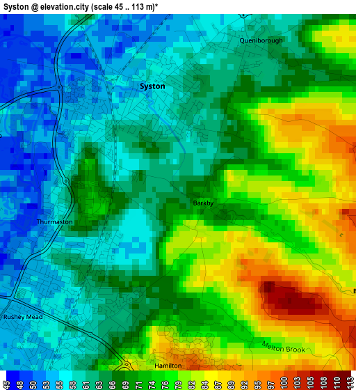
Below is the Elevation map of Syston, which displays elevation range with different colors. Scale of the first map is from 45 to 113 m (148 to 371 ft) with average elevation of 68.5 meters (=225 ft) [note 1]
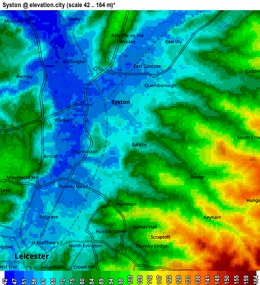
These maps also provides idea of topography and contour of this city, they are displayed at different zoom levels. More info about maps, scale and edge coordinates you can find below images.
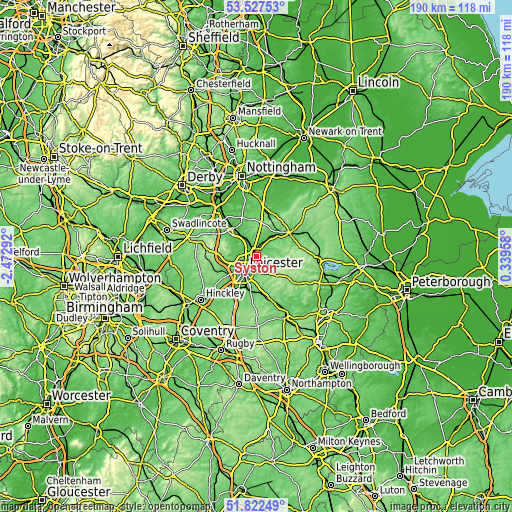
| \ | Map #1 | Map #2 | Topo.Map |
| Scale [m] | 45..113 m | 42..164 m | × |
| Scale [ft] | 148..371 ft | 138..538 ft | × |
| Average | 68.5 m = 225 ft | 78.8 m = 259 ft | × |
| Width | 5.92 km = 3.7 mi | 11.85 km = 7.4 mi | 189.6 km = 117.8 mi |
| Height | 5.92 km = 3.7 mi | 11.85 km = 7.4 mi | 189.6 km = 117.8 mi |
| ↑Max Latitude | 52.709962° | 52.736579° | 53.52753° |
| Latitude at center | 52.68333° | 52.68333° | 52.68333° |
| ↓Min Latitude | 52.656681° | 52.630016° | 51.82249° |
| ← Min Longitude | -1.110615° | -1.154561° | -2.47292° |
| Longitude center | -1.06667° | -1.06667° | -1.06667° |
| →Max Longitude | -1.022725° | -0.978779° | 0.33958° |
Nearby cities:
Cities around Syston sort by population:
• Leicester elevation 65 m
6.6 km,  221°
221°
• Oadby 104 m
8.7 km,  187°
187°
• Mountsorrel 72 m
6.7 km,  303°
303°
• Glenfield 98 m
9.6 km,  244°
244°
• Sileby 52 m
6.2 km,  333°
333°
• Anstey 70 m
8.3 km,  262°
262°
• Barrow upon Soar 61 m
9.3 km,  324°
324°
• Quorndon 51 m
9.9 km,  313°
313°
• Rothley 59 m
5.6 km, 301°
• Asfordby 76 m
11.5 km,  39°
39°
• Queniborough 62 m
2.8 km,  27°
27°
• Houghton on the Hill 173 m
7.9 km,  142°
142°
Multilingual:
 En español:
Syston elevación 63 m.
 En France:
Syston élévation 63 m.


Sources and notes:
- [note 1] Map square and city borders are not equal. Map elevation data is calculated only from area inside that square.
- [src 1] Elevation data from geonames database provided with same terms of usage.
- [src 2] The elevation map of Syston is generated using elevation data from NASA's 3 arcsec (90m) resolution SRTM data.
- [src 3] Base (background) map © OpenStreetMap contributors tiles are generated by Geofabrik and OpenTopoMap.
Copyright & License:
This Syston Elevation Map is licensed under CC BY-SA. You may reuse any part from this page, if you give a proper credit by linking to this URL:
 More info on terms of use page.