Oadby elevation
Oadby (England, Leicestershire), United Kingdom elevation is 104 meters and Oadby elevation in feet is 341 ft above sea level [src 1]. Oadby is a populated place (feature code) with elevation that is 32 meters (105 ft) bigger than average city elevation in United Kingdom.
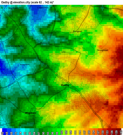
Below is the Elevation map of Oadby, which displays elevation range with different colors. Scale of the first map is from 62 to 142 m (203 to 466 ft) with average elevation of 100.2 meters (=329 ft) [note 1]
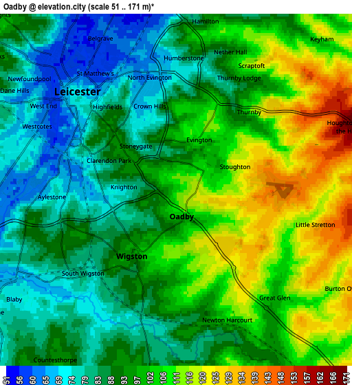
These maps also provides idea of topography and contour of this city, they are displayed at different zoom levels. More info about maps, scale and edge coordinates you can find below images.
| \ | Map #1 | Map #2 | Topo.Map |
| Scale [m] | 62..142 m | 51..171 m | × |
| Scale [ft] | 203..466 ft | 167..561 ft | × |
| Average | 100.2 m = 329 ft | 95.7 m = 314 ft | × |
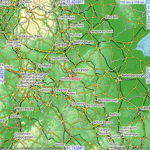
| Width | 5.93 km = 3.7 mi | 11.87 km = 7.4 mi | 189.9 km = 118 mi |
| Height | 5.93 km = 3.7 mi | 11.87 km = 7.4 mi | 189.9 km = 118 mi |
| ↑Max Latitude | 52.632889° | 52.659553° | 53.45191° |
| Latitude at center | 52.60621° | 52.60621° | 52.60621° |
| ↓Min Latitude | 52.579514° | 52.552802° | 51.74386° |
| ← Min Longitude | -1.127485° | -1.171431° | -2.48979° |
| Longitude center | -1.08354° | -1.08354° | -1.08354° |
| →Max Longitude | -1.039595° | -0.995649° | 0.32271° |
Nearby cities:
Cities around Oadby sort by population:
• Leicester elevation 65 m
4.9 km,  317°
317°
• Wigston Magna 104 m
2.8 km,  192°
192°
• Syston 63 m
8.7 km,  7°
7°
• Glenfield 98 m
8.8 km,  300°
300°
• Enderby 95 m
8.5 km,  256°
256°
• Countesthorpe 95 m
7.2 km,  215°
215°
• Narborough 70 m
9 km,  240°
240°
• Blaby 72 m
6.4 km, 238°
• Kibworth Harcourt 120 m
9.1 km,  138°
138°
• Fleckney 109 m
8.3 km,  162°
162°
• Great Glen 99 m
4.7 km, 136°
• Houghton on the Hill 173 m
6.4 km,  69°
69°
Multilingual:
 En español:
Oadby elevación 104 m.
 En France:
Oadby élévation 104 m.


Sources and notes:
- [note 1] Map square and city borders are not equal. Map elevation data is calculated only from area inside that square.
- [src 1] Elevation data from geonames database provided with same terms of usage.
- [src 2] The elevation map of Oadby is generated using elevation data from NASA's 3 arcsec (90m) resolution SRTM data.
- [src 3] Base (background) map © OpenStreetMap contributors tiles are generated by Geofabrik and OpenTopoMap.
Copyright & License:
This Oadby Elevation Map is licensed under CC BY-SA. You may reuse any part from this page, if you give a proper credit by linking to this URL:
 More info on terms of use page.