Countesthorpe elevation
Countesthorpe (England, Leicestershire), United Kingdom elevation is 95 meters and Countesthorpe elevation in feet is 312 ft above sea level [src 1]. Countesthorpe is a populated place (feature code) with elevation that is 23 meters (75 ft) bigger than average city elevation in United Kingdom.
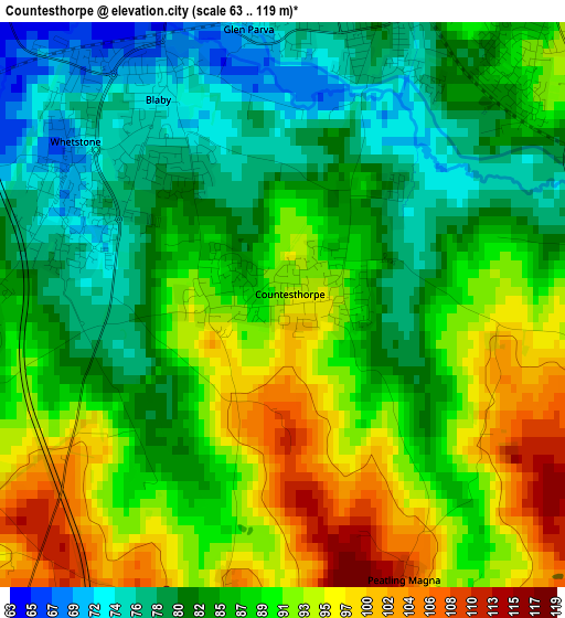
Below is the Elevation map of Countesthorpe, which displays elevation range with different colors. Scale of the first map is from 63 to 119 m (207 to 390 ft) with average elevation of 87.1 meters (=286 ft) [note 1]
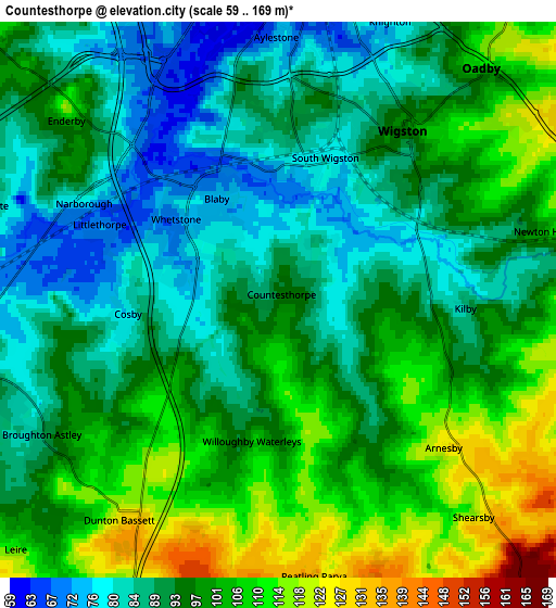
These maps also provides idea of topography and contour of this city, they are displayed at different zoom levels. More info about maps, scale and edge coordinates you can find below images.
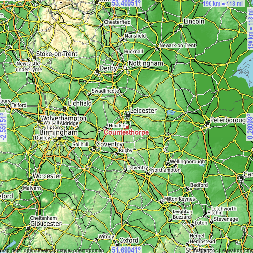
| \ | Map #1 | Map #2 | Topo.Map |
| Scale [m] | 63..119 m | 59..169 m | × |
| Scale [ft] | 207..390 ft | 194..554 ft | × |
| Average | 87.1 m = 286 ft | 95.6 m = 314 ft | × |
| Width | 5.94 km = 3.7 mi | 11.88 km = 7.4 mi | 190.1 km = 118.1 mi |
| Height | 5.94 km = 3.7 mi | 11.88 km = 7.4 mi | 190.1 km = 118.1 mi |
| ↑Max Latitude | 52.580501° | 52.607196° | 53.40051° |
| Latitude at center | 52.55379° | 52.55379° | 52.55379° |
| ↓Min Latitude | 52.527062° | 52.500319° | 51.69041° |
| ← Min Longitude | -1.189205° | -1.233151° | -2.55151° |
| Longitude center | -1.14526° | -1.14526° | -1.14526° |
| →Max Longitude | -1.101315° | -1.057369° | 0.26099° |
Nearby cities:
Cities around Countesthorpe sort by population:
• Wigston Magna elevation 104 m
4.7 km,  49°
49°
• Oadby 104 m
7.2 km,  35°
35°
• Broughton Astley 93 m
5.7 km,  239°
239°
• Enderby 95 m
5.6 km,  312°
312°
• Narborough 70 m
4 km,  291°
291°
• Blaby 72 m
2.8 km,  332°
332°
• Fleckney 109 m
7 km,  107°
107°
• Stoney Stanton 96 m
9.1 km,  266°
266°
• Cosby 75 m
3.3 km, 265°
• Great Glen 99 m
7.8 km,  72°
72°
• Sapcote 96 m
9.2 km,  258°
258°
• Croft 77 m
6.8 km, 272°
Multilingual:
 En español:
Countesthorpe elevación 95 m.
 En France:
Countesthorpe élévation 95 m.
 Auf Deutsch:
Countesthorpe höhe über dem Meeresspiegel ist 95 m.

Sources and notes:
- [note 1] Map square and city borders are not equal. Map elevation data is calculated only from area inside that square.
- [src 1] Elevation data from geonames database provided with same terms of usage.
- [src 2] The elevation map of Countesthorpe is generated using elevation data from NASA's 3 arcsec (90m) resolution SRTM data.
- [src 3] Base (background) map © OpenStreetMap contributors tiles are generated by Geofabrik and OpenTopoMap.
Copyright & License:
This Countesthorpe Elevation Map is licensed under CC BY-SA. You may reuse any part from this page, if you give a proper credit by linking to this URL:
 More info on terms of use page.