Llansadwrn elevation
Llansadwrn (Wales, Carmarthenshire), United Kingdom elevation is 54 meters and Llansadwrn elevation in feet is 177 ft above sea level [src 1]. Llansadwrn is a seat of a third-order administrative division (feature code) with elevation that is 18 meters (59 ft) smaller than average city elevation in United Kingdom.
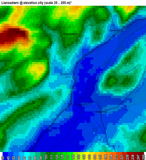
Below is the Elevation map of Llansadwrn, which displays elevation range with different colors. Scale of the first map is from 35 to 255 m (115 to 837 ft) with average elevation of 85.8 meters (=281 ft) [note 1]
These maps also provides idea of topography and contour of this city, they are displayed at different zoom levels. More info about maps, scale and edge coordinates you can find below images.
| \ | Map #1 | Topo.Map |
| Scale [m] | 35..255 m | × |
| Scale [ft] | 115..837 ft | × |
| Average | 85.8 m = 281 ft | × |
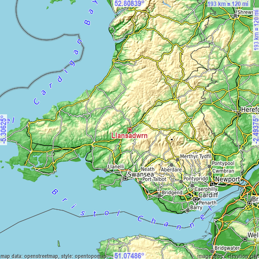
| Width | 6.02 km = 3.7 mi | 192.8 km = 119.8 mi |
| Height | 6.02 km = 3.7 mi | 192.7 km = 119.7 mi |
| ↑Max Latitude | 51.977077° | 52.80839° |
| Latitude at center | 51.95° | 51.95° |
| ↓Min Latitude | 51.922906° | 51.07486° |
| ← Min Longitude | -3.943945° | -5.30625° |
| Longitude center | -3.9° | -3.9° |
| →Max Longitude | -3.856055° | -2.49375° |
Nearby cities:
Cities around Llansadwrn sort by population:
• Ammanford elevation 39 m
18.5 km,  199°
199°
• Brynamman 214 m
16.8 km,  172°
172°
• Glanamman 107 m
16.8 km,  187°
187°
• Llandybie 60 m
16.2 km,  207°
207°
• Tycroes 78 m
20.8 km, 203°
• Llandovery 68 m
8.6 km,  55°
55°
• Llandeilo 59 m
9.6 km,  220°
220°
• Cray 309 m
20.2 km,  105°
105°
• Llanfynydd 157 m
13.9 km,  259°
259°
• Llangathen 103 m
13.3 km,  233°
233°
• Llansawel 169 m
9.7 km,  304°
304°
• Llanddeusant 193 m
9.7 km,  124°
124°
Multilingual:
 En español:
Llansadwrn elevación 54 m.
 En France:
Llansadwrn élévation 54 m.
 Auf Deutsch:
Llansadwrn höhe über dem Meeresspiegel ist 54 m.

Sources and notes:
- [note 1] Map square and city borders are not equal. Map elevation data is calculated only from area inside that square.
- [src 1] Elevation data from geonames database provided with same terms of usage.
- [src 2] The elevation map of Llansadwrn is generated using elevation data from NASA's 3 arcsec (90m) resolution SRTM data.
- [src 3] Base (background) map © OpenStreetMap contributors tiles are generated by Geofabrik and OpenTopoMap.
Copyright & License:
This Llansadwrn Elevation Map is licensed under CC BY-SA. You may reuse any part from this page, if you give a proper credit by linking to this URL:
 More info on terms of use page.