Brynamman elevation
Brynamman (Wales, Neath Port Talbot), United Kingdom elevation is 214 meters and Brynamman elevation in feet is 702 ft above sea level [src 1]. Brynamman is a populated place (feature code) with elevation that is 142 meters (466 ft) bigger than average city elevation in United Kingdom.
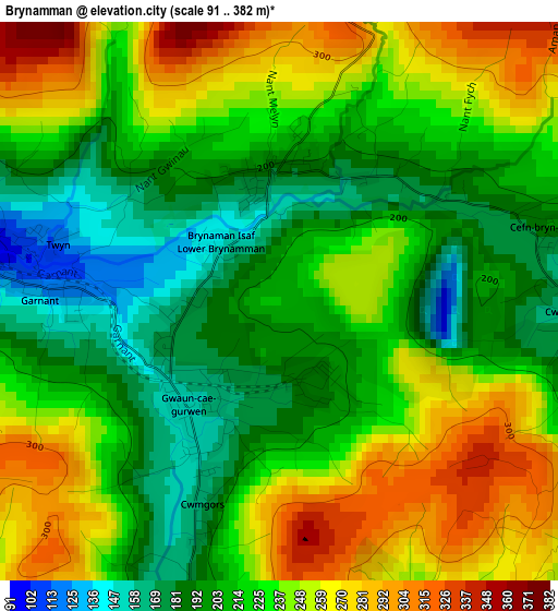
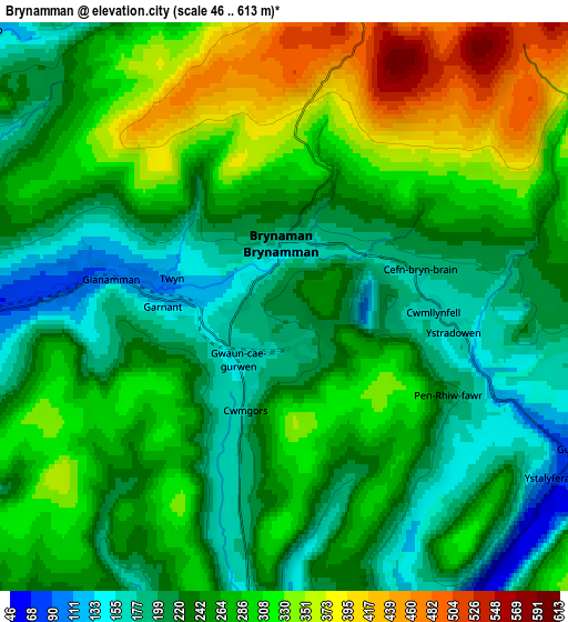
Below is the Elevation map of Brynamman, which displays elevation range with different colors. Scale of the first map is from 91 to 382 m (299 to 1253 ft) with average elevation of 226.3 meters (=742 ft) [note 1]
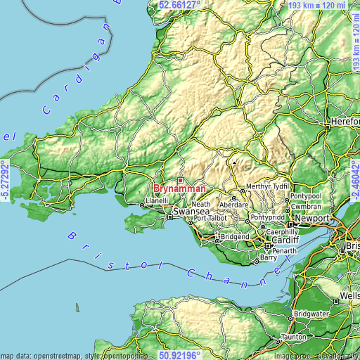
These maps also provides idea of topography and contour of this city, they are displayed at different zoom levels. More info about maps, scale and edge coordinates you can find below images.
| \ | Map #1 | Map #2 | Topo.Map |
| Scale [m] | 91..382 m | 46..613 m | × |
| Scale [ft] | 299..1253 ft | 151..2011 ft | × |
| Average | 226.3 m = 742 ft | 263 m = 863 ft | × |
| Width | 6.04 km = 3.8 mi | 12.09 km = 7.5 mi | 193.4 km = 120.2 mi |
| Height | 6.04 km = 3.8 mi | 12.09 km = 7.5 mi | 193.4 km = 120.2 mi |
| ↑Max Latitude | 51.827168° | 51.85432° | 52.66127° |
| Latitude at center | 51.8° | 51.8° | 51.8° |
| ↓Min Latitude | 51.772816° | 51.745615° | 50.92196° |
| ← Min Longitude | -3.910615° | -3.954561° | -5.27292° |
| Longitude center | -3.86667° | -3.86667° | -3.86667° |
| →Max Longitude | -3.822725° | -3.778779° | -2.46042° |
Nearby cities:
Cities around Brynamman sort by population:
• Ammanford elevation 39 m
8.4 km,  264°
264°
• Clydach 12 m
13.2 km,  190°
190°
• Ystalyfera 74 m
6.9 km,  121°
121°
• Glanamman 107 m
4.6 km,  270°
270°
• Llandybie 60 m
9.9 km,  283°
283°
• Tycroes 78 m
10.8 km, 256°
• Seven Sisters 166 m
11 km,  109°
109°
• Llandeilo 59 m
12.7 km,  317°
317°
• Crynant 112 m
11.4 km,  134°
134°
• Morriston 71 m
15.1 km,  196°
196°
• Llanddeusant 193 m
12.5 km,  27°
27°
• Ystradgynlais 68 m
7.8 km, 118°
Multilingual:
 En español:
Brynamman elevación 214 m.
 En France:
Brynamman élévation 214 m.
 Auf Deutsch:
Brynamman höhe über dem Meeresspiegel ist 214 m.

Sources and notes:
- [note 1] Map square and city borders are not equal. Map elevation data is calculated only from area inside that square.
- [src 1] Elevation data from geonames database provided with same terms of usage.
- [src 2] The elevation map of Brynamman is generated using elevation data from NASA's 3 arcsec (90m) resolution SRTM data.
- [src 3] Base (background) map © OpenStreetMap contributors tiles are generated by Geofabrik and OpenTopoMap.
Copyright & License:
This Brynamman Elevation Map is licensed under CC BY-SA. You may reuse any part from this page, if you give a proper credit by linking to this URL:
 More info on terms of use page.