Marple elevation
Marple (England, Borough of Stockport), United Kingdom elevation is 147 meters and Marple elevation in feet is 482 ft above sea level [src 1]. Marple is a populated place (feature code) with elevation that is 75 meters (246 ft) bigger than average city elevation in United Kingdom.
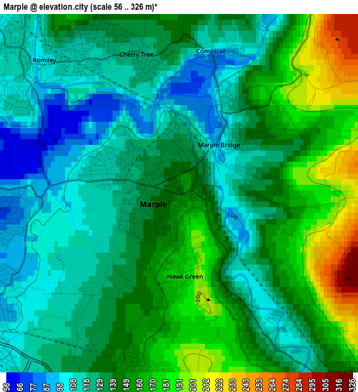
Below is the Elevation map of Marple, which displays elevation range with different colors. Scale of the first map is from 56 to 326 m (184 to 1070 ft) with average elevation of 139.5 meters (=458 ft) [note 1]
These maps also provides idea of topography and contour of this city, they are displayed at different zoom levels. More info about maps, scale and edge coordinates you can find below images.
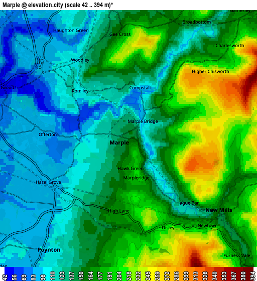
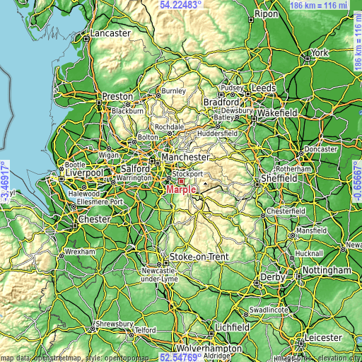
| \ | Map #1 | Map #2 | Topo.Map |
| Scale [m] | 56..326 m | 42..394 m | × |
| Scale [ft] | 184..1070 ft | 138..1293 ft | × |
| Average | 139.5 m = 458 ft | 154.1 m = 506 ft | × |
| Width | 5.83 km = 3.6 mi | 11.65 km = 7.2 mi | 186.5 km = 115.9 mi |
| Height | 5.83 km = 3.6 mi | 11.65 km = 7.2 mi | 186.5 km = 115.9 mi |
| ↑Max Latitude | 53.420717° | 53.446897° | 54.22483° |
| Latitude at center | 53.39452° | 53.39452° | 53.39452° |
| ↓Min Latitude | 53.368307° | 53.342078° | 52.54769° |
| ← Min Longitude | -2.106865° | -2.150811° | -3.46917° |
| Longitude center | -2.06292° | -2.06292° | -2.06292° |
| →Max Longitude | -2.018975° | -1.975029° | -0.65667° |
Nearby cities:
Cities around Marple sort by population:
• Stockport elevation 59 m
6.5 km,  285°
285°
• Hyde 112 m
6.4 km,  350°
350°
• Denton 101 m
7.8 km,  332°
332°
• Bramhall 83 m
7.9 km,  239°
239°
• New Mills 156 m
5.3 km,  127°
127°
• Hazel Grove 88 m
3.8 km,  250°
250°
• Bredbury 91 m
4.3 km,  304°
304°
• Poynton 97 m
6.1 km,  215°
215°
• Haughton Green 113 m
5.7 km,  335°
335°
• Heaton Chapel 67 m
8.4 km, 297°
• Disley 191 m
4.3 km,  157°
157°
• Hayfield 193 m
8 km,  102°
102°
Multilingual:
 En español:
Marple elevación 147 m.
 En France:
Marple élévation 147 m.


Sources and notes:
- [note 1] Map square and city borders are not equal. Map elevation data is calculated only from area inside that square.
- [src 1] Elevation data from geonames database provided with same terms of usage.
- [src 2] The elevation map of Marple is generated using elevation data from NASA's 3 arcsec (90m) resolution SRTM data.
- [src 3] Base (background) map © OpenStreetMap contributors tiles are generated by Geofabrik and OpenTopoMap.
Copyright & License:
This Marple Elevation Map is licensed under CC BY-SA. You may reuse any part from this page, if you give a proper credit by linking to this URL:
 More info on terms of use page.