Pencoyd elevation
Pencoyd (England, Herefordshire), United Kingdom elevation is 108 meters and Pencoyd elevation in feet is 354 ft above sea level [src 1]. Pencoyd is a seat of a third-order administrative division (feature code) with elevation that is 36 meters (118 ft) bigger than average city elevation in United Kingdom.
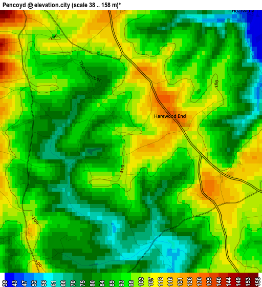
Below is the Elevation map of Pencoyd, which displays elevation range with different colors. Scale of the first map is from 38 to 158 m (125 to 518 ft) with average elevation of 92.3 meters (=303 ft) [note 1]
These maps also provides idea of topography and contour of this city, they are displayed at different zoom levels. More info about maps, scale and edge coordinates you can find below images.
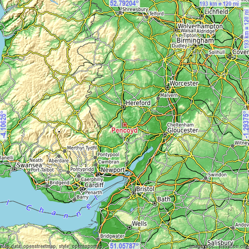
| \ | Map #1 | Topo.Map |
| Scale [m] | 38..158 m | × |
| Scale [ft] | 125..518 ft | × |
| Average | 92.3 m = 303 ft | × |
| Width | 6.03 km = 3.7 mi | 192.8 km = 119.8 mi |
| Height | 6.03 km = 3.7 mi | 192.8 km = 119.8 mi |
| ↑Max Latitude | 51.960418° | 52.79204° |
| Latitude at center | 51.93333° | 51.93333° |
| ↓Min Latitude | 51.906226° | 51.05787° |
| ← Min Longitude | -2.743945° | -4.10625° |
| Longitude center | -2.7° | -2.7° |
| →Max Longitude | -2.656055° | -1.29375° |
Nearby cities:
Cities around Pencoyd sort by population:
• Ross on Wye elevation 39 m
9.3 km,  101°
101°
• Grosmont 117 m
11.6 km,  260°
260°
• Lower Bullingham 56 m
11.1 km,  0°
0°
• Thruxton 103 m
10.9 km,  312°
312°
• Whitchurch 69 m
9.9 km,  159°
159°
• Brockhampton 97 m
9.7 km,  55°
55°
• Callow 77 m
9.5 km,  346°
346°
• Walford 35 m
8.8 km,  129°
129°
• Llanrothal 57 m
8.7 km,  211°
211°
• Marstow 47 m
8.2 km, 155°
• Sellack 38 m
4.9 km,  67°
67°
• Much Birch 163 m
4.5 km,  339°
339°
Multilingual:
 En español:
Pencoyd elevación 108 m.
 En France:
Pencoyd élévation 108 m.


Sources and notes:
- [note 1] Map square and city borders are not equal. Map elevation data is calculated only from area inside that square.
- [src 1] Elevation data from geonames database provided with same terms of usage.
- [src 2] The elevation map of Pencoyd is generated using elevation data from NASA's 3 arcsec (90m) resolution SRTM data.
- [src 3] Base (background) map © OpenStreetMap contributors tiles are generated by Geofabrik and OpenTopoMap.
Copyright & License:
This Pencoyd Elevation Map is licensed under CC BY-SA. You may reuse any part from this page, if you give a proper credit by linking to this URL:
 More info on terms of use page.