Llanrothal elevation
Llanrothal (England, Herefordshire), United Kingdom elevation is 57 meters and Llanrothal elevation in feet is 187 ft above sea level [src 1]. Llanrothal is a seat of a third-order administrative division (feature code) with elevation that is 15 meters (49 ft) smaller than average city elevation in United Kingdom.
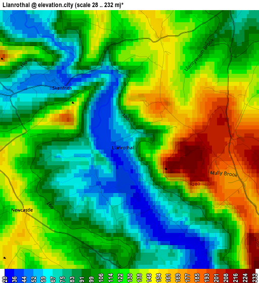
Below is the Elevation map of Llanrothal, which displays elevation range with different colors. Scale of the first map is from 28 to 232 m (92 to 761 ft) with average elevation of 113.1 meters (=371 ft) [note 1]
These maps also provides idea of topography and contour of this city, they are displayed at different zoom levels. More info about maps, scale and edge coordinates you can find below images.
| \ | Map #1 | Topo.Map |
| Scale [m] | 28..232 m | × |
| Scale [ft] | 92..761 ft | × |
| Average | 113.1 m = 371 ft | × |
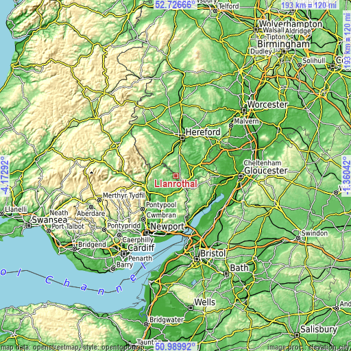
| Width | 6.03 km = 3.7 mi | 193.1 km = 120 mi |
| Height | 6.03 km = 3.7 mi | 193.1 km = 120 mi |
| ↑Max Latitude | 51.893798° | 52.72666° |
| Latitude at center | 51.86667° | 51.86667° |
| ↓Min Latitude | 51.839526° | 50.98992° |
| ← Min Longitude | -2.810615° | -4.17292° |
| Longitude center | -2.76667° | -2.76667° |
| →Max Longitude | -2.722725° | -1.36042° |
Nearby cities:
Cities around Llanrothal sort by population:
• Monmouth elevation 27 m
7 km,  148°
148°
• Raglan 48 m
12.8 km,  207°
207°
• Sellack 38 m
13 km,  44°
44°
• Rowlstone 149 m
12.7 km,  305°
305°
• Llancillo 106 m
12.7 km,  295°
295°
• Much Birch 163 m
12 km,  14°
14°
• Walford 35 m
11.6 km,  80°
80°
• Mitchel Troy 50 m
9.1 km,  167°
167°
• Grosmont 117 m
8.8 km, 309°
• Pencoyd 108 m
8.7 km,  31°
31°
• Whitchurch 69 m
8.2 km,  103°
103°
• Marstow 47 m
8 km,  90°
90°
Multilingual:
 En español:
Llanrothal elevación 57 m.
 En France:
Llanrothal élévation 57 m.
 Auf Deutsch:
Llanrothal höhe über dem Meeresspiegel ist 57 m.

Sources and notes:
- [note 1] Map square and city borders are not equal. Map elevation data is calculated only from area inside that square.
- [src 1] Elevation data from geonames database provided with same terms of usage.
- [src 2] The elevation map of Llanrothal is generated using elevation data from NASA's 3 arcsec (90m) resolution SRTM data.
- [src 3] Base (background) map © OpenStreetMap contributors tiles are generated by Geofabrik and OpenTopoMap.
Copyright & License:
This Llanrothal Elevation Map is licensed under CC BY-SA. You may reuse any part from this page, if you give a proper credit by linking to this URL:
 More info on terms of use page.